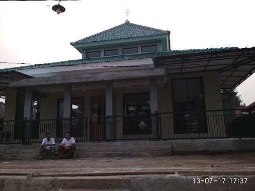
Mosque nearby Mesjid At Taqwa
Indonesia
Mosque nearby Mesjid At Taqwa
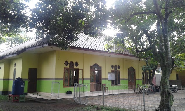
Mesjid At Taqwa
Taman Rahayu, Setu Indonesia
contacts phone
:
+62
Latitude:
-6.368878
, Longitude:
106.9943234
read more
nearest Mosque
20 m
musholla attaqwa
blok p, Taman Rahayu
Mosque
read more
226 m
MASJID IMADUL MUTAQIN
Pasir Angin
Mosque
read more
281 m
Masjid An-nur
Jalan Nuri IV, Pasir Angin
Mosque
read more
281 m
Masjid An-nur
Jl. Nuri IV, Pasir Angin
Mosque
read more
476 m
Masjid Al-muhajirin Perum GAS blok Y
Pasir Angin
Mosque
read more
482 m
Musholla Assalam
Jalan Griya Alam Sentosa No.10, Pasir Angin
Mosque
read more
496 m
Musholah Nurul Falah
Unnamed Road, Pasir Angin
Mosque
read more
598 m
Masjid Nurul Jannah
Jalan Semangat, Taman Rahayu
Mosque
read more
602 m
Masjid Baitul A'la
Unnamed Road, Pasir Angin
Mosque
read more
637 m
Musholah Al Husna
Pasir Angin
Mosque
read more
657 m
Musolah Nurul Jannah
Taman Rahayu
Mosque
read more
747 m
Baitul Ikhlas
Perumahan Griya Alam Sentosa Blok L,, Pasir Angin
Mosque
read more
764 m
musolah nurul hidayah
Pasir Angin
Mosque
read more
814 m
LDII Mosque, Griya Alam Sentosa
Pasir Angin
Mosque
read more
846 m
Miftahul Jannah Mosque
Pasir Angin
Mosque
read more
873 m
Mushola Al-Ihklas
Jalan Griya Alam Sentosa, Ciketing Udik
Mosque
read more
894 m
masjid al-amin yayasan griya sunnah
Jalan Adem Ayem No.1, Pasir Angin
Mosque
read more
900 m
Mushola Al-Ikhlas
Pasir Angin
Mosque
read more
900 m
Masjid Al Jihad Griya Alam Sentosa
Pasir Angin
Mosque
read more
909 m
Al-jihad
Pasir Angin
Mosque
read more
917 m
Masjid Raya Al-Jihad
Jalan Griya Alam Sentosa No.4, Pasir Angin
Mosque
read more
942 m
Masjid Al Amin
Atas Bundaran 1 Perumahan Griya Alam Sentosa,, Pasir Angin
Mosque
read more
1.006 km
Mushola Ar-rohman
Jalan Adem Ayem No.1, Pasir Angin
Mosque
read more
1.222 km
masjid jami' miftahul khoir
Jalan MT. Haryono No.53, Taman Rahayu
Mosque
read more
1.376 km
Masjid Nurul Huda
JL. Pasir Angin, RT. 03 RW. 05, Mega Mendung, Pasir Angin
Mosque
read more
📑
all categories
Accounting
Administrative area level 1
Administrative area level 2
Airport
Amusement park
Aquarium
Art gallery
Atm
Bakery
Bank
Bar
Beauty salon
Bicycle store
Book store
Bowling alley
Bus station
Cafe
Campground
Car dealer
Car rental
Car repair
Car wash
Casino
Cemetery
Church
City hall
Clothing store
Colloquial area
Convenience store
Courthouse
Dentist
Department store
Doctor
Electrician
Electronics store
Embassy
Finance
Fire station
Florist
Food
Funeral home
Furniture store
Gas station
General contractor
Grocery or supermarket
Gym
Hair care
Hardware store
Health
Hindu Temple
Home goods store
Hospital
Insurance agency
Intersection
Jewelry store
Laundry
Lawyer
Library
Liquor store
Local government office
Locality
Locksmith
Lodging
Meal delivery
Meal takeaway
Mosque
Movie rental
Movie theater
Moving company
Museum
Natural feature
Neighborhood
Night club
Painter
Park
Parking
Pet store
Pharmacy
Physiotherapist
Place of worship
Plumber
Point of interest
Police
Political
Post office
Premise
Real estate agency
Restaurant
Roofing contractor
Route
Rv park, camping
School
Shoe store
Shopping mall
Spa
Stadium
Storage
Store
Subpremise
Supermarket
Synagogue
Taxi stand
Train station
Transit station
Travel agency
University
Veterinary care
Zoo
administrative area level 3
administrative area level 4
administrative area level 5
sublocality level 1
↑