Mosque nearby Mesjid Al-Muhajirin
Indonesia
Mosque nearby Mesjid Al-Muhajirin
Mesjid Al-Muhajirin
Jalan Siswa Taas Manado, Tingkulu Indonesia
contacts phone
:
+62
Latitude:
1.4632035
, Longitude:
124.857297
read more
nearest Mosque
937 m
Masjid An Nur Teling Atas
Jalan 14 Februari No.72, Teling Atas
Mosque
read more
1.138 km
Mesjid Asmaul Husna
Kel. Bumi Nyiur Ling V, Bumi Nyiur
Mosque
read more
1.145 km
Masjid Nurur Rahmah Mayora
JL. Baru Lingk, Banjer
Mosque
read more
1.235 km
Masjid Al Maghfira Banjer
Banjer
Mosque
read more
1.244 km
Masjid Nurul Birri
Jalan 17 Agustus, Manado, Teling Atas
Mosque
read more
1.552 km
Wisma Sabilulhuda LDII
Lorong Kubur No. 354 Lingk. VII, Banjer
Mosque
read more
1.652 km
Masjid Al-Falah
Teling Atas
Mosque
read more
1.791 km
Mushola At-Tohirin
Unnamed Road,, Teling Bawah
Mosque
read more
1.814 km
Masjid Thuurul Arqam Banjer
Banjer
Mosque
read more
1.827 km
Mushola Al-Mukmin
Teling Atas
Mosque
read more
1.905 km
Mesjid Al - Jihad
Teling Bawah
Mosque
read more
1.929 km
Masjid Al Kautsar
Banjer
Mosque
read more
1.954 km
Masjid Ikhlas
Jalan 17 Agustus, Manado, Teling Atas
Mosque
read more
1.969 km
Masjid Ar-Rahmah Banjer
Tikala Ares
Mosque
read more
2.034 km
Masjid Al-Mujahidin
Jalan 17 Agustus, Manado, Teling Bawah
Mosque
read more
2.08 km
Masjid At-Taqwa
Jalan Manguni Raya No.27, Perkamil
Mosque
read more
2.094 km
Masjid Uswatun Hasanah Banjer
Banjer
Mosque
read more
2.129 km
Masjid Khairul Bariyyah
kelurahan islam lingk 5, Teling Bawah
Mosque
read more
2.291 km
Masjid Assalaam
Jalan 17 Agustus, Manado, Bumi Beringin
Mosque
read more
2.294 km
Masjid Al-Jamil
Jalan Manguni Raya No.5, Perkamil
Mosque
read more
2.294 km
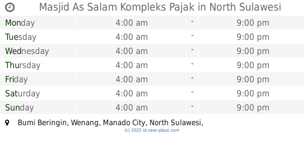
Masjid As Salam Kompleks Pajak
Bumi Beringin
Mosque
read more
2.559 km
Masjid R. A Kartini
Jalan 17 Agustus, Manado, Bumi Beringin
Mosque
read more
2.564 km
Masjid Al Iskandaria
Ranomuut
Mosque
read more
2.853 km
Mesjid At Taqwa
Jalan Pulau Sulawesi, Winangun Dua
Mosque
read more
2.908 km
Masjid Jabal Rahma
Paal Dua
Mosque
read more
📑
all categories
Accounting
Administrative area level 1
Administrative area level 2
Airport
Amusement park
Aquarium
Art gallery
Atm
Bakery
Bank
Bar
Beauty salon
Bicycle store
Book store
Bowling alley
Bus station
Cafe
Campground
Car dealer
Car rental
Car repair
Car wash
Casino
Cemetery
Church
City hall
Clothing store
Colloquial area
Convenience store
Courthouse
Dentist
Department store
Doctor
Electrician
Electronics store
Embassy
Finance
Fire station
Florist
Food
Funeral home
Furniture store
Gas station
General contractor
Grocery or supermarket
Gym
Hair care
Hardware store
Health
Hindu Temple
Home goods store
Hospital
Insurance agency
Intersection
Jewelry store
Laundry
Lawyer
Library
Liquor store
Local government office
Locality
Locksmith
Lodging
Meal delivery
Meal takeaway
Mosque
Movie rental
Movie theater
Moving company
Museum
Natural feature
Neighborhood
Night club
Painter
Park
Parking
Pet store
Pharmacy
Physiotherapist
Place of worship
Plumber
Point of interest
Police
Political
Post office
Premise
Real estate agency
Restaurant
Roofing contractor
Route
Rv park, camping
School
Shoe store
Shopping mall
Spa
Stadium
Storage
Store
Subpremise
Supermarket
Synagogue
Taxi stand
Train station
Transit station
Travel agency
University
Veterinary care
Zoo
administrative area level 3
administrative area level 4
administrative area level 5
sublocality level 1
↑