Mosque nearby Masjid Pondok Ranggon
Indonesia
Mosque nearby Masjid Pondok Ranggon
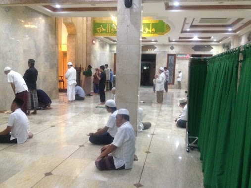
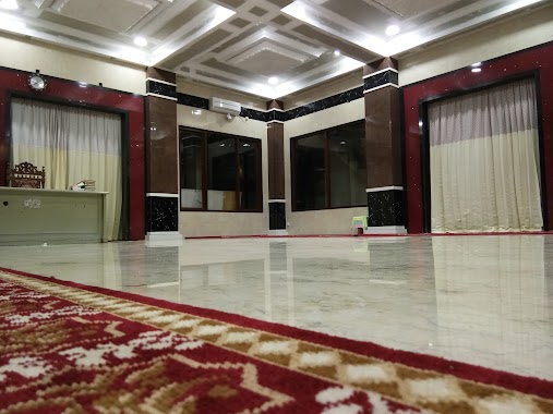
Masjid Pondok Ranggon
Pondok Ranggon, Cipayung, East Jakarta City, Jakarta 16454, Indonesia
contacts phone
:
+62
Latitude:
-6.3726506
, Longitude:
106.9037241
larger map & directions
read more
nearest Mosque
8 m
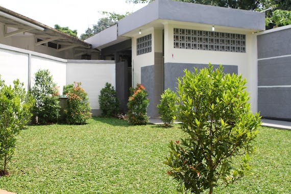
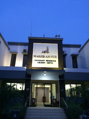
Masjid An Nur
Jalan Mahogany Raya Blok N-11, Harjamukti
Mosque
read more
8 m
Masjid An-Nur
Harjamukti
Mosque
read more
464 m
Masjid Mujahidin
Jalan Alternatif Cibubur, Harjamukti
Mosque
read more
465 m
Masjid Jami' Al- Mujahidin
Jalan Alternatif Cibubur No.24, RT.4/RW.5, Harjamukti
Mosque
read more
489 m
Masjid Raffles
Jalan Alternatif Cibubur Blok AC No.7, Harjamukti
Mosque
read more
504 m
masjid ar-rahmah
Jalan Alternatif Cibubur No.Ac/07, RT.4/RW.5, Harjamukti
Mosque
read more
640 m
Masjid Al Ikhlash Cibubur Residence
Perumahan Cibubur Residence Brasswood, Blok B8 Jatikarya, Jatisampurna, Pondok Gede Jatisampurna, Jatisampurna
Mosque
read more
645 m
Masjid Nur Amaliah
B,, Jalan Alternatif Cibubur Blok AC No.8, Harjamukti
Mosque
read more
772 m
Masjid Yamp - Perumahan Departemen Penerangan
Harjamukti, Cimanggis, Perumahan Departemen Penerangan, Harjamukti
Mosque
read more
848 m
Masjid Al Ikhlas
Kav., Jl No.18, RW.5, Harjamukti
Mosque
read more
888 m
Musholla Al Huda
Harjamukti
Mosque
read more
929 m
Masjid Nurul Huda
Jalan Mawar 5 Blok CS6 No.15, Jatisampurna
Mosque
read more
957 m
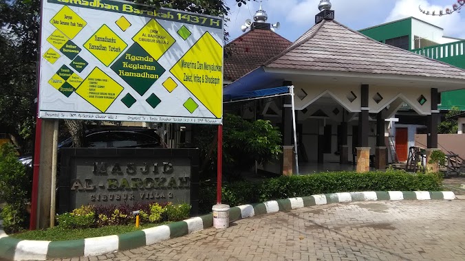
Masjid Al-Barokah Cibubur Villa 2
Jalan Villa Cibubur Blok T1 No.2, Harjamukti
Mosque
read more
1.137 km
Masjid Darul kassyaf
Jalan Buperta RW.5, Pondok Ranggon
Mosque
read more
1.188 km
Masjid Daarul Kaasyaf, BUPERTA - CIBUBUR
RW.5, Pondok Ranggon
Mosque
read more
1.216 km
Masjid Jami Baitul Mu'Min
Perumahan Kranggan Raya, Jalan Wijaya Kusuma, Jatisampurna
Mosque
read more
1.348 km
Masjid AT-TAUHID
Harjamukti
Mosque
read more
1.436 km
Musholla Al Ikhlas
No.1, Jl. Anggrek 14 Blok AS28, Jatisampurna
Mosque
read more
1.749 km
Masjid Al-Ikhlash Kav DPRD DKI Cibubur
RT.8/RW.7, Cibubur
Mosque
read more
1.856 km
Masjid LDII AL Mansyuurin
Jalan Nilam II, RT. 04 RW. 10, Jatiraden, Jatisampurna, Jatiraden
Mosque
read more
1.868 km
Masjid Darul Ulum
Jalan Jambore No.9A, RT.4/RW.14, Cibubur
Mosque
read more
1.87 km
Mushola SPBU 34-13707
Jalan Radar Auri No.77, RT.4/RW.14, Cibubur
Mosque
read more
1.877 km
Masjid Bahrul Ulum Al Azhar
Jalan Jambore No.9, RT.4/RW.14, Cibubur
Mosque
read more
2.556 km
Masjid Hidayaturrahman/Masjid Putih
Jalan Kranggan, Jatiraden
Mosque
read more
2.637 km
Masjid Al Hidayah
Sukatani
Mosque
read more
📑
all categories
Accounting
Administrative area level 1
Administrative area level 2
Airport
Amusement park
Aquarium
Art gallery
Atm
Bakery
Bank
Bar
Beauty salon
Bicycle store
Book store
Bowling alley
Bus station
Cafe
Campground
Car dealer
Car rental
Car repair
Car wash
Casino
Cemetery
Church
City hall
Clothing store
Colloquial area
Convenience store
Courthouse
Dentist
Department store
Doctor
Electrician
Electronics store
Embassy
Finance
Fire station
Florist
Food
Funeral home
Furniture store
Gas station
General contractor
Grocery or supermarket
Gym
Hair care
Hardware store
Health
Hindu Temple
Home goods store
Hospital
Insurance agency
Intersection
Jewelry store
Laundry
Lawyer
Library
Liquor store
Local government office
Locality
Locksmith
Lodging
Meal delivery
Meal takeaway
Mosque
Movie rental
Movie theater
Moving company
Museum
Natural feature
Neighborhood
Night club
Painter
Park
Parking
Pet store
Pharmacy
Physiotherapist
Place of worship
Plumber
Point of interest
Police
Political
Post office
Premise
Real estate agency
Restaurant
Roofing contractor
Route
Rv park, camping
School
Shoe store
Shopping mall
Spa
Stadium
Storage
Store
Subpremise
Supermarket
Synagogue
Taxi stand
Train station
Transit station
Travel agency
University
Veterinary care
Zoo
administrative area level 3
administrative area level 4
administrative area level 5
sublocality level 1
↑