Mosque nearby Masjid Khusnul Khotimah
Indonesia
Mosque nearby Masjid Khusnul Khotimah
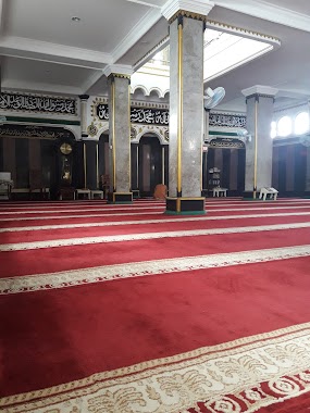
Masjid Khusnul Khotimah
Jalan Pondok Jaya I No.1, Pela Mampang Indonesia
contacts phone
:
+62
Latitude:
-6.2459002
, Longitude:
106.8207317
read more
nearest Mosque
161 m
Mesjid Al-Anwar
No., Jalan Bangka IIG No.9, RT.2/RW.3, Pela Mampang
Mosque
read more
229 m
Nurussaadah
Jalan Bangka II RT.1/RW.13, Pela Mampang
Mosque
read more
384 m
Mesjid LDII Kelompok Pondok Karya
Jalan Bangka I D No.45, RT.5/RW.9, Pela Mampang
Mosque
read more
386 m
Musholla Nurussadah
Jalan Bangka II, RT. 10 / RW. 01, Pela Mampang, Mampang Prapatan, RT.11/RW.1, Pela Mampang
Mosque
read more
395 m
Al - Hikmah Mosque
Jl. Bangka II No.24, RT.8/RW.3, Pela Mampang, Mampang Prapatan, RT.8/RW.3, Pela Mampang
Mosque
read more
556 m
Masjid Jami Al Aqwam
Jalan Bangka Raya No.33
Mosque
read more
567 m
Musholla Gedung Citi Financial
Jalan Kapten Tendean Gedung Citi Financial No.34, RT.2/RW.1, Mampang Prapatan
Mosque
read more
573 m
Masjid At Taqwa
Jl. Bangka III No .6, Mampang Prapatan, RT.12/RW.2, Pela Mampang
Mosque
read more
580 m
Masjid Al Aqwam
Jalan Bangka Raya No.29, RT.13/RW.5, Pela Mampang
Mosque
read more
600 m
Masjid Jami Al Ikhlas
Jl. Bangka 8-C RT 002 RW 12 Pela Mampang Mampang Prapatan Jakarta Selatan DKI Jakarta, RT.2/RW.5, Pela Mampang
Mosque
read more
716 m
Masjid Jami Baitul
JL Bangka IXA, RT 06 RW 01, RT.10/RW.12, Pela Mampang
Mosque
read more
720 m
MESJID JAMIA-BAITURRAHIM
RT.12/RW.11, Pela Mampang
Mosque
read more
776 m
Masjid Jami Al Anwar
Jl. Bangka Raya No. 21, RT.8/RW.11, Pela Mampang
Mosque
read more
845 m
Masjid Barkah
Jalan Bangka No.100A, RT.1/RW.12, Pela Mampang
Mosque
read more
866 m
Masjid Jami' Nurul Huda
Jl.Wijaya Timur VI No.81C Rt 011/002 Jaksel, RT.12/RW.2, Petogogan
Mosque
read more
961 m
Remaja Islam Darussalam
Jalan Rengas 1 RT.14/RW.4, Rawa Barat
Mosque
read more
968 m
Masjid Al Anwar
Jalan Mampang Prapatan II No.17, RT.8/RW.2, Mampang Prapatan
Mosque
read more
1.011 km
Masjid Riadhul Abidin
Jalan Bangka X No.1C, RT.4/RW.7, Pela Mampang
Mosque
read more
1.015 km
Masjid Baitul Halim
Jalan Tegal Parang Selatan V Blok Buncit X No.1, RT.1/RW.6, Tegal Parang
Mosque
read more
1.018 km
Masjid Jami Riadhul Abidin
No.8, Jalan Bangka Raya RT.4/RW.7, Pela Mampang
Mosque
read more
1.04 km
Masjid Jami Al-Anwar
Jalan Mampang Prapatan XI RT.9/RW.1, Tegal Parang
Mosque
read more
1.048 km
Sahabat Tauhid
Jalan Cipaku I No.18, RT.1/RW.4, Petogogan
Mosque
read more
1.051 km
Masjid Jami Nurulisiyah
Jalan Kapten Tendean RT.1/RW.2, Kuningan Barat
Mosque
read more
1.072 km
Masjid Daarut Tauhiid Jakarta
Jalan Cipaku I No.43, RT.1/RW.4, Petogogan, Kebayoran Baru, RT.1/RW.4, Petogogan
Mosque
read more
1.173 km
Mushalla Al Aqso
RT.5/RW.4, Petogogan
Mosque
read more
📑
all categories
Accounting
Administrative area level 1
Administrative area level 2
Airport
Amusement park
Aquarium
Art gallery
Atm
Bakery
Bank
Bar
Beauty salon
Bicycle store
Book store
Bowling alley
Bus station
Cafe
Campground
Car dealer
Car rental
Car repair
Car wash
Casino
Cemetery
Church
City hall
Clothing store
Colloquial area
Convenience store
Courthouse
Dentist
Department store
Doctor
Electrician
Electronics store
Embassy
Finance
Fire station
Florist
Food
Funeral home
Furniture store
Gas station
General contractor
Grocery or supermarket
Gym
Hair care
Hardware store
Health
Hindu Temple
Home goods store
Hospital
Insurance agency
Intersection
Jewelry store
Laundry
Lawyer
Library
Liquor store
Local government office
Locality
Locksmith
Lodging
Meal delivery
Meal takeaway
Mosque
Movie rental
Movie theater
Moving company
Museum
Natural feature
Neighborhood
Night club
Painter
Park
Parking
Pet store
Pharmacy
Physiotherapist
Place of worship
Plumber
Point of interest
Police
Political
Post office
Premise
Real estate agency
Restaurant
Roofing contractor
Route
Rv park, camping
School
Shoe store
Shopping mall
Spa
Stadium
Storage
Store
Subpremise
Supermarket
Synagogue
Taxi stand
Train station
Transit station
Travel agency
University
Veterinary care
Zoo
administrative area level 3
administrative area level 4
administrative area level 5
sublocality level 1
↑