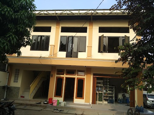
Mosque nearby Masjid Jamie Nuurul Islam
Coronavirus disease (COVID-19) Situation
confirmed cases
6829221
deaths
162063
Indonesia
Mosque nearby Masjid Jamie Nuurul Islam
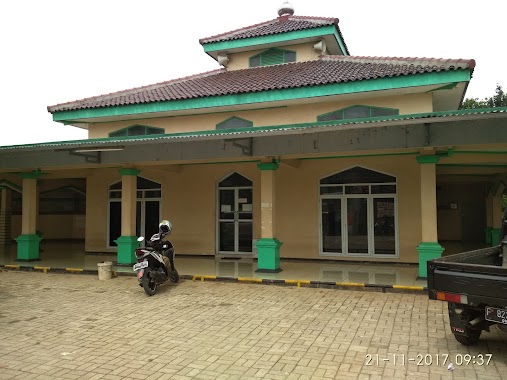
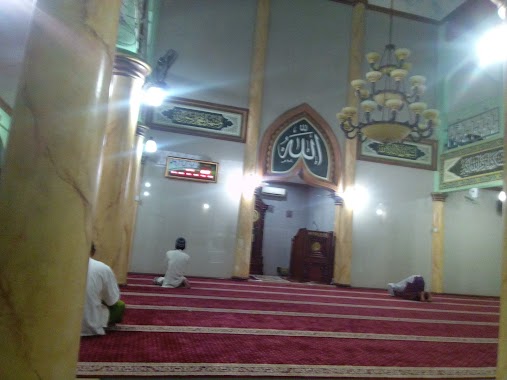
Masjid Jamie Nuurul Islam
1, Jalan Raya Narogong, 16820, Bogor, Jawa Barat, ID Indonesia
contacts phone
:
+62
Latitude:
-6.3988587
, Longitude:
106.9703495
larger map & directions
read more
nearest Mosque
107 m
Masjid Jami Nurul Islam
Jalan Raya Narogong No.1, Cileungsi
Mosque
read more
358 m
MASJID JAMI,I BAITUN NUUR
Jalan Raya Narogong No.168, Cileungsi
Mosque
read more
505 m
Musholla AT-Tauhid Kampoeng Pelangi
Cileungsi
Mosque
read more
643 m
Masjid Al - Awwabin
Jalan Setu Rawa Hingkik, Cileungsi
Mosque
read more
666 m
Masjid Jamie Amaliyah
Cileungsi Kidul
Mosque
read more
759 m
Masjid At-Taqwa PT.KIA
No., Jalan Raya Narogong No.250, Limus Nunggal
Mosque
read more
778 m
Mushalla Ibrahim Griya Cileungsi Asri
Perum Camat Enjan, Jalan Vila Cileungsi Asri I, Cileungsi
Mosque
read more
843 m
Mushala Arrum Al-hamid
Cileungsi
Mosque
read more
845 m
Mulkiz
Jalan Raya Narogong No.47, Cileungsi
Mosque
read more
860 m
Masjid LDII Al-Barokah PAC Cileungsi Kota
Cileungsi
Mosque
read more
884 m
Masjid Jami Al Hidayah
Jalan Raya Jonggol - Cileungsi, Cileungsi
Mosque
read more
893 m
Musholla Al Muhajirin
Jalan Raya Narogong No.47, Cileungsi
Mosque
read more
901 m
Musholla Al Awwalun
Jalan Raya Jonggol, Cileungsi
Mosque
read more
939 m
mushola al ikhlas
Jalan Pahlawan No.57-59, Cileungsi
Mosque
read more
967 m
Masjid Ar-Rozzaaq
Jalan H. Satibi, Cileungsi
Mosque
read more
1.025 km
Masjid LDII Attaqwa
Jalan Raya Jonggol - Cileungsi No.47, Cileungsi
Mosque
read more
1.026 km
Mesjid Al Ariif
Jl. kp. rawa belut rt02/06, Cileungsi Kidul
Mosque
read more
1.038 km
Masjid Al-Arif
Rawa Belut, Rt.02/06, Cileungsi, Cileungsi Kidul
Mosque
read more
1.142 km
Masjid Nurul Iman, Cileungsi Indah
Cileungsi Kidul
Mosque
read more
1.267 km
Masjid Jami Nurul Falah
Jalan Raya Cileungsi, Pasir Angin
Mosque
read more
1.267 km
Masjid Jami Nurul Falah, Pasirangin
Jalan Raya Cileungsi, Pasir Angin
Mosque
read more
1.274 km
Masjid Nurul Falah
Pasir Angin, RT. 01 RW. 11, Cipatat, Pasir Angin
Mosque
read more
1.288 km
Market Mushola Cileungsi
Pasar Cileungsi, Jalan Raya Narogong, Cileungsi Kidul
Mosque
read more
1.288 km
Market Mushola Cileungsi
Pasar Cileungsi, Jalan Narogong Raya, Cileungsi Kidul
Mosque
read more
1.329 km
Musholla Mall Cileungsi-pasar Cileungsi
Jalan Raya Narogong No.5, Cileungsi Kidul
Mosque
read more
📑
all categories
Accounting
Administrative area level 1
Administrative area level 2
Airport
Amusement park
Aquarium
Art gallery
Atm
Bakery
Bank
Bar
Beauty salon
Bicycle store
Book store
Bowling alley
Bus station
Cafe
Campground
Car dealer
Car rental
Car repair
Car wash
Casino
Cemetery
Church
City hall
Clothing store
Colloquial area
Convenience store
Courthouse
Dentist
Department store
Doctor
Electrician
Electronics store
Embassy
Finance
Fire station
Florist
Food
Funeral home
Furniture store
Gas station
General contractor
Grocery or supermarket
Gym
Hair care
Hardware store
Health
Hindu Temple
Home goods store
Hospital
Insurance agency
Intersection
Jewelry store
Laundry
Lawyer
Library
Liquor store
Local government office
Locality
Locksmith
Lodging
Meal delivery
Meal takeaway
Mosque
Movie rental
Movie theater
Moving company
Museum
Natural feature
Neighborhood
Night club
Painter
Park
Parking
Pet store
Pharmacy
Physiotherapist
Place of worship
Plumber
Point of interest
Police
Political
Post office
Premise
Real estate agency
Restaurant
Roofing contractor
Route
Rv park, camping
School
Shoe store
Shopping mall
Spa
Stadium
Storage
Store
Subpremise
Supermarket
Synagogue
Taxi stand
Train station
Transit station
Travel agency
University
Veterinary care
Zoo
administrative area level 3
administrative area level 4
administrative area level 5
sublocality level 1
↑