Mosque nearby Masjid Jami
Indonesia
Mosque nearby Masjid Jami
Masjid Jami
Sentul, Babakan Madang, Bogor, West Java 16810, Indonesien
contacts phone
:
+62
Latitude:
-6.531893
, Longitude:
106.8514784
larger map & directions
read more
nearest Mosque
157 m
Masjid Jami Al Falah
JL. Kalianyar I Dalam, RT. 005/09, Tambora
Mosque
read more
249 m
masjid prapatan sentul
Sentul
Mosque
read more
286 m
Masjid Jami Darussalam
Jalan Raya Sirkuit Sentul, Sentul
Mosque
read more
580 m
Masjid Al - Ikhlas
Jalan Raya Sirkuit Sentul, Sentul
Mosque
read more
817 m
Masjid Alkautsar
kp.jembatan rt.6, 6, Cijujung
Mosque
read more
928 m
Masjid As Salam
Kadumangu
Mosque
read more
947 m
Keramat Mosque
Sentul
Mosque
read more
1.082 km
Masjid Al-Hikmah
Rt.04 Rw.02, Sentul
Mosque
read more
1.167 km
Masjid LDII Al Furqon
Jalan Pahlawan No.474, Sentul
Mosque
read more
1.167 km
Masjid Ldii sentul
Jalan Pahlawan No.474, Sentul
Mosque
read more
1.205 km
Masjid Jamie Al-muminin
Jl. Kp. Blk. Pd. No.11,, Cijujung
Mosque
read more
1.216 km
Masjid Jami Baiturrahman
Jalan Tatya Asri IV, Cijujung
Mosque
read more
1.232 km
MASJID AL-ANWAR
Jalan Sirkuit Gokart Sentul, Sentul
Mosque
read more
1.247 km
MESJID AGUNG WALOSONGO
Jalan Raya Babakan Madang No.8, Kadumangu
Mosque
read more
1.286 km
MASJID MASAGUNG WALISONGO
Kadumangu
Mosque
read more
1.421 km
Mushola Al -Muhajirin
jl. jrmbatan hitam blok muncang Rt 03/06, Cijujung
Mosque
read more
1.512 km
Masjid AL ISTIQOMAH Palm Hill Golf
Kadumangu
Mosque
read more
1.749 km
masjid besar AL-IHSAN
jl. kayumanis, Cirimekar
Mosque
read more
1.81 km
Musholah H.ujang
Jalan Alternatif Sentul No.5 C, Cijujung
Mosque
read more
1.835 km
Mushola Al Ikhwan
Jalan Perum Tatya Asri Blok G3 No.17, Cijujung
Mosque
read more
1.935 km
Masjid Al Hidayah
Sentul, Babakan Madang, Sentul
Mosque
read more
2.009 km
Mushola Al Ikhlas
Jalan Sirsak 2, Cijujung
Mosque
read more
2.053 km
Masjid Al Muhajirin
Perum Mega Sentul, Jalan Bougenville Raya, Pasirlaja, Pasirlaya
Mosque
read more
2.078 km
Masjid Raya The Nature
Sentul
Mosque
read more
2.24 km
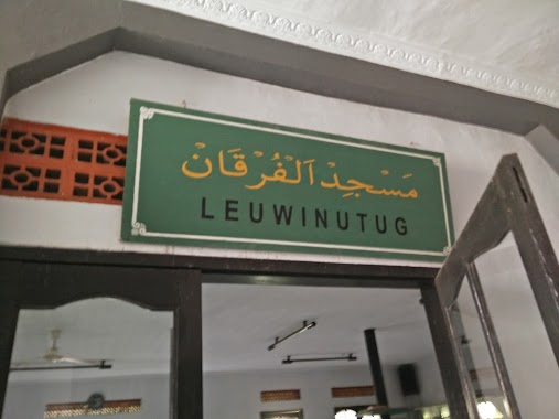
Masjid Jami Nurul Yaqin
Leuwinutug
Mosque
read more
📑
all categories
Accounting
Administrative area level 1
Administrative area level 2
Airport
Amusement park
Aquarium
Art gallery
Atm
Bakery
Bank
Bar
Beauty salon
Bicycle store
Book store
Bowling alley
Bus station
Cafe
Campground
Car dealer
Car rental
Car repair
Car wash
Casino
Cemetery
Church
City hall
Clothing store
Colloquial area
Convenience store
Courthouse
Dentist
Department store
Doctor
Electrician
Electronics store
Embassy
Finance
Fire station
Florist
Food
Funeral home
Furniture store
Gas station
General contractor
Grocery or supermarket
Gym
Hair care
Hardware store
Health
Hindu Temple
Home goods store
Hospital
Insurance agency
Intersection
Jewelry store
Laundry
Lawyer
Library
Liquor store
Local government office
Locality
Locksmith
Lodging
Meal delivery
Meal takeaway
Mosque
Movie rental
Movie theater
Moving company
Museum
Natural feature
Neighborhood
Night club
Painter
Park
Parking
Pet store
Pharmacy
Physiotherapist
Place of worship
Plumber
Point of interest
Police
Political
Post office
Premise
Real estate agency
Restaurant
Roofing contractor
Route
Rv park, camping
School
Shoe store
Shopping mall
Spa
Stadium
Storage
Store
Subpremise
Supermarket
Synagogue
Taxi stand
Train station
Transit station
Travel agency
University
Veterinary care
Zoo
administrative area level 3
administrative area level 4
administrative area level 5
sublocality level 1
↑