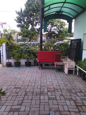
Mosque nearby Masjid Jami' Nurul Amal
Indonesia
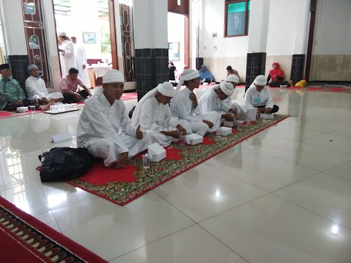
Mosque nearby Masjid Jami' Nurul Amal
Masjid Jami' Nurul Amal
3, Jalan Kemuning II, 13120, Kota Jakarta Timur, Daerah Khusus Ibukota Jakarta, ID Indonesia
contacts phone
:
+62
Latitude:
-6.1976576
, Longitude:
106.8640022
larger map & directions
read more
nearest Mosque
231 m
Masjid Jami At Taqwa
JL. Galur Sari, RT. 06, RW. 07, Matraman, RT.5/RW.7, Utan Kayu Utara
Mosque
read more
322 m
Mushola Baitul Hamdi
Jalan Kayu Manis Timur Raya, Gang Jati No. 6, Matraman, RT.4/RW.3, Kayu Manis
Mosque
read more
347 m
Masjid Al Ikhwan
JL. Kelapa Hijau, RT. 13, RW. 14, Matraman, RT.7/RW.14, Utan Kayu Selatan
Mosque
read more
499 m
Mushollah Binaul Ilmi
Jalan Utan Kayu Barat, Matraman, RT.8/RW.2, Kayu Manis
Mosque
read more
552 m
Masjid Amalia
Jalan Pramuka Sari V No.29B, RT.6/RW.4, Rawasari
Mosque
read more
584 m
Masjid Jami' Nurul Islam Pramuka
Jalan Pramuka No.63, RT.12/RW.5, Rawasari
Mosque
read more
584 m
Masjid Jami Nurul Iman
12, RT.12/RW.005, Rawasari
Mosque
read more
751 m
Nurus Saadah Mosque
Jl Penggalang I 32 RT 004%2F10 Utan Kayu Selatan Matraman Jakarta Timur DKI Jakarta, RT.7/RW.10, Utan Kayu Utara
Mosque
read more
751 m
Mushola Miftahul Huda
Jalan Kamper 1, Utan Kayu Utara
Mosque
read more
763 m
MASJID JAMI AL-IKHLAS
Jalan Jarak I No.25, RT.9/RW.5, Kayu Manis
Mosque
read more
769 m
Masjid Nurul Iman
No.23, Jalan Pramuka Sari IV No.4, RT.9/RW.5, Rawasari
Mosque
read more
787 m
Masjid Baitul Ma'sum
JL Rawamangun, RW. 09, RT.11/RW.1, Rawasari
Mosque
read more
797 m
Masjid Nasrumminaulloh LDII
Jalan Asam Gede 7 RT.1/RW.5, Utan Kayu Selatan
Mosque
read more
842 m
Masjid Jami' At-Taqwa
ID No., Jalan Tegalan No.4, RT.8/RW.4, Palmeriam
Mosque
read more
844 m
Masjid Al-Thohariyah
Jalan Cendana II No.2, RT.6/RW.11, Utan Kayu Selatan
Mosque
read more
850 m
Masjid At Taubah
Indonesia
Mosque
read more
864 m
Masjid Al Muttaqin
Jalan Kebon Kelapa No.17A, RT.5/RW.11, Utan Kayu Selatan
Mosque
read more
877 m
Masjid Dakwah Islam
RT.3/RW.8, Utan Kayu Utara
Mosque
read more
881 m
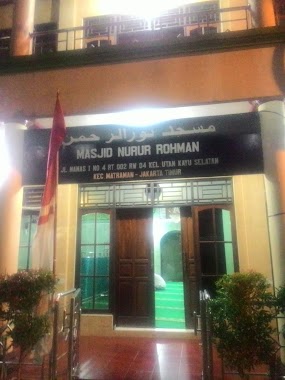
Masjid Nurur Rohman
Jalan Nanas I No.1, RT.2/RW.4, Utan Kayu Selatan
Mosque
read more
945 m
Masjid Nurul Hidayah
JL. Kramat Asem, RT. 07, RW. 05, Matraman, RT.11/RW.5, Utan Kayu Selatan
Mosque
read more
954 m
Masjid Ih Yaus Sunnah
Jalan Kramat Asem No.54, RT.11/RW.5, Utan Kayu Selatan
Mosque
read more
998 m
Musholla Al-Muthohhirin
19, 007, Jl. Peecetakan Negara II No, RT.13
Mosque
read more
1.13 km
Masjid Al Muttaqiin
Komp. TNI AL, Jalan Pramuka, RT 14 RW 08, Rawasari, Cempaka Putih, RT.14/RW.8, Rawasari
Mosque
read more
1.193 km
Nurul Hidayah Mosque
Jalan Kramat Asem No.24, RT.7/RW.5, Utan Kayu Selatan
Mosque
read more
1.296 km
Musholla AT MUTHOHIRIN
Jalan Percetakan Negara 2 Gang Naviri No.18, RT.15/RW.7, Johar Baru
Mosque
read more
📑
all categories
Accounting
Administrative area level 1
Administrative area level 2
Airport
Amusement park
Aquarium
Art gallery
Atm
Bakery
Bank
Bar
Beauty salon
Bicycle store
Book store
Bowling alley
Bus station
Cafe
Campground
Car dealer
Car rental
Car repair
Car wash
Casino
Cemetery
Church
City hall
Clothing store
Colloquial area
Convenience store
Courthouse
Dentist
Department store
Doctor
Electrician
Electronics store
Embassy
Finance
Fire station
Florist
Food
Funeral home
Furniture store
Gas station
General contractor
Grocery or supermarket
Gym
Hair care
Hardware store
Health
Hindu Temple
Home goods store
Hospital
Insurance agency
Intersection
Jewelry store
Laundry
Lawyer
Library
Liquor store
Local government office
Locality
Locksmith
Lodging
Meal delivery
Meal takeaway
Mosque
Movie rental
Movie theater
Moving company
Museum
Natural feature
Neighborhood
Night club
Painter
Park
Parking
Pet store
Pharmacy
Physiotherapist
Place of worship
Plumber
Point of interest
Police
Political
Post office
Premise
Real estate agency
Restaurant
Roofing contractor
Route
Rv park, camping
School
Shoe store
Shopping mall
Spa
Stadium
Storage
Store
Subpremise
Supermarket
Synagogue
Taxi stand
Train station
Transit station
Travel agency
University
Veterinary care
Zoo
administrative area level 3
administrative area level 4
administrative area level 5
sublocality level 1
↑