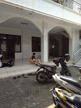
Mosque nearby Masjid Bait Al Rahmah
Indonesia
Mosque nearby Masjid Bait Al Rahmah
Masjid Bait Al Rahmah
36, Jalan Duren Tiga Selatan VII, 12760, Kota Jakarta Selatan, Daerah Khusus Ibukota Jakarta, ID Indonesia
contacts phone
:
+62 21 7993077
Latitude:
-6.2597445
, Longitude:
106.8300277
larger map & directions
read more
nearest Mosque
212 m
Masjid Jami Nurul Muhammad
Jalan Daksa Piun No.99, RT.2/RW.2, Duren Tiga
Mosque
read more
244 m
Masjid At Taqwa
Jalan Riam Kanan No.19, RT.12/RW.1, Duren Tiga
Mosque
read more
248 m
Musholla Jam'iyatul Barkah
2, RT.2/RW.2, Duren Tiga
Mosque
read more
364 m
Masjid LDII BAABUSSALAM desa PMP
Jalan Duren Tiga Selatan VII No.15, RT.14/RW.2, Duren Tiga
Mosque
read more
364 m
Masjid LDII BAABUSSALAM
Jalan Duren Tiga Selatan VII No.15, RT.14/RW.2, Duren Tiga
Mosque
read more
619 m
Musholla Anni'mah
Jalan Duren Tiga Selatan RT.9/RW.2, Kalibata
Mosque
read more
655 m
Musholla Al Hidayah
Jalan Duren Tiga Utara No.17, RT.8/RW.5, Duren Tiga
Mosque
read more
664 m
Baitussalam Mosque
Jalan Duren Tiga No.102, RT.7/RW.1, Duren Tiga
Mosque
read more
671 m
Masjid Baitussalam
Indonesia
Mosque
read more
671 m
Masjid Baitussalam
Indonesien
Mosque
read more
675 m
Mushola alhidayah
Jalan Timo RT.11/RW.3, Duren Tiga
Mosque
read more
755 m
Musholla Arrohmah
Jalan Kemang Timur No.4, RT.5/RW.4, Bangka
Mosque
read more
804 m
Masjid Jami-Al-Barkah
Indonesia
Mosque
read more
854 m
Masjid Baitul Halim
Jalan Tegal Parang Selatan V Blok Buncit X No.1, RT.1/RW.6, Tegal Parang
Mosque
read more
896 m
Musholla At Taqwa
Jalan Duren Tiga No.3A, RT.7/RW.6, Duren Tiga
Mosque
read more
905 m
Musholla Al- Barokah
Jalan Mampang Prapatan XIV RT.12/RW.1, Tegal Parang
Mosque
read more
923 m
Musholla Al Awwabin
Jalan Kalibata Utara II No.29, RT.7/RW.7, Kalibata
Mosque
read more
941 m
Masjid Jami Ahmad Al-Amin
Jalan Guru Alif Minyak 1 No.54, RT.4/RW.6, Duren Tiga
Mosque
read more
1.043 km
Mushollah Syaiful Rohim
Jalan Kemang Timur XV No.1, RT.10/RW.3, Bangka
Mosque
read more
1.069 km
Musholla Baiturasyidin
Jalan Mampang Prapatan XIV RT.002/RW.4, Tegal Parang
Mosque
read more
1.101 km
Masjid Jami Nurul Huda
Jalan Kemang Timur No.49, RT.6/RW.3, Bangka
Mosque
read more
1.11 km
Masjid Jami " Nurul Huda"
Indonesien
Mosque
read more
1.122 km
Masjid Darul Muttaqin
Jalan Bangka RT.12/RW.10, Pela Mampang
Mosque
read more
1.159 km
Masjid Jami Baitul
JL Bangka IXA, RT 06 RW 01, RT.10/RW.12, Pela Mampang
Mosque
read more
1.275 km
Masjid Al - Ittihad
Jalan Bangka IX No.23, RT.10/RW.12, Pela Mampang
Mosque
read more
📑
all categories
Accounting
Administrative area level 1
Administrative area level 2
Airport
Amusement park
Aquarium
Art gallery
Atm
Bakery
Bank
Bar
Beauty salon
Bicycle store
Book store
Bowling alley
Bus station
Cafe
Campground
Car dealer
Car rental
Car repair
Car wash
Casino
Cemetery
Church
City hall
Clothing store
Colloquial area
Convenience store
Courthouse
Dentist
Department store
Doctor
Electrician
Electronics store
Embassy
Finance
Fire station
Florist
Food
Funeral home
Furniture store
Gas station
General contractor
Grocery or supermarket
Gym
Hair care
Hardware store
Health
Hindu Temple
Home goods store
Hospital
Insurance agency
Intersection
Jewelry store
Laundry
Lawyer
Library
Liquor store
Local government office
Locality
Locksmith
Lodging
Meal delivery
Meal takeaway
Mosque
Movie rental
Movie theater
Moving company
Museum
Natural feature
Neighborhood
Night club
Painter
Park
Parking
Pet store
Pharmacy
Physiotherapist
Place of worship
Plumber
Point of interest
Police
Political
Post office
Premise
Real estate agency
Restaurant
Roofing contractor
Route
Rv park, camping
School
Shoe store
Shopping mall
Spa
Stadium
Storage
Store
Subpremise
Supermarket
Synagogue
Taxi stand
Train station
Transit station
Travel agency
University
Veterinary care
Zoo
administrative area level 3
administrative area level 4
administrative area level 5
sublocality level 1
↑