Mosque nearby Masjid At Taqwa Gunung Leutik
Indonesia
Mosque nearby Masjid At Taqwa Gunung Leutik
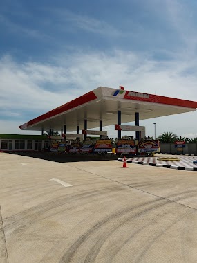
Masjid At Taqwa Gunung Leutik
Benteng Indonesia
contacts phone
:
+62
Latitude:
-6.5474995
, Longitude:
106.7089739
read more
nearest Mosque
688 m
Masjid Nurul Huda(IRMA)
Lebak
Mosque
read more
707 m
Masjid Al Ihsan
Cibanteng
Mosque
read more
890 m
Masjid Assholihin
Benteng
Mosque
read more
894 m
Masjid Baitu rahhim desa Cibanteng Darut Tafsir
Cibanteng
Mosque
read more
894 m
Masjid baitu Rahim
Cibanteng
Mosque
read more
1.001 km
Masjid Ibaadurrahman, Ma'had Imam Malik bin Anas
Blok Kampung Pasir Gaok, Jalan Letkol Atang Sanjaya Blok Kampung Pasir Gaok No.45, Pasirgaok, Ranca Bungur, Pasirgaok
Mosque
read more
1.082 km
Musholla At Taqwa Cinangneng
Jalan Raya Cinangneng - Ciampea No.5, Benteng
Mosque
read more
1.108 km
Masjid Al Hidayah, Jembatan Cinangneng
Jalan Nasional 11, Cibanteng
Mosque
read more
1.127 km
Masjid Jamie Al - Hidayah
Jembatan Cinangneng,, Jalan Raya Pasar Ciampea, Cibanteng
Mosque
read more
1.404 km
Mesjid At-Taqwa Cibanteng
Jalan Raya Cibanteng No.60, Ciampea, Cibanteng
Mosque
read more
1.671 km
Mushola Nurul Ihsan
Bojong Rangkas
Mosque
read more
1.681 km
Jami Masjid Al-Muttaqin
Jalan Sindang Sari Blok E No.3A, Bojong Rangkas
Mosque
read more
1.739 km
Masjid Al Qodim
Gedong, Rt.03/01, Ciampea, Ciampea
Mosque
read more
1.743 km
Masjid Al Ikhlas
Jalan Sindang Sari, Bojong Rangkas
Mosque
read more
1.808 km
Masjid Al Istiqomah
Jalan Purnawarman No.11, Ciampea
Mosque
read more
1.93 km
Masjid Nurul Hidayah
Kampung Babakan, RT. 01/01, Ciampea, Ciampea
Mosque
read more
1.957 km
Masjid Darur Rawa
Kampung Bj Rangkas, Ciampea, RT 05 RW 05, Ciampea
Mosque
read more
1.957 km
Masjid As Syifa
Kampung Gn. Leutik, RT 05 RW 05, Ciampea, Ciampea
Mosque
read more
1.957 km
Masjid Al Muttaqin
Ciampealir, Rt.05/06, Ciampea, Ciampea
Mosque
read more
1.957 km
Masjid Nurul Rohman
Kampung Tegawaru, Rt.02/01, Ciampea, Ciampea
Mosque
read more
1.963 km
Masjid Jami Nurul Huda
Ciampea
Mosque
read more
1.992 km
Fatimah MOSQUE
Jln. Sersan Misdja, Carang Pulang, Cikarawang
Mosque
read more
2.091 km
Masjid LDII Nuruttarbiyah 354
Cihideung Ilir
Mosque
read more
2.237 km
Masjid Daarul Hikmah Pasirgaok
Gang Senyum, Pasirgaok
Mosque
read more
2.251 km
Masjid Al Barokah
Kp. Bojong Rangkas RW.04, Bojong Rangkas
Mosque
read more
📑
all categories
Accounting
Administrative area level 1
Administrative area level 2
Airport
Amusement park
Aquarium
Art gallery
Atm
Bakery
Bank
Bar
Beauty salon
Bicycle store
Book store
Bowling alley
Bus station
Cafe
Campground
Car dealer
Car rental
Car repair
Car wash
Casino
Cemetery
Church
City hall
Clothing store
Colloquial area
Convenience store
Courthouse
Dentist
Department store
Doctor
Electrician
Electronics store
Embassy
Finance
Fire station
Florist
Food
Funeral home
Furniture store
Gas station
General contractor
Grocery or supermarket
Gym
Hair care
Hardware store
Health
Hindu Temple
Home goods store
Hospital
Insurance agency
Intersection
Jewelry store
Laundry
Lawyer
Library
Liquor store
Local government office
Locality
Locksmith
Lodging
Meal delivery
Meal takeaway
Mosque
Movie rental
Movie theater
Moving company
Museum
Natural feature
Neighborhood
Night club
Painter
Park
Parking
Pet store
Pharmacy
Physiotherapist
Place of worship
Plumber
Point of interest
Police
Political
Post office
Premise
Real estate agency
Restaurant
Roofing contractor
Route
Rv park, camping
School
Shoe store
Shopping mall
Spa
Stadium
Storage
Store
Subpremise
Supermarket
Synagogue
Taxi stand
Train station
Transit station
Travel agency
University
Veterinary care
Zoo
administrative area level 3
administrative area level 4
administrative area level 5
sublocality level 1
↑