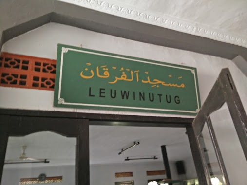
Mosque nearby Masjid Ash Sholeh
Indonesia
Mosque nearby Masjid Ash Sholeh
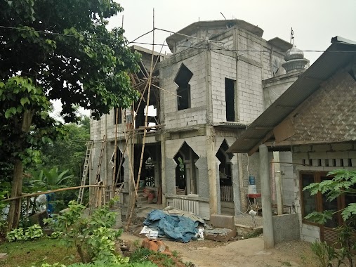
Masjid Ash Sholeh
JL. Leuwi Nutug, RT. 01 RW. 04, Citeureup, Leuwinutug Indonesia
contacts phone
:
+62
Latitude:
-6.511911
, Longitude:
106.858891
read more
nearest Mosque
9 m
Masjid Nurul Yakin
Jalan Leuwi Nutug No.14, RT.3/RW.4, Leuwinutug
Mosque
read more
10 m
Masjid Al Ihklas
Jalan Leuwi Nutug No.11, RT.3/RW.4, Leuwinutug
Mosque
read more
10 m
Masjid Al Mubaokah
Jalan Leuwi Nutug No.11, RT.3/RW.4, Leuwinutug
Mosque
read more
10 m
Masjid Jami Al-Manan
Jalan Leuwi Nutug No.14, RT.3/RW.4, Leuwinutug
Mosque
read more
14 m
Masjid Al Hijrah
Jalan Leuwi Nutug No.63, RT.3/RW.4, Leuwinutug
Mosque
read more
402 m
Masjid Al-wustho
Jalan Lang Bau Blok Belingbing No.37, Leuwinutug
Mosque
read more
549 m
Masjid Jami Nurul Yaqin
Leuwinutug
Mosque
read more
559 m
Rumah Babang H'Zie
Kp. Cigandaria Sentul, Kampung Parung Jambu, Leuwinutug
Mosque
read more
571 m
Masjid Jami Al Huda Cigandaria
Gang Masjid, Sentul
Mosque
read more
719 m
Masjid Jami Al-huda
Jalan Raya Sirkuit Sentul, Sentul
Mosque
read more
721 m
masjid besar AL-IHSAN
jl. kayumanis, Cirimekar
Mosque
read more
997 m
Musholla Cemani
Sanja
Mosque
read more
1.091 km
Pondok Pesantren As-Shoheh
Lingkungan Sampora RT 004/009
Mosque
read more
1.091 km
Pondok Pesantren As-Shoheh
Jl. Kp. Sampora RT 004/009, Cibinong
Mosque
read more
1.121 km
Masjid Jamie Nurul Hikmah
Jalan Sejahtera No.50, Sanja
Mosque
read more
1.327 km
Masjid LDII Al Furqon
Jalan Pahlawan No.474, Sentul
Mosque
read more
1.364 km
Mushola Baiturrohman
Sentul
Mosque
read more
1.577 km
Masjid Raya The Nature
Sentul
Mosque
read more
1.594 km
mosque
Jalan Elang No.16, Sukahati
Mosque
read more
1.644 km
Masjid Jami As'salam
Jl Ps Petani Kp Nanggewer No.52, Nanggewer
Mosque
read more
1.65 km
LDII Sanja
Jalan Pahlawan Blok Tanuwija 3 No.39, Sanja
Mosque
read more
1.664 km
Keramat Mosque
Sentul
Mosque
read more
1.74 km
Masjid Daarul Istiqomah
Blok Tanuwijaya 2 No.5, Jalan Pahlawan, Sanja
Mosque
read more
1.991 km
Mushola SPBU Nanggewer
Jalan Raya Bogor, Nanggewer
Mosque
read more
2.201 km
Jasa Cuci Karpet Masjid
Jalan Raya Bogor - Jakarta, Nanggewer Mekar
Mosque
read more
📑
all categories
Accounting
Administrative area level 1
Administrative area level 2
Airport
Amusement park
Aquarium
Art gallery
Atm
Bakery
Bank
Bar
Beauty salon
Bicycle store
Book store
Bowling alley
Bus station
Cafe
Campground
Car dealer
Car rental
Car repair
Car wash
Casino
Cemetery
Church
City hall
Clothing store
Colloquial area
Convenience store
Courthouse
Dentist
Department store
Doctor
Electrician
Electronics store
Embassy
Finance
Fire station
Florist
Food
Funeral home
Furniture store
Gas station
General contractor
Grocery or supermarket
Gym
Hair care
Hardware store
Health
Hindu Temple
Home goods store
Hospital
Insurance agency
Intersection
Jewelry store
Laundry
Lawyer
Library
Liquor store
Local government office
Locality
Locksmith
Lodging
Meal delivery
Meal takeaway
Mosque
Movie rental
Movie theater
Moving company
Museum
Natural feature
Neighborhood
Night club
Painter
Park
Parking
Pet store
Pharmacy
Physiotherapist
Place of worship
Plumber
Point of interest
Police
Political
Post office
Premise
Real estate agency
Restaurant
Roofing contractor
Route
Rv park, camping
School
Shoe store
Shopping mall
Spa
Stadium
Storage
Store
Subpremise
Supermarket
Synagogue
Taxi stand
Train station
Transit station
Travel agency
University
Veterinary care
Zoo
administrative area level 3
administrative area level 4
administrative area level 5
sublocality level 1
↑