Mosque nearby Masjid AlHABASIYAH ANNUR
Indonesia
Mosque nearby Masjid AlHABASIYAH ANNUR
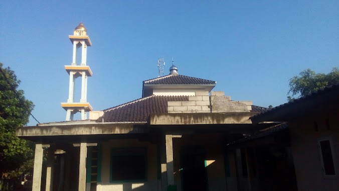
Masjid AlHABASIYAH ANNUR
Dayeuh Indonesia
contacts phone
:
+62
Latitude:
-6.4270966
, Longitude:
106.9782996
read more
nearest Mosque
328 m
Musholla Al Ikhlas
Dayeuh
Mosque
read more
393 m
Mushola At-Taqwa
Jalan Raya KH Umar Rawa Ilat, Dayeuh
Mosque
read more
479 m
Mushola Al-Hidayah
Dayeuh
Mosque
read more
595 m
Pondok Pesantren Madinatul Ulum Cipari Cikahuripan
Dayeuh
Mosque
read more
715 m
mushollah al-barokah
Dayeuh
Mosque
read more
744 m
Mesjid Jamie Darul-ikhlas
Perumahan Villa Dayeuh, Dayeuh
Mosque
read more
888 m
Masjid Jami Annur Rawa Ilat
kampung rawa ilat rt 03 rw 09, Dayeuh
Mosque
read more
921 m
Musholah Al-Huda
Dayeuh
Mosque
read more
1.02 km
musholah al amanah
Dayeuh
Mosque
read more
1.045 km
Mushola Al Muhajirin
Puri Harmoni 1,Rawailat,, Dayeuh
Mosque
read more
1.237 km
Masjid Ar-royan Pt. Nandya Karya Perkasa
Dayeuh
Mosque
read more
1.492 km
Musholla Attaqwa
Dayeuh
Mosque
read more
1.514 km
Masjid Al Fattah
Gang Nangka No.8, Dayeuh
Mosque
read more
1.529 km
Masjid Al Hikmah
2, Villa Cileungsi Asri, Mampir
Mosque
read more
1.561 km
Masjid JAMI AL-HIDAYAH
Mampir
Mosque
read more
1.59 km
Masjid al-hidayah
Jalan Kampung Sawah Raya, Cileungsi Kidul
Mosque
read more
1.618 km
Masjid Nurul IMAN
Jalan Cileungsi, Mampir
Mosque
read more
1.67 km
Masjid Al-Hijrah
Dayeuh
Mosque
read more
1.723 km
Masjid Al Muttakhir
JL. Nyangegeng, RT. 01 RW. 01, Jonggol, Cileungsi Kidul
Mosque
read more
1.733 km
Ummu Nabila
Kampung Sawah, RT. 04 RW. 02, Cileungsi Kidul, CIleungsi, Cileungsi Kidul
Mosque
read more
1.741 km
Masjid AL Jauharoh
Jalan Griya Cileungsi 2 No.5, Mampir
Mosque
read more
1.937 km
Masjid Ar-Rahmah
Jalan Plamboyan II, Cileungsi Kidul
Mosque
read more
1.962 km
Jami Masjid Nurul Falaah
Jalan Cileungsi-Jonggol Jalan Pondok Damai, Cileungsi Kidul
Mosque
read more
2.34 km
Masjid Al - Ghorib
Dayeuh
Mosque
read more
2.479 km
Masjid Alhikmah
kampung cibrreum Rt/w. 07/05, Cileungsi Kidul
Mosque
read more
📑
all categories
Accounting
Administrative area level 1
Administrative area level 2
Airport
Amusement park
Aquarium
Art gallery
Atm
Bakery
Bank
Bar
Beauty salon
Bicycle store
Book store
Bowling alley
Bus station
Cafe
Campground
Car dealer
Car rental
Car repair
Car wash
Casino
Cemetery
Church
City hall
Clothing store
Colloquial area
Convenience store
Courthouse
Dentist
Department store
Doctor
Electrician
Electronics store
Embassy
Finance
Fire station
Florist
Food
Funeral home
Furniture store
Gas station
General contractor
Grocery or supermarket
Gym
Hair care
Hardware store
Health
Hindu Temple
Home goods store
Hospital
Insurance agency
Intersection
Jewelry store
Laundry
Lawyer
Library
Liquor store
Local government office
Locality
Locksmith
Lodging
Meal delivery
Meal takeaway
Mosque
Movie rental
Movie theater
Moving company
Museum
Natural feature
Neighborhood
Night club
Painter
Park
Parking
Pet store
Pharmacy
Physiotherapist
Place of worship
Plumber
Point of interest
Police
Political
Post office
Premise
Real estate agency
Restaurant
Roofing contractor
Route
Rv park, camping
School
Shoe store
Shopping mall
Spa
Stadium
Storage
Store
Subpremise
Supermarket
Synagogue
Taxi stand
Train station
Transit station
Travel agency
University
Veterinary care
Zoo
administrative area level 3
administrative area level 4
administrative area level 5
sublocality level 1
↑