Mosque nearby Masjid Al Kamal
Indonesia
Mosque nearby Masjid Al Kamal
Masjid Al Kamal
Jalan Kedoya Raya, 2, 11520, Kota Jakarta Barat, Daerah Khusus Ibukota Jakarta, ID Indonesia
contacts phone
:
+62
Latitude:
-6.1878684
, Longitude:
106.7615695
larger map & directions
read more
nearest Mosque
274 m
Masjid Nursiah Daud Paloh
Jalan Pilar Mas Utama KAv. A - D, Kedoya Selatan, Kebon Jeruk, RT.4/RW.3, Kedoya Selatan
Mosque
read more
587 m
Mushollah
Jalan Melati No.22, RT.12/RW.10, Kebon Jeruk
Mosque
read more
628 m
Masjid Jamiul Ikhsan
Jalan Pesanggrahan No.8D, RT.1/RW.7, Kembangan Selatan
Mosque
read more
635 m
Masjid Nurul Huda
JL Pesanggrahan, RT 01 RW 01, RT.1/RW.7, Kembangan Selatan
Mosque
read more
674 m
Mosque Of Public Senior High School 112
Jalan Pesanggrahan No.2, RT.10/RW.5, Meruya Utara
Mosque
read more
698 m
Masjid Al Ihsan
Jalan Pesanggrahan RT.2/RW.7, Kembangan Selatan
Mosque
read more
741 m
Masjid Al-Isyraq
Jalan Melati No.55, RT.10/RW.10, Kebon Jeruk
Mosque
read more
797 m
Mushala Ash-Sholatiyyah, Puri Kembangan
Jalan Pesanggrahan No.37, RT.1/RW.6, Kembangan Selatan
Mosque
read more
826 m
Masjid Assalam
Komplek DPR RI Kebon Jeruk Kebon Jeruk Jakarta Barat DKI Jakarta, RT.11/RW.10, Kebon Jeruk
Mosque
read more
843 m
Masjid An-Nasiriyah
Jl. Duri terusan tol no 24, Duri Kepa Kebon Jeruk, Kebon Jeruk, RT.6/RW.1, Kedoya Selatan
Mosque
read more
853 m
Jami 'Baitul Khoir
Jalan Sanggrahan No.52, RT.11/RW.3, 03, Meruya Utara
Mosque
read more
872 m
Mushola Nurul Iman
Jalan Jomas No.40, RT.2/RW.5, Meruya Utara
Mosque
read more
908 m
Masjid Al - Mujahidin
JL. Kedoya Selatan, RT. 02/05, RT.1/RW.3, Kedoya Selatan
Mosque
read more
940 m
Masjid Baitul Makmur
Jalan Kedoya Raya No.1, RT.1/RW.3, Kedoya Selatan
Mosque
read more
940 m
Masjid Sirajul Huda
Jalan Kedoya Raya No.1, RT.1/RW.3, Kedoya Selatan
Mosque
read more
940 m
Masjid Darul Jihad
Jalan Kedoya Raya No.1, RT.1/RW.3, Kedoya Selatan
Mosque
read more
940 m
Masjid Darussalam
Jalan Kedoya Raya No.1, RT.1/RW.3, Kedoya Selatan
Mosque
read more
972 m
Musholla
Gang H.Amir No.25, RT.10/RW.7, Kebon Jeruk
Mosque
read more
1000 m
Musholla Nurul Jannah
Jalan Kedoya Duri RT.2/RW.7, Duri Kepa
Mosque
read more
1.012 km
Masjid BPPT JM
RT.9/RW.3, Meruya Utara
Mosque
read more
1.031 km
Masjid An Nur
Jalan Teknologi XVI No.3, RT.9/RW.3, Meruya Utara
Mosque
read more
1.064 km
Masjid Al Barkah
Jalan Kompleks Bepeka 6 RT.5/RW.10, Kebon Jeruk
Mosque
read more
1.096 km
Masjid Jami Manba'ul Huda LDII
Jalan Haji Ja'ani RT.6/RW.11, Kebon Jeruk
Mosque
read more
1.111 km
mushola subulissalam
Jalan Puri Kembangan No.64, RT.11/RW.5, Kembangan Selatan
Mosque
read more
1.125 km
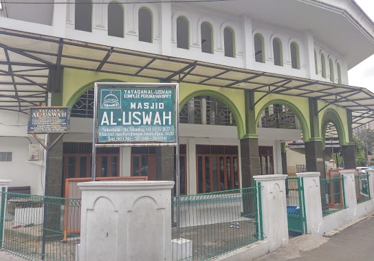
Masjid Al-USWAH KOMP. BPPT
RT.8/RW.3, Srengseng
Mosque
read more
📑
all categories
Accounting
Administrative area level 1
Administrative area level 2
Airport
Amusement park
Aquarium
Art gallery
Atm
Bakery
Bank
Bar
Beauty salon
Bicycle store
Book store
Bowling alley
Bus station
Cafe
Campground
Car dealer
Car rental
Car repair
Car wash
Casino
Cemetery
Church
City hall
Clothing store
Colloquial area
Convenience store
Courthouse
Dentist
Department store
Doctor
Electrician
Electronics store
Embassy
Finance
Fire station
Florist
Food
Funeral home
Furniture store
Gas station
General contractor
Grocery or supermarket
Gym
Hair care
Hardware store
Health
Hindu Temple
Home goods store
Hospital
Insurance agency
Intersection
Jewelry store
Laundry
Lawyer
Library
Liquor store
Local government office
Locality
Locksmith
Lodging
Meal delivery
Meal takeaway
Mosque
Movie rental
Movie theater
Moving company
Museum
Natural feature
Neighborhood
Night club
Painter
Park
Parking
Pet store
Pharmacy
Physiotherapist
Place of worship
Plumber
Point of interest
Police
Political
Post office
Premise
Real estate agency
Restaurant
Roofing contractor
Route
Rv park, camping
School
Shoe store
Shopping mall
Spa
Stadium
Storage
Store
Subpremise
Supermarket
Synagogue
Taxi stand
Train station
Transit station
Travel agency
University
Veterinary care
Zoo
administrative area level 3
administrative area level 4
administrative area level 5
sublocality level 1
↑