Mosque nearby Masjid Al Iksan Waeheru
Indonesia
Mosque nearby Masjid Al Iksan Waeheru
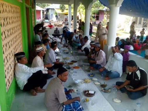
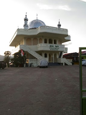
Masjid Al Iksan Waeheru
Jalan Laksdya Leo Wattimena, Negeri Lama Indonesia
contacts phone
:
+62
Latitude:
-3.6303573
, Longitude:
128.2161617
read more
nearest Mosque
905 m
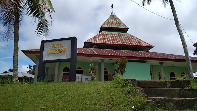
Al-Hamid Mosque
Waiheru
Mosque
read more
1.461 km
Masjid Nurul Yaqin Dusun Hulung
Hunuth/Durian Patah
Mosque
read more
1.714 km
Mesjid Al Hijrah
Hunuth/Durian Patah
Mosque
read more
2.28 km
Masjid Jannatun Naim Batu Koneng
Poka
Mosque
read more
2.444 km
Masjid Nurul Ikwan
Hunuth/Durian Patah
Mosque
read more
2.445 km
Mesjil Nurul Iklsas
Hunuth/Durian Patah
Mosque
read more
2.886 km
Masjid Nurul Hidayah LATTA
Jalan Wolter Monginsidi, Halong
Mosque
read more
3.138 km
Masjid An Nur
Tlk., Hunuth/Durian Patah
Mosque
read more
3.181 km
Masjid Darul Hasanah
Poka
Mosque
read more
3.196 km
Masjid Jami
Hunuth/Durian Patah
Mosque
read more
3.577 km
Masjid Kampus Unpatti
Poka
Mosque
read more
3.78 km
Masjid Almuhajirin Perumnas Poka
Tihu
Mosque
read more
3.818 km
Masjid Al Falah
Tlk., Tlk., Hunuth/Durian Patah
Mosque
read more
4.021 km
Masjid Zipur
Rumah Tiga
Mosque
read more
4.181 km
MASJID AL-TAQWA
Rumah Tiga
Mosque
read more
4.414 km
Masjid Al Muhajirin
Hitu Mesing
Mosque
read more
4.447 km
Masjid Agung An-Nuur Batumerah
Batumerah
Mosque
read more
4.831 km
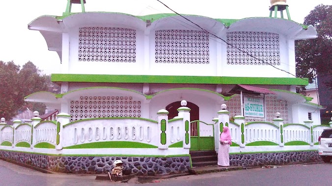
As'Syukur Mosque
Hative Kecil
Mosque
read more
4.943 km
wailela pantai
Rumah Tiga
Mosque
read more
4.97 km
Masjid Bani Muhammad
Jalan Gunung Malintang, Hative Kecil
Mosque
read more
5.576 km
Masjid Al Huda Kota Jawa
Rumah Tiga
Mosque
read more
5.66 km
Masjid Raya (Kapaha)
Jalan Sultan Hasanudin, Pandan Kasturi
Mosque
read more
5.812 km
Masjid Amal Shaleh
Batu Merah
Mosque
read more
5.967 km
Masjid Hizbullah
Hitu Mesing
Mosque
read more
6.868 km
Masjid Asrama Batumerah
Jalan Dokter Wem Tehupeiory, Kel Amantelu
Mosque
read more
📑
all categories
Accounting
Administrative area level 1
Administrative area level 2
Airport
Amusement park
Aquarium
Art gallery
Atm
Bakery
Bank
Bar
Beauty salon
Bicycle store
Book store
Bowling alley
Bus station
Cafe
Campground
Car dealer
Car rental
Car repair
Car wash
Casino
Cemetery
Church
City hall
Clothing store
Colloquial area
Convenience store
Courthouse
Dentist
Department store
Doctor
Electrician
Electronics store
Embassy
Finance
Fire station
Florist
Food
Funeral home
Furniture store
Gas station
General contractor
Grocery or supermarket
Gym
Hair care
Hardware store
Health
Hindu Temple
Home goods store
Hospital
Insurance agency
Intersection
Jewelry store
Laundry
Lawyer
Library
Liquor store
Local government office
Locality
Locksmith
Lodging
Meal delivery
Meal takeaway
Mosque
Movie rental
Movie theater
Moving company
Museum
Natural feature
Neighborhood
Night club
Painter
Park
Parking
Pet store
Pharmacy
Physiotherapist
Place of worship
Plumber
Point of interest
Police
Political
Post office
Premise
Real estate agency
Restaurant
Roofing contractor
Route
Rv park, camping
School
Shoe store
Shopping mall
Spa
Stadium
Storage
Store
Subpremise
Supermarket
Synagogue
Taxi stand
Train station
Transit station
Travel agency
University
Veterinary care
Zoo
administrative area level 3
administrative area level 4
administrative area level 5
sublocality level 1
↑