Mosque nearby Masjid Al Huda
Indonesia
Mosque nearby Masjid Al Huda
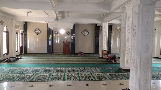
Masjid Al Huda
Jalan Re. Abdullah, Kota Bogor, Jawa Barat, ID Indonezja
contacts phone
:
+62
Latitude:
-6.5981169
, Longitude:
106.7791794
larger map & directions
read more
nearest Mosque
151 m
Masjid Al-Huda
Jalan Gunung Batu No.37, Gunungbatu
Mosque
read more
335 m
Masjid An Nizariyyah
Jalan Aria Surialaga No.9, Pasirkuda, Bogor Barat, Pasirmulya
Mosque
read more
375 m
Mesjid Pasir Jaya 1
Jalan Aria Surialaga No.4, Pasirkuda
Mosque
read more
391 m
MASJID JAMI MUAMALAH
Gunungbatu, Bogor Barat, Gunungbatu
Mosque
read more
464 m
Masjid Darussalam
Jalan Rh. Acesukarna Raya No.28, Pasirmulya
Mosque
read more
592 m
Nurul Hikmah Mosque
Jalan Gunung Batu Blok Kutilang No.123, Gunungbatu
Mosque
read more
622 m
Musholla Al Ikhlas
Jalan Panaragan Penggilingan No.1-49, Panaragan
Mosque
read more
637 m
Mesjid Al-Mujahidin
Jalan Raya Ciomas No.19, Pasirkuda
Mosque
read more
678 m
Al-Ikhlass Jami' Mosque
Jalan Aria Surialaga No.30, Pasir Jaya
Mosque
read more
688 m
Masjid Al Hidayah
Jalan Aria Surialaga No.123, Pasir Jaya
Mosque
read more
725 m
MASJID JAMI AL ISTIQOMAH
Jl. Jabaru 3 No.24, rt 02/ Bar., Jalan Pasir Kuda Blok Darmajaya No.10, Pasirkuda
Mosque
read more
734 m
Mushola Al Barokah Mekarsari
Gunungbatu
Mosque
read more
781 m
Madrasah Su'latu Shibyan
Jalan Gunung Batu No.45, Gunungbatu
Mosque
read more
823 m
Masjid Jami Nurul 'Amal
Jalan Mayjen Ishak Djuarsa, Gunungbatu, Bogor Barat, Gunungbatu
Mosque
read more
833 m
Masjd Nurul Amal
Jalan Gunung Batu No.120, Gunungbatu
Mosque
read more
858 m
Masjid Al Mu'Awanah
JL Cibalagung, Pasar Jaya, Pasir Jaya
Mosque
read more
901 m
Masjid Al Istiqomah
Jalan Gunung Batu Blok Rante No.40, Gunungbatu
Mosque
read more
915 m
Mesjid Al Ikhlas
Jalan Bojong Menteng, Ciomas
Mosque
read more
936 m
Masjid Al-Munawwaroh RW 14
Jalan Gunung Batu No.19, Gunungbatu
Mosque
read more
938 m
Musholla Al Fatah
Jl. Hegarmanah RT. 02/01, Ciomas, Gunungbatu
Mosque
read more
978 m
MUSHALA NURUL IMAN
Gang Rante, Gunungbatu
Mosque
read more
1.023 km
Al Mubarok Mosque
Jalan Hegarmanah III No.37, Gunungbatu
Mosque
read more
1.079 km
Masjid Al-Fadhl
Indonezja
Mosque
read more
1.08 km
Masjid Al-Fadhl
Jalan Perintis Kemerdekaan No.34B, Kebon Kelapa
Mosque
read more
1.133 km
Mesjid Al-Ikhlas
Jalan Pasir Kuda No.Blok Darmajaya, Pasirkuda
Mosque
read more
📑
all categories
Accounting
Administrative area level 1
Administrative area level 2
Airport
Amusement park
Aquarium
Art gallery
Atm
Bakery
Bank
Bar
Beauty salon
Bicycle store
Book store
Bowling alley
Bus station
Cafe
Campground
Car dealer
Car rental
Car repair
Car wash
Casino
Cemetery
Church
City hall
Clothing store
Colloquial area
Convenience store
Courthouse
Dentist
Department store
Doctor
Electrician
Electronics store
Embassy
Finance
Fire station
Florist
Food
Funeral home
Furniture store
Gas station
General contractor
Grocery or supermarket
Gym
Hair care
Hardware store
Health
Hindu Temple
Home goods store
Hospital
Insurance agency
Intersection
Jewelry store
Laundry
Lawyer
Library
Liquor store
Local government office
Locality
Locksmith
Lodging
Meal delivery
Meal takeaway
Mosque
Movie rental
Movie theater
Moving company
Museum
Natural feature
Neighborhood
Night club
Painter
Park
Parking
Pet store
Pharmacy
Physiotherapist
Place of worship
Plumber
Point of interest
Police
Political
Post office
Premise
Real estate agency
Restaurant
Roofing contractor
Route
Rv park, camping
School
Shoe store
Shopping mall
Spa
Stadium
Storage
Store
Subpremise
Supermarket
Synagogue
Taxi stand
Train station
Transit station
Travel agency
University
Veterinary care
Zoo
administrative area level 3
administrative area level 4
administrative area level 5
sublocality level 1
↑