Mosque nearby Masjid Al Hamd
Indonesia
Mosque nearby Masjid Al Hamd
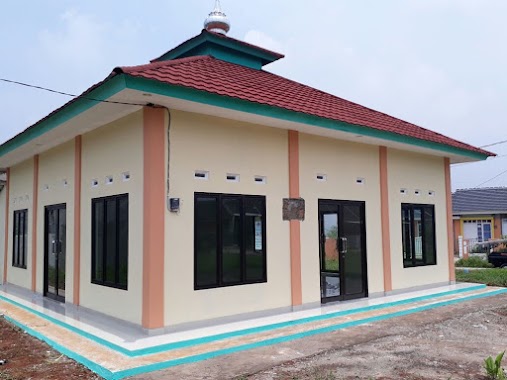
Masjid Al Hamd
Sumur Batu, Bantargebang, Bekasi City, West Java 17154, Indonesia
contacts phone
:
+62
Latitude:
-6.339166
, Longitude:
107.013041
larger map & directions
read more
nearest Mosque
106 m
Musholla Al Lathiif
Sumur Batu
Mosque
read more
169 m
Masjid Almuhajirin
Sumur Batu
Mosque
read more
278 m
Masjid Baiturrohman Blok R
Blok R6. 17325, Jalan Rajawali No.4, Burangkeng
Mosque
read more
386 m
Masjid An'Nur
Sumur Batu
Mosque
read more
451 m
Masjid Baitul Muttaqin Cluster Hibiscus
Sumur Batu
Mosque
read more
461 m
Masjid Raudatul Jannah
Jalan Bekasi Timur Regensi Raya Blok r2 No.8, Burangkeng
Mosque
read more
477 m
Masjid Al Mujahidin Cluster Ixora
Bekasi Timur Regensi 5, Cluster Ixora,, Sumur Batu
Mosque
read more
546 m
Mushola Darussalam
Cimuning
Mosque
read more
609 m
Masjid Jami Nurul Huda
Jalan Bawang Raya, Cimuning
Mosque
read more
645 m
MASJID AL IKHLAS
Sumur Batu
Mosque
read more
675 m
Masjid Baitul Muttaqin
Cimuning
Mosque
read more
736 m
Masjid Baitul Hikmah
Burangkeng
Mosque
read more
799 m
Musholah Nurul Hidayah
Jalan H. Ma'mun No.17, Burangkeng
Mosque
read more
864 m
Masjid Al Mujahidien
Jalan Bekasi Timur Regensi Raya No.2, Burangkeng
Mosque
read more
902 m
IC Ayid bin Khazam Al Rouqy
Burangkeng
Mosque
read more
909 m
Masjid Almuhajirin
rt 03 rw 08 cluster jasmine, Sumur Batu
Mosque
read more
966 m
Masjid Jamie Baetal Ma'mur
Sumur Batu
Mosque
read more
1.009 km
Masjid Nurul Fallah
bekasi timur regensi3 cluster lazulite cimuning, Mustika Jaya
Mosque
read more
1.01 km
Masjid AL-IKHLAS
Jalan Cinyosog No.123, Burangkeng
Mosque
read more
1.043 km
Musholla Al Furqon
Cimuning
Mosque
read more
1.129 km
Masjid Thoifah Manshuroh
no., Jalan Cinyosog No.48, Burangkeng
Mosque
read more
1.248 km
Masjid Ta'lim Ar Ridwan
Jalan Caringin, Sumur Batu
Mosque
read more
1.277 km
Masjid Al- Barkah
Sumur Batu
Mosque
read more
1.573 km
Masjid At Taqwa
Clsuter Chrysocolla - BTR 3, Padurenan
Mosque
read more
1.656 km
MASJID AN-NUR BLOK F
9, Jalan Flaminggo I, Cimuning
Mosque
read more
📑
all categories
Accounting
Administrative area level 1
Administrative area level 2
Airport
Amusement park
Aquarium
Art gallery
Atm
Bakery
Bank
Bar
Beauty salon
Bicycle store
Book store
Bowling alley
Bus station
Cafe
Campground
Car dealer
Car rental
Car repair
Car wash
Casino
Cemetery
Church
City hall
Clothing store
Colloquial area
Convenience store
Courthouse
Dentist
Department store
Doctor
Electrician
Electronics store
Embassy
Finance
Fire station
Florist
Food
Funeral home
Furniture store
Gas station
General contractor
Grocery or supermarket
Gym
Hair care
Hardware store
Health
Hindu Temple
Home goods store
Hospital
Insurance agency
Intersection
Jewelry store
Laundry
Lawyer
Library
Liquor store
Local government office
Locality
Locksmith
Lodging
Meal delivery
Meal takeaway
Mosque
Movie rental
Movie theater
Moving company
Museum
Natural feature
Neighborhood
Night club
Painter
Park
Parking
Pet store
Pharmacy
Physiotherapist
Place of worship
Plumber
Point of interest
Police
Political
Post office
Premise
Real estate agency
Restaurant
Roofing contractor
Route
Rv park, camping
School
Shoe store
Shopping mall
Spa
Stadium
Storage
Store
Subpremise
Supermarket
Synagogue
Taxi stand
Train station
Transit station
Travel agency
University
Veterinary care
Zoo
administrative area level 3
administrative area level 4
administrative area level 5
sublocality level 1
↑