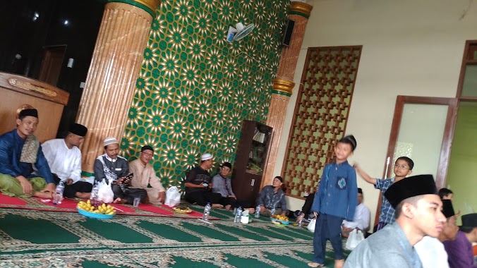
Mosque nearby Bukan Musholah Iftahuddin
Indonesia
Mosque nearby Bukan Musholah Iftahuddin
Bukan Musholah Iftahuddin
Unnamed Road, Cilangkap Indonesia
contacts phone
:
+62
Latitude:
-6.4345273
, Longitude:
106.8597423
read more
nearest Mosque
250 m
Masjid Baiturrahman Cilangkap
Cilangkap, Tapos
Mosque
read more
278 m
Musholla Al Amin
Jalan Lingkar Cilangkap No.9, RT.1/RW.11, Cilangkap
Mosque
read more
297 m
Mushola Albarokah
Cilangkap
Mosque
read more
317 m
Mushola Nurul Ikhwan
rt.02 rw 11, Cilangkap
Mosque
read more
336 m
Musholah Al Hikmah
Kp Cilangkap Rt 03, 17, Cilangkap
Mosque
read more
446 m
Masjid Jami At-Taubah
Jalan Masjid Al-Abror No.61, RT.1/RW.2, Cilangkap
Mosque
read more
487 m
Masjid Al Hikmah
rt 03 rw 015, Jalan BDB Cilangkap, Cilangkap
Mosque
read more
509 m
Masjid Al Abror
rt2/, Jalan Kampung Cilangkap No.15, Cilangkap
Mosque
read more
547 m
Musholah Al Fath
Cilangkap
Mosque
read more
552 m
Masjid Al Barkah
Jalan Banjaran Pucung No.44, Cilangkap
Mosque
read more
576 m
Musholla An Nur
Jalan Cilangkap No.23, RT.2/RW.3, Cilangkap
Mosque
read more
642 m
Masjid Daarul Faizin
Cimanggis 2, Cilangkap
Mosque
read more
653 m
Musholah Al Ikhlas
Jalan Banjaran Pucung No.44, Cilangkap
Mosque
read more
686 m
Musolah Almuhajirin
Cilangkap
Mosque
read more
746 m
Musholah Al Jihad
Kp. Sidamukti RT.02/01, Sukamaju
Mosque
read more
749 m
Musholah Al Ikhsan
Jalan Al-Ikhsan, Cilangkap
Mosque
read more
779 m
Masjid Jami Baiturrahman
Cilangkap
Mosque
read more
885 m
Mushola Al-Hikmah Cilangkap
Cilangkap
Mosque
read more
900 m
Masjid Al Barokah
Sukamaju
Mosque
read more
916 m
Masjid Nurul Falah
Blok Mohammad Ali No.20, Jalan Kampung Bendungan, Cilodong
Mosque
read more
921 m
masjid baiturrahman
Cilangkap
Mosque
read more
962 m
Masjid Attawwabiin
Jalan Cilangkap No.8, Cilangkap
Mosque
read more
969 m
Masjid Jami Al-Maghfiroh
Jalan Maghfiroh, Cilangkap
Mosque
read more
1.118 km
musholla Ash-shohabah
Cilangkap
Mosque
read more
1.146 km
Masjid Al-Ikhlas
Jalan Haji Ali, Sukamaju
Mosque
read more
📑
all categories
Accounting
Administrative area level 1
Administrative area level 2
Airport
Amusement park
Aquarium
Art gallery
Atm
Bakery
Bank
Bar
Beauty salon
Bicycle store
Book store
Bowling alley
Bus station
Cafe
Campground
Car dealer
Car rental
Car repair
Car wash
Casino
Cemetery
Church
City hall
Clothing store
Colloquial area
Convenience store
Courthouse
Dentist
Department store
Doctor
Electrician
Electronics store
Embassy
Finance
Fire station
Florist
Food
Funeral home
Furniture store
Gas station
General contractor
Grocery or supermarket
Gym
Hair care
Hardware store
Health
Hindu Temple
Home goods store
Hospital
Insurance agency
Intersection
Jewelry store
Laundry
Lawyer
Library
Liquor store
Local government office
Locality
Locksmith
Lodging
Meal delivery
Meal takeaway
Mosque
Movie rental
Movie theater
Moving company
Museum
Natural feature
Neighborhood
Night club
Painter
Park
Parking
Pet store
Pharmacy
Physiotherapist
Place of worship
Plumber
Point of interest
Police
Political
Post office
Premise
Real estate agency
Restaurant
Roofing contractor
Route
Rv park, camping
School
Shoe store
Shopping mall
Spa
Stadium
Storage
Store
Subpremise
Supermarket
Synagogue
Taxi stand
Train station
Transit station
Travel agency
University
Veterinary care
Zoo
administrative area level 3
administrative area level 4
administrative area level 5
sublocality level 1
↑