Lodging nearby Warung Ma' Suha, Curung Cihurang
Indonesia
Lodging nearby Warung Ma' Suha, Curung Cihurang
Warung Ma' Suha, Curung Cihurang
Jalan Gunung Bunder, Gunung Picung Indonesien
contacts phone
:
+62
Latitude:
-6.68672
, Longitude:
106.6865235
read more
nearest Lodging
40 m
Villa Jawa Bogor
Jalan Gunung Bunder, Gunung Picung
Lodging
read more
214 m
Curug Batu Ampar
Jalan Gunung Bunder, Gunung Picung
Lodging
read more
323 m
Curug Batu Ampar
Jalan Raya Gunung Salak Endah, Gunung Bunder 2
Lodging
read more
627 m
HARIS FAMILY CAMP
Gunung Picung
Lodging
read more
834 m
pondok kalembo ade
Gunung Sari
Lodging
read more
834 m
villa bima
Gunung Sari
Lodging
read more
888 m
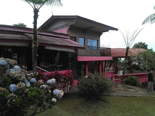
Vila Pink
Jalan Gunung Bunder, Gunung Picung
Lodging
read more
893 m
Camping Graun
Air Terjun Cigamea, Jalan Curug Cigamea, Gunung Sari
Lodging
read more
912 m
Saung Benteng
Gunung Picung
Lodging
read more
956 m
Pondok Rasamala
Kawasan Wisata Gunung Salak Endah, Jalan Gunung Bunder, Gunung Sari, Pamijahan, Bogor Barat, Gunung Picung
Lodging
read more
997 m
Homestay Lariska
Gunung Sari
Lodging
read more
1.011 km
Earth Aki Nini
Gunung Sari
Lodging
read more
1.015 km
Home Stay Deliza
Gunung Sari
Lodging
read more
1.016 km
Villa D'oase
Gunung Sari
Lodging
read more
1.052 km
Pondok 97
Jalan Gunung Picung, Gunung Sari
Lodging
read more
1.053 km
Vila Ping GSE
Gunung Sari
Lodging
read more
1.054 km
Villa pondok padil
Gunung Sari
Lodging
read more
1.059 km
Villa warkop betawi
Gunung Sari
Lodging
read more
1.071 km
Villa Pink
Jalan Gunung Picung, Gunung Sari
Lodging
read more
1.076 km
Villa Jemaras Batu Gajah
Gunung Picung
Lodging
read more
1.083 km
Penginapan Adat Dayak
Jalan Gunung Picung, Gunung Sari
Lodging
read more
1.096 km
Gubug Kiwari
Jalan Gunung Picung, Gunung Sari
Lodging
read more
1.113 km
Pondok Anugerah
Gunung Sari
Lodging
read more
1.113 km
Greenvilla Bogor
Jl. Gunung Salak Endah, Kampung Rawabogo, Pamijahan, Gunung Sari
Lodging
read more
1.117 km
Villa Hegar Sari
Gunung Sari
Lodging
read more
📑
all categories
Accounting
Administrative area level 1
Administrative area level 2
Airport
Amusement park
Aquarium
Art gallery
Atm
Bakery
Bank
Bar
Beauty salon
Bicycle store
Book store
Bowling alley
Bus station
Cafe
Campground
Car dealer
Car rental
Car repair
Car wash
Casino
Cemetery
Church
City hall
Clothing store
Colloquial area
Convenience store
Courthouse
Dentist
Department store
Doctor
Electrician
Electronics store
Embassy
Finance
Fire station
Florist
Food
Funeral home
Furniture store
Gas station
General contractor
Grocery or supermarket
Gym
Hair care
Hardware store
Health
Hindu Temple
Home goods store
Hospital
Insurance agency
Intersection
Jewelry store
Laundry
Lawyer
Library
Liquor store
Local government office
Locality
Locksmith
Lodging
Meal delivery
Meal takeaway
Mosque
Movie rental
Movie theater
Moving company
Museum
Natural feature
Neighborhood
Night club
Painter
Park
Parking
Pet store
Pharmacy
Physiotherapist
Place of worship
Plumber
Point of interest
Police
Political
Post office
Premise
Real estate agency
Restaurant
Roofing contractor
Route
Rv park, camping
School
Shoe store
Shopping mall
Spa
Stadium
Storage
Store
Subpremise
Supermarket
Synagogue
Taxi stand
Train station
Transit station
Travel agency
University
Veterinary care
Zoo
administrative area level 3
administrative area level 4
administrative area level 5
sublocality level 1
↑