Lodging nearby Villa Pak Mus
Indonesia
Lodging nearby Villa Pak Mus
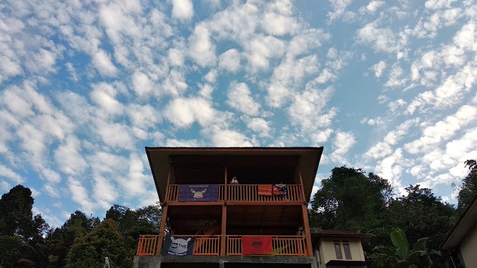
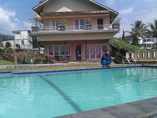
Villa Pak Mus
Jalan Pasir Panjang, Jogjogan Indonesia
contacts phone
:
+62
Latitude:
-6.6620792
, Longitude:
106.9340771
read more
nearest Lodging
173 m
Villa ZCO - BLS
Jalan Pasir Panjang, Jogjogan, Cisarua, Jogjogan
Lodging
read more
177 m
Villa Jco Puncak
Jalan Puncak Suji, Pasirpanjang
Lodging
read more
183 m
VILLA PAGAR MERAH ORANGE
Jalan Pasir Panjang, Jogjogan
Lodging
read more
335 m
Villa BUMI IBU
Jalan Jogjogan No.2, Jogjogan
Lodging
read more
366 m
Buyung Penginapan
Jogjogan
Lodging
read more
366 m
Panca Karya Variasi Hotel
Jogjogan
Lodging
read more
366 m
Budi Luhur Hotel
Jalan Raya Puncak No.2, Batu Layang
Lodging
read more
366 m
PT. Cisarua Prima Hiltop
Jalan Raya Puncak No.Km 22, Jogjogan
Lodging
read more
446 m
Villa Aldo
Jogjogan
Lodging
read more
488 m
Villa Midi
Jalan Jogjogan No.245, Jogjogan
Lodging
read more
751 m
Villa Brendita
Jalan Jogjogan No.34, Jogjogan, Cisarua, Jogjogan
Lodging
read more
881 m
Villa Griya 29
Jalan Desa Cilember, Cilember
Lodging
read more
884 m
Villa Sahira
Jogjogan
Lodging
read more
934 m
Villa Ibu Omoh
Cilember
Lodging
read more
972 m
Villa Bukit Binual
Jalan Air Terjun No.27, Jogjogan, Cisarua
Lodging
read more
982 m
Villa Damar
Cilember
Lodging
read more
983 m
Villa Kayu
Lodging
read more
983 m
Villa Kayu
Megamendung
Lodging
read more
991 m
Saung Camara
Cilember
Lodging
read more
1.03 km
Villa Evita
Jalan Jogjogan No.2001, Jogjogan
Lodging
read more
1.096 km
Villa Soebandi
Unnamed Road, Leuwimalang
Lodging
read more
1.103 km
Villa Silma
Jalan Jogjogan No.2001, Jogjogan
Lodging
read more
1.23 km
Villa Green Malaysia
No., Jalan Jogjogan No.70, Batu Layang
Lodging
read more
1.257 km
Villa Nadine Jogjogan
Jogjogan
Lodging
read more
1.299 km
Hotel & Restaurant Gondangdia
Jl. Raya Puncak Km 79,3, Cisarua, Kopo
Lodging
read more
📑
all categories
Accounting
Administrative area level 1
Administrative area level 2
Airport
Amusement park
Aquarium
Art gallery
Atm
Bakery
Bank
Bar
Beauty salon
Bicycle store
Book store
Bowling alley
Bus station
Cafe
Campground
Car dealer
Car rental
Car repair
Car wash
Casino
Cemetery
Church
City hall
Clothing store
Colloquial area
Convenience store
Courthouse
Dentist
Department store
Doctor
Electrician
Electronics store
Embassy
Finance
Fire station
Florist
Food
Funeral home
Furniture store
Gas station
General contractor
Grocery or supermarket
Gym
Hair care
Hardware store
Health
Hindu Temple
Home goods store
Hospital
Insurance agency
Intersection
Jewelry store
Laundry
Lawyer
Library
Liquor store
Local government office
Locality
Locksmith
Lodging
Meal delivery
Meal takeaway
Mosque
Movie rental
Movie theater
Moving company
Museum
Natural feature
Neighborhood
Night club
Painter
Park
Parking
Pet store
Pharmacy
Physiotherapist
Place of worship
Plumber
Point of interest
Police
Political
Post office
Premise
Real estate agency
Restaurant
Roofing contractor
Route
Rv park, camping
School
Shoe store
Shopping mall
Spa
Stadium
Storage
Store
Subpremise
Supermarket
Synagogue
Taxi stand
Train station
Transit station
Travel agency
University
Veterinary care
Zoo
administrative area level 3
administrative area level 4
administrative area level 5
sublocality level 1
↑