Lodging nearby Saung Alamanda
Indonesia
Lodging nearby Saung Alamanda
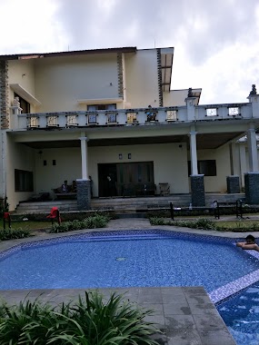
Saung Alamanda
Desa Pakancilan Kuta, Megamendung, Kuta Indonesia
contacts phone
:
+62
Latitude:
-6.6920285
, Longitude:
106.9199605
read more
nearest Lodging
38 m
Patria Tama Resort
Kuta
Lodging
read more
42 m
Villa Pondok Yedidah
Kuta
Lodging
read more
114 m
Villa Aruan
Jalan Pesantren Lembah Arafah, Kuta
Lodging
read more
150 m
Bukit Badr Bin Ali, Puncak
Kuta
Lodging
read more
252 m
Villa Kopasus
Jl. WaruDoyong, Pekancilan, Kuta
Lodging
read more
340 m
Griya Kayana
JL Raya Puncak, RT 2 RW 4, Citeko, Cisarua, Kuta
Lodging
read more
590 m
Villa Mawar Citeko
Citeko
Lodging
read more
652 m
Villa Wirantini Kuning
No., Jalan Alternatif Tapos-Ciawi No.8, Citeko
Lodging
read more
713 m
Villa CB 383
Unnamed Rd,, Kuta
Lodging
read more
773 m
Vila Bumi Elok Resort
Sukagalih
Lodging
read more
808 m
Villa Quattro
Jalan Alternatif Tapos-Ciawi No.11, Citeko, Puncak Cisarua, Citeko
Lodging
read more
838 m
Villa LMPP, BUMI CITEKO
Jalan Alternatif Tapos-Ciawi No.8, Citeko
Lodging
read more
838 m
LMPP Resort
Jalan Alternatif Tapos-Ciawi No.19, Citeko
Lodging
read more
893 m
Safari Hotel
Jalan Alternatif Tapos-Ciawi No.46, Citeko
Lodging
read more
893 m
Parama
Jalan Alternatif Tapos-Ciawi No.46, Citeko
Lodging
read more
923 m
Saung Ikebana
Kuta
Lodging
read more
965 m
Vila Bali
Citeko
Lodging
read more
966 m
Villa Baliku Cisarua
Jalan Alternatif Tapos-Ciawi No.2, Citeko
Lodging
read more
975 m
Indrajaya Hotel
JL Raya Cipayung,Cisarua, Kopo
Lodging
read more
986 m
Villa 1001
Jalan Waru Doyong No.45, Kuta
Lodging
read more
997 m
Puri Purwodadi
Jalan Cidokom, Kopo, Cisarua, Kopo
Lodging
read more
1.049 km
Villa Dnc
No., Jalan Cidokom No.29, Citeko
Lodging
read more
1.078 km
Villa Juwita
Citeko
Lodging
read more
1.131 km
Pondok Salam Ressort
Jalan Kopo, Sukagalih
Lodging
read more
1.233 km
Villa Faijo
Jalan Waru Doyong No.41, Kuta
Lodging
read more
📑
all categories
Accounting
Administrative area level 1
Administrative area level 2
Airport
Amusement park
Aquarium
Art gallery
Atm
Bakery
Bank
Bar
Beauty salon
Bicycle store
Book store
Bowling alley
Bus station
Cafe
Campground
Car dealer
Car rental
Car repair
Car wash
Casino
Cemetery
Church
City hall
Clothing store
Colloquial area
Convenience store
Courthouse
Dentist
Department store
Doctor
Electrician
Electronics store
Embassy
Finance
Fire station
Florist
Food
Funeral home
Furniture store
Gas station
General contractor
Grocery or supermarket
Gym
Hair care
Hardware store
Health
Hindu Temple
Home goods store
Hospital
Insurance agency
Intersection
Jewelry store
Laundry
Lawyer
Library
Liquor store
Local government office
Locality
Locksmith
Lodging
Meal delivery
Meal takeaway
Mosque
Movie rental
Movie theater
Moving company
Museum
Natural feature
Neighborhood
Night club
Painter
Park
Parking
Pet store
Pharmacy
Physiotherapist
Place of worship
Plumber
Point of interest
Police
Political
Post office
Premise
Real estate agency
Restaurant
Roofing contractor
Route
Rv park, camping
School
Shoe store
Shopping mall
Spa
Stadium
Storage
Store
Subpremise
Supermarket
Synagogue
Taxi stand
Train station
Transit station
Travel agency
University
Veterinary care
Zoo
administrative area level 3
administrative area level 4
administrative area level 5
sublocality level 1
↑