Lodging nearby Natrabu
Indonesia
Lodging nearby Natrabu
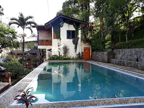
Natrabu
Jalan Raya Gunung Salak Endah No.1, Gunung Picung Indonesia
contacts phone
:
+62
Latitude:
-6.6644684
, Longitude:
106.6644271
read more
nearest Lodging
400 m
Villa Casablanca Pamijahan, Bogor
Gunung Picung
Lodging
read more
476 m
Villa rosalin
Gunung Picung
Lodging
read more
525 m
Green Salak Hotel
Gunung Picung
Lodging
read more
1.416 km
VILLA RAHMA
Gunung Picung
Lodging
read more
1.567 km
Villa Wawan
Jalan Raya Gunung Salak Endah No.04, Gunung Picung
Lodging
read more
1.713 km
Saung Lembur Kuring
Jalan Raya Gunung Salak Endah, Gunung Sari
Lodging
read more
1.88 km
Poeti Mountian Resort
Jalan Raya Gunung Salak Endah, Gunung Sari
Lodging
read more
1.922 km
Istana Halimun
Gunung Sari
Lodging
read more
1.932 km
Villa Ayu Cibatok
Gunung Sari
Lodging
read more
1.962 km
Pondok Pesantren Salsabila
Gunung Sari
Lodging
read more
1.992 km
The KekkeRai Valley Resort
Jalan Raya Gunung Salak Endah, RT.01 / RW.07, Pamijahan, Cibatok, Gunung Sari
Lodging
read more
1.993 km
VILLA TIRTA ENDAH
Gunung Sari
Lodging
read more
2.11 km
Saung 88
No.88, Bogor, 16810, Indonesia, Jalan Raya Gunung Salak Endah No.88, Pamijahan, Gunung Sari
Lodging
read more
2.147 km
Villa Lembah Endah
Jalan Raya Gunung Salak Endah, Gunung Sari
Lodging
read more
2.252 km
HARIS FAMILY CAMP
Ciasihan
Lodging
read more
2.951 km
Bukit Panorama
Gunung Sari
Lodging
read more
2.968 km
Pusat Informasi Penginapan
Jalan Gunung Picung, Gunung Sari
Lodging
read more
3.021 km
Villa Idank Beranjuk
Gunung Sari
Lodging
read more
3.166 km
Pondok Al-Barokah
Gunung Sari
Lodging
read more
3.185 km
Villa pondok padil
Gunung Sari
Lodging
read more
3.188 km
Villa 3 Pinang
Gunung Sari
Lodging
read more
3.251 km
Villa Mount Bunder
Jalan Gunung Bunder, Gunung Bunder 2
Lodging
read more
3.272 km
Homestay Lariska
Gunung Sari
Lodging
read more
3.401 km
villa bima
Gunung Sari
Lodging
read more
3.49 km
Villa Jawa Bogor
Jalan Gunung Bunder, Gunung Picung
Lodging
read more
📑
all categories
Accounting
Administrative area level 1
Administrative area level 2
Airport
Amusement park
Aquarium
Art gallery
Atm
Bakery
Bank
Bar
Beauty salon
Bicycle store
Book store
Bowling alley
Bus station
Cafe
Campground
Car dealer
Car rental
Car repair
Car wash
Casino
Cemetery
Church
City hall
Clothing store
Colloquial area
Convenience store
Courthouse
Dentist
Department store
Doctor
Electrician
Electronics store
Embassy
Finance
Fire station
Florist
Food
Funeral home
Furniture store
Gas station
General contractor
Grocery or supermarket
Gym
Hair care
Hardware store
Health
Hindu Temple
Home goods store
Hospital
Insurance agency
Intersection
Jewelry store
Laundry
Lawyer
Library
Liquor store
Local government office
Locality
Locksmith
Lodging
Meal delivery
Meal takeaway
Mosque
Movie rental
Movie theater
Moving company
Museum
Natural feature
Neighborhood
Night club
Painter
Park
Parking
Pet store
Pharmacy
Physiotherapist
Place of worship
Plumber
Point of interest
Police
Political
Post office
Premise
Real estate agency
Restaurant
Roofing contractor
Route
Rv park, camping
School
Shoe store
Shopping mall
Spa
Stadium
Storage
Store
Subpremise
Supermarket
Synagogue
Taxi stand
Train station
Transit station
Travel agency
University
Veterinary care
Zoo
administrative area level 3
administrative area level 4
administrative area level 5
sublocality level 1
↑