Lodging nearby Hotel Atlet
Indonesia
Lodging nearby Hotel Atlet
Hotel Atlet
Sawah Lebar Baru Indonesia
contacts phone
:
+62
Latitude:
-3.7929022
, Longitude:
102.27118
read more
nearest Lodging
497 m
Losmen 555
Jalan Padang - Bengkulu, Suka Merindu
Lodging
read more
580 m
Hotel Santika Bengkulu
Jalan Jati, Sawah Lebar, Ratu Agung, Sawah Lebar
Lodging
read more
591 m
Hotel Santika Bengkulu
Sawah Lebar
Lodging
read more
592 m
Surya Losmen
Belakang Pondok
Lodging
read more
608 m
Hotel Santika Bengkulu
Jalan Jati No.45, Sawah Lebar
Lodging
read more
626 m
Selekta Abadi Hotel
Padang Jati
Lodging
read more
660 m
Sederhana Losmen
Padang Jati
Lodging
read more
675 m
Bougainville Hotel
Jalan Jati 5 No.37, Sawah Lebar
Lodging
read more
722 m
Wisata Hotel
JL. Letjen S Parman No.115, Padang Jati
Lodging
read more
763 m
Hotel Muara
Jalan Al-Furqan No.27, Kebun Dahri
Lodging
read more
771 m
Mira Hotel
Jalan Soeprapto No.106, Kebun Dahri
Lodging
read more
787 m
Kos ALVIZA
Sawah Lebar Baru
Lodging
read more
788 m
Sinar Sport Hotel
Anggut Dalam
Lodging
read more
830 m
Hotel Mercure
Jalan Semeru, Padang Jati
Lodging
read more
906 m
Hotel Vista
Jl. MT. Haryono No. 67, Bajak
Lodging
read more
944 m
Hayani Hotel
JL Letjen S Parman No.65, Kebun Kenanga
Lodging
read more
946 m
Hotel Bumi Cendana
Kebun Beler
Lodging
read more
959 m
SS Hotel
Jl. MT. Haryono No. 15-16, Bajak
Lodging
read more
989 m
Hotel Bencoolen
Padang Jati
Lodging
read more
993 m
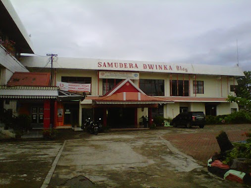
Hotel Samudra Dwinka
Jalan Jenderal Sudirman No.246, Pintu Batu
Lodging
read more
1.002 km
Kendi Wisma
Jalan Soekarno Hatta No.2, Anggut Dalam
Lodging
read more
1.009 km
Flamboyan Hotel
JL. Flamboyan Raya, No. 2-3 RT. 19, Kebun Kenanga
Lodging
read more
1.014 km
Hotel Mercure Bengkulu
Padang Jati
Lodging
read more
1.046 km
Bumi Endah Hotel
Jl. Fatmawati No. 29-30, Penurunan
Lodging
read more
1.249 km
Kos Putri Azwar
Anggut Atas
Lodging
read more
📑
all categories
Accounting
Administrative area level 1
Administrative area level 2
Airport
Amusement park
Aquarium
Art gallery
Atm
Bakery
Bank
Bar
Beauty salon
Bicycle store
Book store
Bowling alley
Bus station
Cafe
Campground
Car dealer
Car rental
Car repair
Car wash
Casino
Cemetery
Church
City hall
Clothing store
Colloquial area
Convenience store
Courthouse
Dentist
Department store
Doctor
Electrician
Electronics store
Embassy
Finance
Fire station
Florist
Food
Funeral home
Furniture store
Gas station
General contractor
Grocery or supermarket
Gym
Hair care
Hardware store
Health
Hindu Temple
Home goods store
Hospital
Insurance agency
Intersection
Jewelry store
Laundry
Lawyer
Library
Liquor store
Local government office
Locality
Locksmith
Lodging
Meal delivery
Meal takeaway
Mosque
Movie rental
Movie theater
Moving company
Museum
Natural feature
Neighborhood
Night club
Painter
Park
Parking
Pet store
Pharmacy
Physiotherapist
Place of worship
Plumber
Point of interest
Police
Political
Post office
Premise
Real estate agency
Restaurant
Roofing contractor
Route
Rv park, camping
School
Shoe store
Shopping mall
Spa
Stadium
Storage
Store
Subpremise
Supermarket
Synagogue
Taxi stand
Train station
Transit station
Travel agency
University
Veterinary care
Zoo
administrative area level 3
administrative area level 4
administrative area level 5
sublocality level 1
↑