Lodging nearby home stay bintang
Indonesia
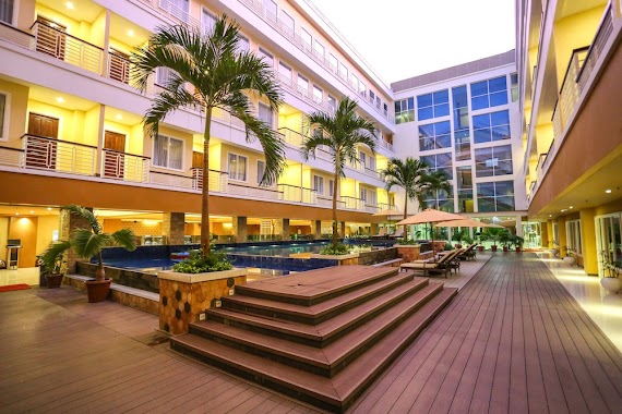
Lodging nearby home stay bintang
home stay bintang
jl Bintang, Oepura Indonesia
contacts phone
:
+62
Latitude:
-10.1871862
, Longitude:
123.6071801
read more
nearest Lodging
408 m
Kontrakanq
Jalan Teratai, Naikolan
Lodging
read more
640 m
Puri Gajah Dompak
Jalan Bougenvile No.18, Naikolan
Lodging
read more
842 m
Penginapan Vanya
Jalan Jendral Soeharto No.55, Naikoten I
Lodging
read more
920 m
Kost Danyela
Jalan Lantana Dalam No.18, Naikoten I
Lodging
read more
984 m
Sylvia Hotel Budget
Naikoten I
Lodging
read more
1.003 km
Kost Danyela
Jalan Lantana Dalam, Naikoten I
Lodging
read more
1.027 km
Sylvia Hotel Premier Kupang
Jl. Soeharto No. 49 - 51, Naikoten I
Lodging
read more
1.11 km
fatuoof fau's
Oebobo
Lodging
read more
1.11 km
Hotel Papajohns Kupang
Oebobo
Lodging
read more
1.111 km
Manna Motor
Jalan Jendral Soeharto No.65, Naikoten I
Lodging
read more
1.304 km
BERKAT KOST
Jalan Polisi Militer No.9, Oebobo
Lodging
read more
1.403 km
Taman Ria Hotel
Naikoten I
Lodging
read more
1.44 km
Mess RAJA mtr
Naikoten I
Lodging
read more
1.49 km
Andhika Wisma
Naikoten I
Lodging
read more
1.645 km
Narisha Guest House
Oebufu
Lodging
read more
1.749 km
Hotel Cahaya Bapa
Jalan Herewilla No.34, Naikoten II
Lodging
read more
1.759 km
Kost Ronny T Toebe
Oebobo
Lodging
read more
1.804 km
Astiti Hotel
Jalan Jendral Sudirman No.166, Nunleu
Lodging
read more
1.856 km
I Nyoman Hotel
JL Lontar, Naikoten I
Lodging
read more
1.872 km
Asrama Putri Stela Maris Naikoten 2 Kota Kupang
nomor 25A, Jalan Sudirman, Naikoten II
Lodging
read more
1.878 km
Hotel John's
Jalan W.J. Lalamentik, Oebufu
Lodging
read more
2.038 km
Bougenville Hostel
Oebufu
Lodging
read more
2.053 km
Jolly Hotel
Jalan Suprapto No.22
Lodging
read more
2.368 km
Hotel Romyta
Jalan Bundaran P. U., Oebufu
Lodging
read more
2.393 km
Flabamor Hotel
Jalan Jenderal Sudirman No.55, Nunleu
Lodging
read more
📑
all categories
Accounting
Administrative area level 1
Administrative area level 2
Airport
Amusement park
Aquarium
Art gallery
Atm
Bakery
Bank
Bar
Beauty salon
Bicycle store
Book store
Bowling alley
Bus station
Cafe
Campground
Car dealer
Car rental
Car repair
Car wash
Casino
Cemetery
Church
City hall
Clothing store
Colloquial area
Convenience store
Courthouse
Dentist
Department store
Doctor
Electrician
Electronics store
Embassy
Finance
Fire station
Florist
Food
Funeral home
Furniture store
Gas station
General contractor
Grocery or supermarket
Gym
Hair care
Hardware store
Health
Hindu Temple
Home goods store
Hospital
Insurance agency
Intersection
Jewelry store
Laundry
Lawyer
Library
Liquor store
Local government office
Locality
Locksmith
Lodging
Meal delivery
Meal takeaway
Mosque
Movie rental
Movie theater
Moving company
Museum
Natural feature
Neighborhood
Night club
Painter
Park
Parking
Pet store
Pharmacy
Physiotherapist
Place of worship
Plumber
Point of interest
Police
Political
Post office
Premise
Real estate agency
Restaurant
Roofing contractor
Route
Rv park, camping
School
Shoe store
Shopping mall
Spa
Stadium
Storage
Store
Subpremise
Supermarket
Synagogue
Taxi stand
Train station
Transit station
Travel agency
University
Veterinary care
Zoo
administrative area level 3
administrative area level 4
administrative area level 5
sublocality level 1
↑