Local government office nearby Sekretariat Rukun Warga 07/1 Johar Baru
Coronavirus disease (COVID-19) Situation
confirmed cases
6829221
deaths
162063
Indonesia
Local government office nearby Sekretariat Rukun Warga 07/1 Johar Baru
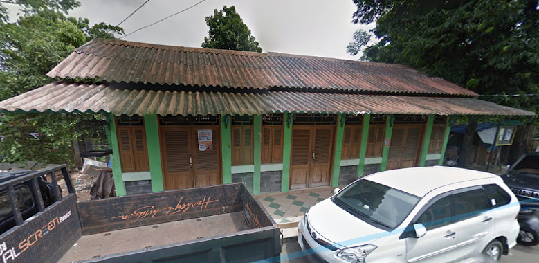
Sekretariat Rukun Warga 07/1 Johar Baru
Jalan Percetakan Negara II RT.23/RW.7, Johar Baru Indonesien
contacts phone
:
+62
Latitude:
-6.1887933
, Longitude:
106.8568575
read more
nearest Local government office
205 m
Safety Center for Healthcare Equipments - Jakarta
No. A, Jalan Percetakan Negara No.23, RT.23/RW.7, Johar Baru
Local government office
read more
221 m
Secretariat of Health Research and Development Agency
Jalan Percetakan Negara, RT. 23 / RW. 7, Johar Baru, RT.23/RW.7, Johar Baru
Local government office
read more
234 m
PT. Inti Presisi Medika
Jalan Percetakan Negara Gang I No.52A, RT.6/RW.1, Rawasari
Local government office
read more
457 m
Kantor Kelurahan Paseban
Jalan Paseban Raya No.71, RT.2/RW.7, Paseban
Local government office
read more
626 m
Sekretariat Rt 04/08 Kel. Paseban
Jalan Keramat Sawah III Gang 3 No.2, RT.4/RW.8, Paseban
Local government office
read more
650 m
Inovasi Sehat Indonesia
Jalan Salemba Tengah No.39BB Senen Kota Jakarta Pusat, Daerah Khusus Ibukota Jakarta 10440, RT.14/RW.3, Paseban
Local government office
read more
685 m
Kasatlak Hansip Unit RW 07
Pemerintahan, Jalan Kramat Sentiong RT.10/RW.7, Paseban
Local government office
read more
693 m
Gedung Pemerintahan Lokal
Pemerintahan Lokal, Jalan Kramat Sentiong RT.10/RW.7, Kramat
Local government office
read more
695 m
Sekretariat RW 07
Pemerintahan, Jalan Kramat Sentiong RT.10/RW.7, Kramat
Local government office
read more
702 m
BALAI WARGA KRAMAT LONTAR
Jalan Kramat Lontar Buntu RT.9/RW.1, Paseban
Local government office
read more
730 m
UKS
Jalan Percetakan Negara II No.477, RT.11/RW.10, Johar Baru
Local government office
read more
741 m
Pos Ronda RT. 002/08 Kel. Paseban
Jalan Keramat Sawah III Gang 3 No.318/23, RT.2/RW.8, Paseban
Local government office
read more
754 m
Pos Kamling Terpadu Pramuka Jati
Jalan Keramat Sawah III Gang 3 No.5, RT.2/RW.8, Paseban
Local government office
read more
792 m
Polsubsektor Rawasari
Jalan Percetakan Negara IX A RT.5/RW.4, Rawasari
Local government office
read more
804 m
Pos RW Siaga
Jalan Pulo Gundul No.112, RT.3/RW.10, Tanah Tinggi
Local government office
read more
911 m
LexFortis Amaliha Lase & Partners
No. Blok. D, Jalan Paseban Raya No.47, RT.1/RW.3, Paseban
Local government office
read more
913 m
Johar Baru Urban Village Puskesmas 3
Jl. Kramat Jaya Baru Blok E No. 6 RT 13 RW 01, Kel. Johar Baru Kec. Johar Baru, RT.13/RW.1, Johar Baru
Local government office
read more
952 m
Kantor Lurah Kampung Rawa
Jalan Rawa Selatan III No.39, RT.4/RW.5, Kampung Rawa
Local government office
read more
961 m
SUDIN PPAPP JAKARTA PUSAT
NO. C255, Jalan Percetakan Negara RT.1/RW.6, Rawasari
Local government office
read more
969 m
Conservation of Natural Resources - Jakarta
Jalan Salemba Raya No. 9, RT.1/RW.3, Paseban, Senen, RT.1/RW.3, RT.1/RW.3, Paseban
Local government office
read more
1.001 km
Kantor Pengacara Sahaala Pangaribuan, SH
Jalan Kramat Sentiong No.14B, RT.5/RW.7, Kramat
Local government office
read more
1.11 km
Gedung IASTH
Jalan Salemba Raya No.4, RW.5, Kenari
Local government office
read more
1.164 km
Dirjen Peternakan
RT.3/RW.6, Kenari
Local government office
read more
1.196 km
Hiu Hindiana, S.H. & Rekan
Jalan Mangga No.204, RT.5/RW.5, Utan Kayu Utara
Local government office
read more
1.274 km
Polsubsektor Diponegoro
Jalan Pangeran Diponegoro No.88, RT.3, Kenari, Senen, RT.2/RW.6, Kenari
Local government office
read more
📑
all categories
Accounting
Administrative area level 1
Administrative area level 2
Airport
Amusement park
Aquarium
Art gallery
Atm
Bakery
Bank
Bar
Beauty salon
Bicycle store
Book store
Bowling alley
Bus station
Cafe
Campground
Car dealer
Car rental
Car repair
Car wash
Casino
Cemetery
Church
City hall
Clothing store
Colloquial area
Convenience store
Courthouse
Dentist
Department store
Doctor
Electrician
Electronics store
Embassy
Finance
Fire station
Florist
Food
Funeral home
Furniture store
Gas station
General contractor
Grocery or supermarket
Gym
Hair care
Hardware store
Health
Hindu Temple
Home goods store
Hospital
Insurance agency
Intersection
Jewelry store
Laundry
Lawyer
Library
Liquor store
Local government office
Locality
Locksmith
Lodging
Meal delivery
Meal takeaway
Mosque
Movie rental
Movie theater
Moving company
Museum
Natural feature
Neighborhood
Night club
Painter
Park
Parking
Pet store
Pharmacy
Physiotherapist
Place of worship
Plumber
Point of interest
Police
Political
Post office
Premise
Real estate agency
Restaurant
Roofing contractor
Route
Rv park, camping
School
Shoe store
Shopping mall
Spa
Stadium
Storage
Store
Subpremise
Supermarket
Synagogue
Taxi stand
Train station
Transit station
Travel agency
University
Veterinary care
Zoo
administrative area level 3
administrative area level 4
administrative area level 5
sublocality level 1
↑