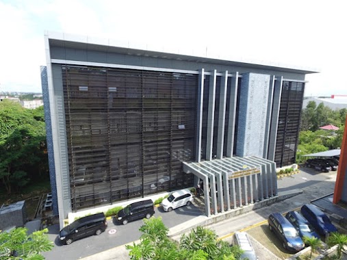
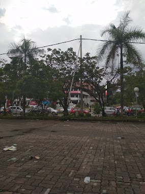
Local government office nearby Puskesmas Batu Ampar
Indonesia
Local government office nearby Puskesmas Batu Ampar
Puskesmas Batu Ampar
54, Jalan Abdul Wahab Syachrani Rt.10, 76136, Kota Balikpapan, Kalimantan Timur, ID Indonesia
contacts phone
:
+62 542 413451
Latitude:
-1.2177931
, Longitude:
116.8406872
larger map & directions
read more
nearest Local government office
745 m
Balai Karantina Pertanian Kls 1
Jalan Wahab Syarani No.37, RT.43, Batu Ampar
Local government office
read more
839 m
Pondok Anggun
Jalan Wahab Syarani, Batu Ampar
Local government office
read more
1.167 km
Komplek BPD
Jalan Batu Butok No.84, Muara Rapak
Local government office
read more
1.482 km
Perum Pesona Alam Permai
Perum Pesona Alam Permai, Batu Ampar
Local government office
read more
1.741 km
Kantor Advokat ROY YUNIARSO,SH & REKAN
Jl. Gn. Steling, RT. 52, Gunung Samarinda
Local government office
read more
1.774 km
Kantor Kelurahan Margomulyo
Margo Mulyo
Local government office
read more
2.018 km
One Roof Administration System Office Balikpapan
Jalan Soekarno Hatta No.6, Muara Rapak
Local government office
read more
2.052 km
Perumahan PDAM KM 5,5
Perumahan PDAM, Batu Ampar, Balikpapan Utara, Batu Ampar
Local government office
read more
2.462 km
POS KAMLING RT 01 SIDOMULYO
Bar., Margo Mulyo
Local government office
read more
2.478 km
jl Sidomulyo
Margo Mulyo
Local government office
read more
2.598 km
Perumahan Graha Indah Balikpapan
Jalan Projakal No.51, Batu Ampar, Balikpapan Utara, Batu Ampar
Local government office
read more
2.636 km
Polsek Bpp Utara
Muara Rapak
Local government office
read more
2.644 km
Kantor SAMSAT cabang pembantu
Baru Ilir
Local government office
read more
2.76 km
Kantor Kecamatan Balikpapan Utara
Jl. Projakal, RT.22, Graha Indah, Balikpapan Utara, Batu Ampar
Local government office
read more
2.815 km
Caladium Residence 1
Jalan Kampung Timur, Gunung Samarinda
Local government office
read more
3.169 km
Adi Guna Complex Excellence
Unnamed Road, Batu Ampar
Local government office
read more
3.198 km
Mangrove Center Balikpapan
Gunung Samarinda, Balikpapan Utara, Gunung Samarinda
Local government office
read more
3.298 km
Pukesmas Baru Tengah
Central Baru
Local government office
read more
3.967 km
Perumahan Pemda Balikpapan Baru
Jalan Nusa Indah Kelurahan, Gunung Samarinda
Local government office
read more
4.139 km
KANTOR GEREJA ROCK MINISTRY
Komp. Ruko Balikpapan Baru Blok C No.21, South Balikpapan, Damai
Local government office
read more
4.164 km
RT 22 Gunungsari Ulu
Gunungsari Ulu
Local government office
read more
4.279 km
PT.Patra Trading
kilang minyak, Mekar Sari
Local government office
read more
4.403 km
Perumahan Telkom
Jalan MT Haryono, Gunung Bahagia
Local government office
read more
4.729 km
Kanwil DJP Kalimantan Timur
Jalan Ruhui Rahayu Ring Road No.1, Gunung Bahagia
Local government office
read more
4.917 km
perum sepinggan pratama
Jalan Sepinggan Pratama, Sepinggan
Local government office
read more
📑
all categories
Accounting
Administrative area level 1
Administrative area level 2
Airport
Amusement park
Aquarium
Art gallery
Atm
Bakery
Bank
Bar
Beauty salon
Bicycle store
Book store
Bowling alley
Bus station
Cafe
Campground
Car dealer
Car rental
Car repair
Car wash
Casino
Cemetery
Church
City hall
Clothing store
Colloquial area
Convenience store
Courthouse
Dentist
Department store
Doctor
Electrician
Electronics store
Embassy
Finance
Fire station
Florist
Food
Funeral home
Furniture store
Gas station
General contractor
Grocery or supermarket
Gym
Hair care
Hardware store
Health
Hindu Temple
Home goods store
Hospital
Insurance agency
Intersection
Jewelry store
Laundry
Lawyer
Library
Liquor store
Local government office
Locality
Locksmith
Lodging
Meal delivery
Meal takeaway
Mosque
Movie rental
Movie theater
Moving company
Museum
Natural feature
Neighborhood
Night club
Painter
Park
Parking
Pet store
Pharmacy
Physiotherapist
Place of worship
Plumber
Point of interest
Police
Political
Post office
Premise
Real estate agency
Restaurant
Roofing contractor
Route
Rv park, camping
School
Shoe store
Shopping mall
Spa
Stadium
Storage
Store
Subpremise
Supermarket
Synagogue
Taxi stand
Train station
Transit station
Travel agency
University
Veterinary care
Zoo
administrative area level 3
administrative area level 4
administrative area level 5
sublocality level 1
↑