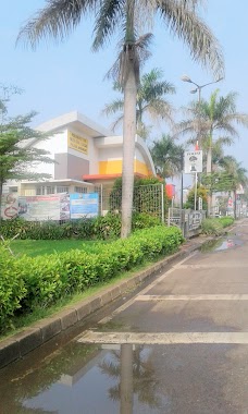
Local government office nearby Polsubsektor Palem Semi
Indonesia
Local government office nearby Polsubsektor Palem Semi
Polsubsektor Palem Semi
37, Jalan Palem Raja Raya, 15810, Tangerang, Banten, ID Indonesia
contacts phone
:
+62
website:
www.polri.go.id
Latitude:
-6.2204797
, Longitude:
106.6136486
larger map & directions
read more
nearest Local government office
833 m
Rumah 54, RT. 001/015
RT. 001/015. No.54, Jalan Belimbing IV, Cibodasari
Local government office
read more
887 m
SATKER PERHUBUNGAN DARAT PROVINSI BANTEN
Jalan Palem Putri I, Bencongan Indah
Local government office
read more
1.017 km
TIME TRAVELERS INDONESIA
PALEM SEMI, Bencongan
Local government office
read more
1.054 km
Upt Damkar Kota Tangerang
Jalan Merak Raya No.40, Cibodas, Cibodasari
Local government office
read more
1.068 km
Gerai Samsat Supermall Karawaci
Bencongan
Local government office
read more
1.082 km
Arminareka Perdana
Jalan Bayam 2 No.68, Cibodasari
Local government office
read more
1.084 km
Travel Haji & Umroh Arminareka
Jalan Bayam 2 No.68, Cibodasari
Local government office
read more
1.087 km
Komite Pemberantasan Korupsi
1, Jalan Pisang Raya, Cibodasari
Local government office
read more
1.119 km
Kelurahan Nusa Jaya
Jalan Karet Raya No.1, Nusa Jaya
Local government office
read more
1.189 km
Kantor Kelurahan Bencongan Indah
Perum Harapan Kita, Jalan Doktor Sukaman, Bencongan Indah
Local government office
read more
1.211 km
Mina, Blok I.5 / 10 - Islamic Village
Jalan Mina II, Panunggangan Barat
Local government office
read more
1.285 km
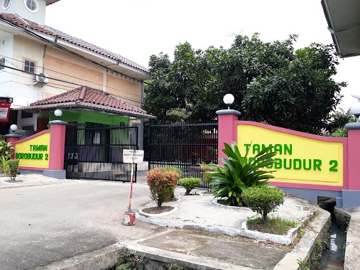
Taman Borobudur 2
Jalan Pawon Raya, Bencongan Indah
Local government office
read more
1.295 km
Kelurahan Cibodasari
Jalan Mangga Raya Blok 17 No.1, Cibodasari
Local government office
read more
1.356 km
perumnas
Jalan Salira III No.3, Bencongan Indah
Local government office
read more
1.381 km
The House Studio
Jl. Kalimantan No. 705, Lippo Karawaci Utara, Panunggangan Barat, Cibodas, Panunggangan Barat
Local government office
read more
1.515 km
Biro Jasa Ramaniko
Jalan Kelapa Dua Raya, Kelapa Dua
Local government office
read more
1.689 km
Village of New Cibodas
Jalan Swasa, Cibodas Baru
Local government office
read more
1.751 km
Citarum 2 Karawaci Tangerang
Jalan Citarum Raya, Kelapa Dua
Local government office
read more
1.812 km
Sulis
Jalan D. Ranau No.26, Bencongan
Local government office
read more
1.862 km
Perumnas Perpustakaan Nasional
Jalan Lontar No.8, RT.2/RW.4, Bencongan
Local government office
read more
1.883 km
Perumahan Griya Cibodas Asri
Masnim, Jalan Hartono Raya No.3, Cibodas
Local government office
read more
1.901 km
Komplek Asdam
Jalan Asrama Damatex No.38, Cikokol
Local government office
read more
1.906 km
Kantor Kecamatan Cibodas Kota Tangerang
Jalan Baja Raya No.83, Cibodas Baru
Local government office
read more
1.971 km
Kantor Kelurahan Bencongan
Jl. Sabi Raya No. 1, Kelapa Dua, Bencongan Indah
Local government office
read more
2.737 km
Cluster Topas Pondok Hijaugolf Gading Serpong
West Pakulonan
Local government office
read more
📑
all categories
Accounting
Administrative area level 1
Administrative area level 2
Airport
Amusement park
Aquarium
Art gallery
Atm
Bakery
Bank
Bar
Beauty salon
Bicycle store
Book store
Bowling alley
Bus station
Cafe
Campground
Car dealer
Car rental
Car repair
Car wash
Casino
Cemetery
Church
City hall
Clothing store
Colloquial area
Convenience store
Courthouse
Dentist
Department store
Doctor
Electrician
Electronics store
Embassy
Finance
Fire station
Florist
Food
Funeral home
Furniture store
Gas station
General contractor
Grocery or supermarket
Gym
Hair care
Hardware store
Health
Hindu Temple
Home goods store
Hospital
Insurance agency
Intersection
Jewelry store
Laundry
Lawyer
Library
Liquor store
Local government office
Locality
Locksmith
Lodging
Meal delivery
Meal takeaway
Mosque
Movie rental
Movie theater
Moving company
Museum
Natural feature
Neighborhood
Night club
Painter
Park
Parking
Pet store
Pharmacy
Physiotherapist
Place of worship
Plumber
Point of interest
Police
Political
Post office
Premise
Real estate agency
Restaurant
Roofing contractor
Route
Rv park, camping
School
Shoe store
Shopping mall
Spa
Stadium
Storage
Store
Subpremise
Supermarket
Synagogue
Taxi stand
Train station
Transit station
Travel agency
University
Veterinary care
Zoo
administrative area level 3
administrative area level 4
administrative area level 5
sublocality level 1
↑