Local government office nearby Permata I
Indonesia
Local government office nearby Permata I
Permata I
Jalan Permata Raya II, 17111, Kota Bekasi, Jawa Barat, ID Indonezja
contacts phone
:
+62
Latitude:
-6.2322661
, Longitude:
107.023018
larger map & directions
read more
nearest Local government office
169 m
Perumahan Permata Bekasi II
Jalan Permata Permai II, Duren Jaya, Bekasi Timur, Duren Jaya
Local government office
read more
182 m
Kp. Cerewet
Jalan Permata Raya Blok H No.1, Duren Jaya
Local government office
read more
191 m
Bekasi Jaya Indah Kp. Cerewet
Jalan Mangga 1 Blok F41 No.9, Duren Jaya, Bekasi Timur, Duren Jaya
Local government office
read more
426 m
Teluk Angsan Permai
Jalan Wijaya Kusuma Raya Blok B10 No.11, Bekasi Jaya
Local government office
read more
427 m
Housing Duren Jaya
Jalan Candi Borobudur Blok D No.636, Duren Jaya, Bekasi Timur, Duren Jaya
Local government office
read more
521 m
Housing Bekasi Indah Jaya Utama
Jalan Teluk Angsan Permai No.295, Bekasi Jaya
Local government office
read more
547 m
Kantor RW 14 Duren Jaya
Jalan Mawar 3 Blok F2 No.4, Duren Jaya
Local government office
read more
574 m
Puri Wedari
Jalan Professor Mohammad Yamin No.59, Duren Jaya
Local government office
read more
641 m
PT. Wijaya Sukses Gemilang
Blok 248, Jalan Bandung Blok D No.601, Duren Jaya
Local government office
read more
692 m
Mawar 9
Jalan Mawar IX No.6, Bekasi Jaya
Local government office
read more
701 m
Danita 2
Jalan Wijaya Kusuma Raya Blok B10 No.11, Bekasi Jaya
Local government office
read more
702 m
Perumahan Bekasi Jaya Indah Danita
Jalan Anggrek, Bekasi Jaya
Local government office
read more
996 m
Cluster Citra Residence Bekasi
Unnamed Road, Duren Jaya
Local government office
read more
1.005 km
Cluster Citra Residence
Unnamed Road, Duren Jaya
Local government office
read more
1.012 km
Employment Training Center of West Java
Jl. KH. Agus Salim, No. 206, Bekasi Jaya
Local government office
read more
1.078 km
Kavling Mede Island
Jalan Hikmah No.42, Bekasi Jaya
Local government office
read more
1.084 km
Komplek Patal Ganda Agung
Jalan KH. Agus Salim No.4, RT.5/RW.8, Bekasi Jaya
Local government office
read more
1.157 km
Komplek KODIM Mede
Jl.Kh Mas Mansur Tim., Kota Bks,, Jalan Istiqomah, Bekasi Jaya
Local government office
read more
1.285 km
East Bekasi District Office
JL.Mekarsari Raya No.3, Bekasi Jaya
Local government office
read more
1.397 km
Perumahan Telaga Mas
17123, Jalan Perjuangan No.32, Harapan Baru
Local government office
read more
1.538 km
Bumi Anggrek
Karangsatria
Local government office
read more
1.696 km
Perumahan Pesona Griya Satria Bekasi
Karangsatria, Tambun Utara, Karangsatria
Local government office
read more
1.817 km
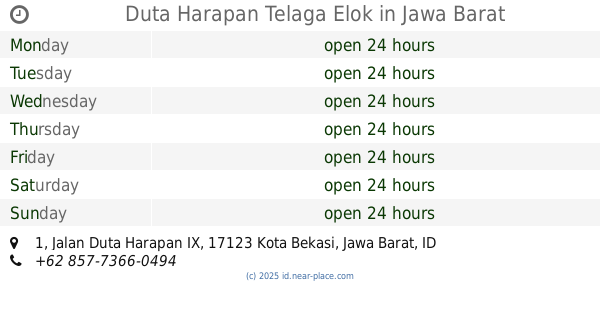
Duta Harapan Telaga Elok
Jalan Duta Harapan IX No.1, Harapan Baru
Local government office
read more
2.214 km
Karunia Abadi
Jalan Insinyur Haji Juanda Blok A6-7 No.139, RT.1/RW.4, Bekasi Jaya
Local government office
read more
2.448 km
Perum Villa Mutiara Gading 2
Karangsatria
Local government office
read more
📑
all categories
Accounting
Administrative area level 1
Administrative area level 2
Airport
Amusement park
Aquarium
Art gallery
Atm
Bakery
Bank
Bar
Beauty salon
Bicycle store
Book store
Bowling alley
Bus station
Cafe
Campground
Car dealer
Car rental
Car repair
Car wash
Casino
Cemetery
Church
City hall
Clothing store
Colloquial area
Convenience store
Courthouse
Dentist
Department store
Doctor
Electrician
Electronics store
Embassy
Finance
Fire station
Florist
Food
Funeral home
Furniture store
Gas station
General contractor
Grocery or supermarket
Gym
Hair care
Hardware store
Health
Hindu Temple
Home goods store
Hospital
Insurance agency
Intersection
Jewelry store
Laundry
Lawyer
Library
Liquor store
Local government office
Locality
Locksmith
Lodging
Meal delivery
Meal takeaway
Mosque
Movie rental
Movie theater
Moving company
Museum
Natural feature
Neighborhood
Night club
Painter
Park
Parking
Pet store
Pharmacy
Physiotherapist
Place of worship
Plumber
Point of interest
Police
Political
Post office
Premise
Real estate agency
Restaurant
Roofing contractor
Route
Rv park, camping
School
Shoe store
Shopping mall
Spa
Stadium
Storage
Store
Subpremise
Supermarket
Synagogue
Taxi stand
Train station
Transit station
Travel agency
University
Veterinary care
Zoo
administrative area level 3
administrative area level 4
administrative area level 5
sublocality level 1
↑