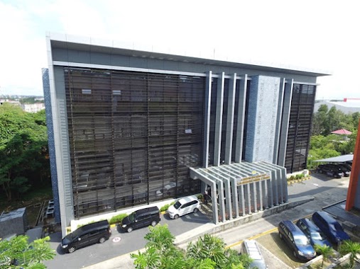
Local government office nearby Kopel Bulog
Indonesia
Local government office nearby Kopel Bulog
Kopel Bulog
Jalan Jenderal Sudirman, Klandasan Ilir, Balikpapan Kota, Klandasan Ilir Indonesia
contacts phone
:
+62
Latitude:
-1.2755954
, Longitude:
116.8450012
read more
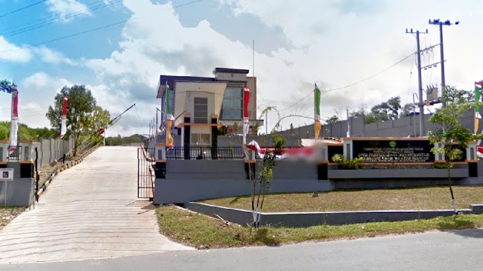
nearest Local government office
1.33 km
Kantor Sanbe Farma
Klandasan Ilir
Local government office
read more
1.403 km
ADVOCATES ~ LEGAL CONSULTANTS Dr. H. Abdul Rais, S.H., M.H
Jalan Jenderal Ahmad Yani No.25 RT.55, Gunungsari Ilir
Local government office
read more
1.465 km
UPT Metrologi
2,, Jalan Mayjend Sutoyo, Klandasan Ilir
Local government office
read more
1.64 km
Komplek Prefab
Jl. Martadinata Kompleks Prefab, Gunungsari Ilir
Local government office
read more
1.883 km
Kantor Jasa Desain Rumah Balikpapan
Jalan Gunung Rejo, Gunungsari Ulu
Local government office
read more
2.302 km
RT 22 Gunungsari Ulu
Gunungsari Ulu
Local government office
read more
3.186 km
Kantor Kelurahan Damai Baru
Jalan MT Haryono RT.41, Damai
Local government office
read more
3.192 km
Office of Population and Civil Registration Balikpapan
Jalan MT Haryono No.187, Damai
Local government office
read more
3.256 km
Pertamina UPMS VI
JL Let Jend Suprapto, Mekar Sari
Local government office
read more
3.462 km
PT.Patra Trading
kilang minyak, Mekar Sari
Local government office
read more
3.52 km
Perumahan Telkom
Jalan MT Haryono, Gunung Bahagia
Local government office
read more
3.908 km
BDI Outcrop
Gunung Bahagia
Local government office
read more
3.911 km
Polsek Bpp Utara
Muara Rapak
Local government office
read more
3.98 km
KNRP Balikpapan
Jl MT. Haryono No.46 RT.30 Ruko Lt.2 (Seberang Roti Tiam, DAM), Gunung Bahagia
Local government office
read more
4.249 km
Caladium Residence 1
Jalan Kampung Timur, Gunung Samarinda
Local government office
read more
4.792 km
Kantor WIKA
Jalan MT.Haryono, Gunung Bahagia
Local government office
read more
5.051 km
KANTOR GEREJA ROCK MINISTRY
Komp. Ruko Balikpapan Baru Blok C No.21, South Balikpapan, Damai
Local government office
read more
5.072 km
Mangrove Center Balikpapan
Gunung Samarinda, Balikpapan Utara, Gunung Samarinda
Local government office
read more
5.185 km
Perumahan Pemda Balikpapan Baru
Jalan Nusa Indah Kelurahan, Gunung Samarinda
Local government office
read more
5.227 km
Kanwil DJP Kalimantan Timur
Jalan Ruhui Rahayu Ring Road No.1, Gunung Bahagia
Local government office
read more
5.34 km
Leaf Village gate
Jalan Mohammad T. Haryono Balikpapan Kaltim, Gunung Bahagia
Local government office
read more
5.35 km
Dinas PU, UPTD Pemeliharaan Infrastruktur Wilayah Selatan
Jalan MT. Haryono, Balikpapan Selatan, Gunung Bahagia
Local government office
read more
5.401 km
Kantor Panwaslu Balikpapan Selatan
Jalan Rengganis, Gunung Bahagia
Local government office
read more
5.504 km
Sinergia Beaute Indonesia Balikpapan
Jalan Ketinjau, Perumahan Villa Damai Permai, Blok B2 No. 19, Gunung Bahagia
Local government office
read more
5.566 km
POS KAMLING RT 01 SIDOMULYO
Bar., Margo Mulyo
Local government office
read more
📑
all categories
Accounting
Administrative area level 1
Administrative area level 2
Airport
Amusement park
Aquarium
Art gallery
Atm
Bakery
Bank
Bar
Beauty salon
Bicycle store
Book store
Bowling alley
Bus station
Cafe
Campground
Car dealer
Car rental
Car repair
Car wash
Casino
Cemetery
Church
City hall
Clothing store
Colloquial area
Convenience store
Courthouse
Dentist
Department store
Doctor
Electrician
Electronics store
Embassy
Finance
Fire station
Florist
Food
Funeral home
Furniture store
Gas station
General contractor
Grocery or supermarket
Gym
Hair care
Hardware store
Health
Hindu Temple
Home goods store
Hospital
Insurance agency
Intersection
Jewelry store
Laundry
Lawyer
Library
Liquor store
Local government office
Locality
Locksmith
Lodging
Meal delivery
Meal takeaway
Mosque
Movie rental
Movie theater
Moving company
Museum
Natural feature
Neighborhood
Night club
Painter
Park
Parking
Pet store
Pharmacy
Physiotherapist
Place of worship
Plumber
Point of interest
Police
Political
Post office
Premise
Real estate agency
Restaurant
Roofing contractor
Route
Rv park, camping
School
Shoe store
Shopping mall
Spa
Stadium
Storage
Store
Subpremise
Supermarket
Synagogue
Taxi stand
Train station
Transit station
Travel agency
University
Veterinary care
Zoo
administrative area level 3
administrative area level 4
administrative area level 5
sublocality level 1
↑