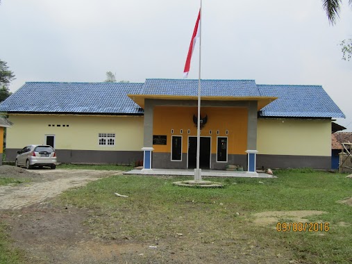
Local government office nearby Kantor Desa Sukasari
Coronavirus disease (COVID-19) Situation
confirmed cases
6829221
deaths
162063
Indonesia
Local government office nearby Kantor Desa Sukasari
Kantor Desa Sukasari
Sukasari Indonesia
contacts phone
:
+62
Latitude:
-6.4188659
, Longitude:
106.6423388
read more
nearest Local government office
84 m
Kantor Pengacara Mas War SH & Rekan
Sukasari
Local government office
read more
1.668 km
Perumahan Bumi Mas Ciseeng
Jalan Amd Kuripan, Kuripan
Local government office
read more
2.218 km
Kantor Kelurahan Desa Jampang Kahuripan
Jampang
Local government office
read more
4.142 km
Kantor Desa Sukamulya
Jalan Raya Rumpin, Sukamulya
Local government office
read more
4.558 km
Village Head Office Kertajaya
Jalan Raya Cikandang No.1, Kertajaya
Local government office
read more
4.94 km
Perumahan Walikota 801
Unnamed Road, Cibeuteung Muara
Local government office
read more
5.076 km
griya Cimangir
Jalan Griya Cimangir No.c4, no17
Local government office
read more
5.153 km
District Office Gunung Sindur
Jalan Atma Asnawi, Gunung Sindur
Local government office
read more
5.171 km
Mayor of South Jakarta Housing
16330, Jalan Raya Haji Usa, Cibeuteung Muara
Local government office
read more
5.304 km
PT. Daya Mulia Group
Jalan Raya Haji Usa, Ciseeng
Local government office
read more
5.613 km
Kantor Kepala Desa Mekarsari
Mekar Sari
Local government office
read more
5.684 km
Puskesmas Desa Ciseeng
Jalan Raya Haji Usa No.36, Cibentang
Local government office
read more
5.701 km
Perumahan Metro Victory
Jalan Pembangunan Raya, Gunung Sindur
Local government office
read more
6.587 km
Riski Twice Home
Pengasinan
Local government office
read more
8.103 km
GSA ASTER
Jalan Raya Serpong Rumpin No.109, Suradita
Local government office
read more
9.985 km
Dinas Pemadam Kebakaran Sektor Parung
Jalan Raya Parung No.640, RT.01, Parung
Local government office
read more
10.69 km
Satuan Polisi Pamong Praja (Satpol PP) Kota Tangerang Selatan
Setu
Local government office
read more
10.97 km
Perum Curug Residence 2
RT 004 RW 006, Kel., Jalan Mawar, Curug
Local government office
read more
11.409 km
Perumahan Muslim Al Falaah 3
Jalan Salak Raya, Pondok Benda
Local government office
read more
12.892 km
Sekretariat PPS Pamulang Barat
Jalan Dr. Setiabudi No.1, Pamulang Barat
Local government office
read more
13.21 km
Telaga Golf Cluster Great Britain
Jalan Telaga No.19, Sawangan Lama
Local government office
read more
13.473 km
Zema
Jalan Panti Asuhan Muhammadiyah, Sawangan Lama
Local government office
read more
14.627 km
PCR
Jalan Pendidikan No.81, Rangkapan Jaya Baru
Local government office
read more
16.363 km
perum pondok hijau
Jalan Pondok Hijau Raya No.25, Pisangan
Local government office
read more
17.938 km
Akses Ke Desa Bojong
Gang Bayam, Parakan Jaya
Local government office
read more
📑
all categories
Accounting
Administrative area level 1
Administrative area level 2
Airport
Amusement park
Aquarium
Art gallery
Atm
Bakery
Bank
Bar
Beauty salon
Bicycle store
Book store
Bowling alley
Bus station
Cafe
Campground
Car dealer
Car rental
Car repair
Car wash
Casino
Cemetery
Church
City hall
Clothing store
Colloquial area
Convenience store
Courthouse
Dentist
Department store
Doctor
Electrician
Electronics store
Embassy
Finance
Fire station
Florist
Food
Funeral home
Furniture store
Gas station
General contractor
Grocery or supermarket
Gym
Hair care
Hardware store
Health
Hindu Temple
Home goods store
Hospital
Insurance agency
Intersection
Jewelry store
Laundry
Lawyer
Library
Liquor store
Local government office
Locality
Locksmith
Lodging
Meal delivery
Meal takeaway
Mosque
Movie rental
Movie theater
Moving company
Museum
Natural feature
Neighborhood
Night club
Painter
Park
Parking
Pet store
Pharmacy
Physiotherapist
Place of worship
Plumber
Point of interest
Police
Political
Post office
Premise
Real estate agency
Restaurant
Roofing contractor
Route
Rv park, camping
School
Shoe store
Shopping mall
Spa
Stadium
Storage
Store
Subpremise
Supermarket
Synagogue
Taxi stand
Train station
Transit station
Travel agency
University
Veterinary care
Zoo
administrative area level 3
administrative area level 4
administrative area level 5
sublocality level 1
↑