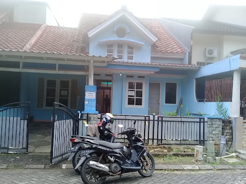
Local government office nearby Kades Sukamanah - Gintung Cilejet
Indonesia
Local government office nearby Kades Sukamanah - Gintung Cilejet
Kades Sukamanah - Gintung Cilejet
Suka Manah Indonesien
contacts phone
:
+62
Latitude:
-6.3449928
, Longitude:
106.5171626
read more
nearest Local government office
975 m
Village Office Sukamanah
Jl. Salimah No. 1, Sukamanah, Jambe, Suka Manah
Local government office
read more
4.415 km
Kades Rancaiyuh
Ranca Iyuh
Local government office
read more
4.451 km
Serpong Garden Village
Jl. Raya Sudamanik Kp. Cilangkap Kel. Lumpang Kec. Parungpanjang, Lumpang
Local government office
read more
4.518 km
keluarga besar bapak jaenudin dan ibu Nurhayati(yayah)
Unnamed Road, Jalan Kampung Pabuaran, Babakan
Local government office
read more
4.623 km
Dispenda Kab. Bogor Area Parungpanjang
Jalan Raya Sudamanik No.12, Cibunar
Local government office
read more
4.63 km
Sentraland Madeira
No, Jl. Raya Cikabon, No, 16, Cibunar
Local government office
read more
5.014 km
Griya Arum Sari Dan Selaras Baru (Perum Jagabaya)
Jalan Sudamanik, Jagabaya
Local government office
read more
6.127 km
Kantor Desa Gorowong
Gorowong
Local government office
read more
6.23 km
Pearl Cluster Tigaraksa 2
Jambe
Local government office
read more
6.625 km
Puskesmas Gorowong
Gorowong
Local government office
read more
6.736 km
UPT PTPH I Parungpanjang
Jagabaya
Local government office
read more
6.899 km
griya Parung Panjang
Unnamed Road, Kabasiran
Local government office
read more
8.724 km
Cluster Raflesia Graha Citra Raya,
Utama Raya, Jalan Komplek Serdang Asri III, Panongan
Local government office
read more
8.757 km
Kantor Disporabudpar Tigaraksa
Jalan M. Atik Soeardi Blok AN 33 No.24, Kadu Agung, Tigaraksa, Kadu Agung
Local government office
read more
9.984 km
Kantor BAF cab. Curug
Jalan Raya STPI Curug No.86, Curug Wetan
Local government office
read more
11.206 km
Sudirman Indah Housing Block G 22/14
Pasir Nangka
Local government office
read more
11.669 km
Taman Puspita
Jalan Harpa Utama, Cikupa
Local government office
read more
11.863 km
Cluster Emerald Karawaci Residence
Jalan Raya Parigi, Suka Bakti
Local government office
read more
11.923 km
Perum Mediterania 1
Sukamulya
Local government office
read more
12.666 km
Perumhan Dasana Indah
blok SO20/3, Jalan Perum Dasana Indah, Bojong Nangka
Local government office
read more
13.024 km
Polsek Maja
Maja
Local government office
read more
13.203 km
GSA ASTER
Jalan Raya Serpong Rumpin No.109, Suradita
Local government office
read more
16.763 km
Kantor RW 08
Jalan Bidar 1C, Kelapa Dua
Local government office
read more
18.051 km
Rumah 54, RT. 001/015
RT. 001/015. No.54, Jalan Belimbing IV, Cibodasari
Local government office
read more
19.599 km
Komlek BDI 1
Cikokol
Local government office
read more
📑
all categories
Accounting
Administrative area level 1
Administrative area level 2
Airport
Amusement park
Aquarium
Art gallery
Atm
Bakery
Bank
Bar
Beauty salon
Bicycle store
Book store
Bowling alley
Bus station
Cafe
Campground
Car dealer
Car rental
Car repair
Car wash
Casino
Cemetery
Church
City hall
Clothing store
Colloquial area
Convenience store
Courthouse
Dentist
Department store
Doctor
Electrician
Electronics store
Embassy
Finance
Fire station
Florist
Food
Funeral home
Furniture store
Gas station
General contractor
Grocery or supermarket
Gym
Hair care
Hardware store
Health
Hindu Temple
Home goods store
Hospital
Insurance agency
Intersection
Jewelry store
Laundry
Lawyer
Library
Liquor store
Local government office
Locality
Locksmith
Lodging
Meal delivery
Meal takeaway
Mosque
Movie rental
Movie theater
Moving company
Museum
Natural feature
Neighborhood
Night club
Painter
Park
Parking
Pet store
Pharmacy
Physiotherapist
Place of worship
Plumber
Point of interest
Police
Political
Post office
Premise
Real estate agency
Restaurant
Roofing contractor
Route
Rv park, camping
School
Shoe store
Shopping mall
Spa
Stadium
Storage
Store
Subpremise
Supermarket
Synagogue
Taxi stand
Train station
Transit station
Travel agency
University
Veterinary care
Zoo
administrative area level 3
administrative area level 4
administrative area level 5
sublocality level 1
↑