Gym nearby Rangga Gym
Indonesia
Gym nearby Rangga Gym
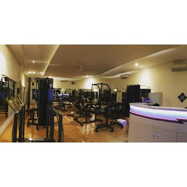
Rangga Gym
Bojong Rangkas Indonesia
contacts phone
:
+62
Latitude:
-6.5592361
, Longitude:
106.6916717
read more
nearest Gym
300 m
PB INSAN MANDIRI
Jalan Dramaga Pratama Raya I, Cibadak
Gym
read more
2.631 km
Elvand Shop
Cibanteng
Gym
read more
2.664 km
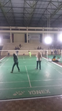
GOR BULUTANGKIS CIAMPEA
Jalan Raya Cagak No.84, Rancabungur
Gym
read more
3.431 km
Lapangan Voli Asrama Sylvapinus
Babakan
Gym
read more
3.494 km
Lapangan Soka
Jalan Soka, Babakan
Gym
read more
3.605 km
Gedung Fortendik
Babakan
Gym
read more
3.639 km
Lapangan Basket IPB
Babakan
Gym
read more
3.645 km
Gedung Olahraga IPB
Babakan
Gym
read more
3.646 km
Gor Lama IPB
Babakan
Gym
read more
3.91 km
Agrifitness
Jalan Tanjung No.4, Babakan
Gym
read more
3.969 km
Davied Gym
Mekarjaya, Cidokom
Gym
read more
3.989 km
Lapangan Serbaguna Asrama Putra IPB
No. 16680, Jalan Tanjung IV, Babakan
Gym
read more
4.555 km
Gymnasium IPB
Babakan
Gym
read more
4.617 km
Roby Gym
Cidokom
Gym
read more
4.76 km
Lapangan Bulutangkis Butonk
cibar butong, Cimulang
Gym
read more
4.867 km
Hilzastro Gym
Jalan Raya Cibungbulang - Bogor, Babakan
Gym
read more
5.099 km
CLUB ZIRA BUGAR
Jalan Cimulang, Bantarjaya
Gym
read more
5.136 km
HAJI WARDI FUTSAL
Bantarjaya
Gym
read more
5.642 km
Imah na Jejen
Jalan Sinar Sari No.51, Sinar Sari
Gym
read more
6.533 km
Ari Wibowo Fitness Centre
Gobang
Gym
read more
9.168 km
Lapangan GERHANA FC
Kayu Manis
Gym
read more
11.047 km
Kursus Yoga
Blok, Jalan Mahoni Raya Blok H No.12A, Mekarjaya
Gym
read more
12.205 km
Taman Angin Angin Pura
Jalan Bandung 7, Tajurhalang
Gym
read more
12.513 km
Lapangan Basket Sempur
Sempur
Gym
read more
13.193 km
Selang Jogging Club
Babakan
Gym
read more
📑
all categories
Accounting
Administrative area level 1
Administrative area level 2
Airport
Amusement park
Aquarium
Art gallery
Atm
Bakery
Bank
Bar
Beauty salon
Bicycle store
Book store
Bowling alley
Bus station
Cafe
Campground
Car dealer
Car rental
Car repair
Car wash
Casino
Cemetery
Church
City hall
Clothing store
Colloquial area
Convenience store
Courthouse
Dentist
Department store
Doctor
Electrician
Electronics store
Embassy
Finance
Fire station
Florist
Food
Funeral home
Furniture store
Gas station
General contractor
Grocery or supermarket
Gym
Hair care
Hardware store
Health
Hindu Temple
Home goods store
Hospital
Insurance agency
Intersection
Jewelry store
Laundry
Lawyer
Library
Liquor store
Local government office
Locality
Locksmith
Lodging
Meal delivery
Meal takeaway
Mosque
Movie rental
Movie theater
Moving company
Museum
Natural feature
Neighborhood
Night club
Painter
Park
Parking
Pet store
Pharmacy
Physiotherapist
Place of worship
Plumber
Point of interest
Police
Political
Post office
Premise
Real estate agency
Restaurant
Roofing contractor
Route
Rv park, camping
School
Shoe store
Shopping mall
Spa
Stadium
Storage
Store
Subpremise
Supermarket
Synagogue
Taxi stand
Train station
Transit station
Travel agency
University
Veterinary care
Zoo
administrative area level 3
administrative area level 4
administrative area level 5
sublocality level 1
↑