Gas station nearby SPBU Pertamina 34-16938
Indonesia
Gas station nearby SPBU Pertamina 34-16938
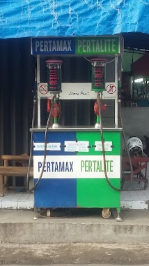
SPBU Pertamina 34-16938
Jalan Sudi Mampir No.37, RT.2/RW.1, Cimanggis Indonesia
contacts phone
:
+62
Latitude:
-6.4997769
, Longitude:
106.7724209
read more
nearest Gas station
17 m
pom bensin sudimampir
Jalan Raya Sudimampir No. 27, Cimanggis, Bojong Gede, Cimanggis
Gas station
read more
978 m
Ronny Bragi Warung Ibu Odah
Jalan Kemuning II No.56, Cimanggis, Bojong Gede, Bogor, Jawa Barat 16320, Cimanggis
Gas station
read more
978 m
Bensin Eceran Ronny Bragi Property Indepent
Jalan Kemuning II, Cimanggis
Gas station
read more
1.119 km
Setim Bang Gefeng
Jalan Raya Tonjong, Tonjong
Gas station
read more
1.33 km
pom bensin pertamini gelegelo
Jl. Lamping 4-64 Cimanggis, Cimanggis
Gas station
read more
1.615 km
Pertamini Dawamida
Cimanggis
Gas station
read more
1.827 km
Spbu 34-16301
Jalan Raya Parung, Kemang
Gas station
read more
1.839 km
Pertamina SPBU
Jalan Raya Parung-Bogor No.498, RT.2/RW.8, Kemang
Gas station
read more
2.261 km
Pom Mini Ma'ut
Jalan Desa Waringinjaya No.83, Waringin Jaya
Gas station
read more
2.414 km
Pertamini Dawamida
Jalan Kampung Sawah Indah, Kedung Waringin
Gas station
read more
2.45 km
Pertamini Pak Taufik
Tajurhalang, Tajur Halang, Tajurhalang
Gas station
read more
2.491 km
Pertamina
Jalan Raya Bojong Gede No.10, RT.3/RW.5, Kedung Waringin
Gas station
read more
2.497 km
Pertamina Bojong Gede
Jalan Haji Abdul Halim, Kedung Waringin
Gas station
read more
2.497 km
Fuel Bojong Gede
Jalan Haji Abdul Halim, Kedung Waringin
Gas station
read more
2.716 km
Jalan Setasiun Bojonggede, Pasar Lama
Gang Pasar Lama, Bojonggede
Gas station
read more
2.738 km
ST Surabaya Gubeng
Kayu Manis
Gas station
read more
2.74 km
warung bensin mang anda
Jalan Kampung Sawah Indah, Bojonggede
Gas station
read more
2.84 km
Pom Bensin Mini
Jalan Kyai Haji Ahmad Sayani, Mekarwangi
Gas station
read more
3.696 km
Warung Bensin Pulsa Eletrik
Jalan Raya Susukan No.36, RT.4/RW.5, Susukan
Gas station
read more
4.018 km
spbu mini dawamida
Sukahati
Gas station
read more
4.029 km
Rindo's Fuel
Jalan Raya Kalisuren, Kalisuren
Gas station
read more
4.072 km
Bensin Bang Timo
Jalan Desa Mekar Wangi No.21, Kencana
Gas station
read more
4.24 km
Pom Mini Pertalite
Jalan Kalimurni Barat No.72, RT.13/RW.9, Kencana
Gas station
read more
5.194 km
Samudra Residence Gupy
Jl. Raya Inkopad Blok B L. 10 No.17, Sasak Panjang
Gas station
read more
5.866 km
Aldy Bensin
Jalan Raya Situ Babakan, Bantarjaya
Gas station
read more
📑
all categories
Accounting
Administrative area level 1
Administrative area level 2
Airport
Amusement park
Aquarium
Art gallery
Atm
Bakery
Bank
Bar
Beauty salon
Bicycle store
Book store
Bowling alley
Bus station
Cafe
Campground
Car dealer
Car rental
Car repair
Car wash
Casino
Cemetery
Church
City hall
Clothing store
Colloquial area
Convenience store
Courthouse
Dentist
Department store
Doctor
Electrician
Electronics store
Embassy
Finance
Fire station
Florist
Food
Funeral home
Furniture store
Gas station
General contractor
Grocery or supermarket
Gym
Hair care
Hardware store
Health
Hindu Temple
Home goods store
Hospital
Insurance agency
Intersection
Jewelry store
Laundry
Lawyer
Library
Liquor store
Local government office
Locality
Locksmith
Lodging
Meal delivery
Meal takeaway
Mosque
Movie rental
Movie theater
Moving company
Museum
Natural feature
Neighborhood
Night club
Painter
Park
Parking
Pet store
Pharmacy
Physiotherapist
Place of worship
Plumber
Point of interest
Police
Political
Post office
Premise
Real estate agency
Restaurant
Roofing contractor
Route
Rv park, camping
School
Shoe store
Shopping mall
Spa
Stadium
Storage
Store
Subpremise
Supermarket
Synagogue
Taxi stand
Train station
Transit station
Travel agency
University
Veterinary care
Zoo
administrative area level 3
administrative area level 4
administrative area level 5
sublocality level 1
↑