Gas station nearby SPBU 15808 Caringin
Indonesia
Gas station nearby SPBU 15808 Caringin
SPBU 15808 Caringin
Jalan Raya Parung Panjang No.81, Caringin Indonesia
contacts phone
:
+62
Latitude:
-6.3170257
, Longitude:
106.5817608
read more
nearest Gas station
17 m
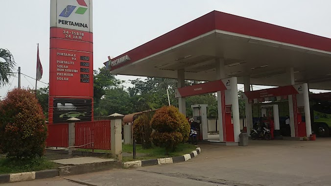
Pertamina
Jalan Raya Parung Panjang No.81, Caringin
Gas station
read more
220 m
SPBE ARTHA JAYA GAS
Caringin
Gas station
read more
391 m
Pertamina SPBU3
Caringin
Gas station
read more
631 m
Jaha gas stations Caringin
Jalan Raya Jatake No.77, Caringin
Gas station
read more
666 m
SPBE KOSAN - PT. Artha Jaya Gas
Jl. Raya Jatake, Kec. Pagedangan, Caringin
Gas station
read more
720 m
Arta Jaya Gas
Caringin
Gas station
read more
855 m
Pertamina
Jalan Garuda Raya Legok Banten, Caringin, Legok, Malang Nengah
Gas station
read more
1.138 km
SPBE KOSAN - PT. Kurnia Abadi Prima
Mr. Sulis, Legok, Jalan Raya Jatake, Jatake
Gas station
read more
1.667 km
SPBE Pertamina
Jatake
Gas station
read more
1.963 km
Polsek Legok
Jalan Raya Parung Panjang No.10, Babakan
Gas station
read more
2.212 km
SPBU 34.15306
JL Raya Legok, RT 001 RW 01, Legok, Babakan
Gas station
read more
2.236 km
Pertamina Spbu 34-15801
Jalan Jatake-Babakan No.17, Babakan
Gas station
read more
2.244 km
PERTAMINI KACIPET
Malang Nengah
Gas station
read more
2.274 km
Pertamina
Babakan
Gas station
read more
2.283 km
SPBU 3415801
Babakan
Gas station
read more
2.333 km
Pertamini
Jalan Raya Pagedangan, Babakan
Gas station
read more
2.524 km
PERTAMINI KPK
Jalan Rancahaur, Karang Tengah
Gas station
read more
2.571 km
Garsip Kemuning, CA144
Kemuning
Gas station
read more
2.599 km
SPBU
Gang Babakan Santri III, Babakan
Gas station
read more
2.651 km
SPBU 34-15321 Kadusirung
Jl. Maloko Raya, Kadu Sirung, Pagedangan, Kadu Sirung
Gas station
read more
3.292 km
Pom Mini
Bojongkamal
Gas station
read more
3.563 km
Spbu nuhunSdm
Kadu Sirung
Gas station
read more
4.782 km
Sofenk
Babat
Gas station
read more
5.173 km
SPBU 34-15813
Jalan Raya Legok - Karawaci, Legok
Gas station
read more
5.96 km
SPBU 3416307 AEON
Lumpang
Gas station
read more
📑
all categories
Accounting
Administrative area level 1
Administrative area level 2
Airport
Amusement park
Aquarium
Art gallery
Atm
Bakery
Bank
Bar
Beauty salon
Bicycle store
Book store
Bowling alley
Bus station
Cafe
Campground
Car dealer
Car rental
Car repair
Car wash
Casino
Cemetery
Church
City hall
Clothing store
Colloquial area
Convenience store
Courthouse
Dentist
Department store
Doctor
Electrician
Electronics store
Embassy
Finance
Fire station
Florist
Food
Funeral home
Furniture store
Gas station
General contractor
Grocery or supermarket
Gym
Hair care
Hardware store
Health
Hindu Temple
Home goods store
Hospital
Insurance agency
Intersection
Jewelry store
Laundry
Lawyer
Library
Liquor store
Local government office
Locality
Locksmith
Lodging
Meal delivery
Meal takeaway
Mosque
Movie rental
Movie theater
Moving company
Museum
Natural feature
Neighborhood
Night club
Painter
Park
Parking
Pet store
Pharmacy
Physiotherapist
Place of worship
Plumber
Point of interest
Police
Political
Post office
Premise
Real estate agency
Restaurant
Roofing contractor
Route
Rv park, camping
School
Shoe store
Shopping mall
Spa
Stadium
Storage
Store
Subpremise
Supermarket
Synagogue
Taxi stand
Train station
Transit station
Travel agency
University
Veterinary care
Zoo
administrative area level 3
administrative area level 4
administrative area level 5
sublocality level 1
↑