Church nearby GPSI Kasih Kudus (Meruyung)
Indonesia
Church nearby GPSI Kasih Kudus (Meruyung)
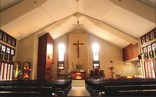
GPSI Kasih Kudus (Meruyung)
Jalan Perjuangan, Meruyung Indonesia
contacts phone
:
+62
Latitude:
-6.381341
, Longitude:
106.7736859
read more
nearest Church
345 m
GKB Bukit Kemuliaan Limo
Jalan Tiga Putra No.18, Meruyung
Church
read more
637 m
GBI Tiga Putra - Meruyung
Blok, Jalan Damai Raya Blok K1 No.1, Meruyung
Church
read more
785 m
GKP Jabar Jemaat Bahtera Hayat Depok
JL. Meruyung Raya Komplek Marinir Blok QQ/1, Rangkapan Jaya Baru
Church
read more
1.491 km
HKBP LIMO
Jalan Benda, Limo
Church
read more
1.543 km
GPI Sidang Limo
Jalan Benda, Limo
Church
read more
1.547 km
GPSI Kasih Kudus
Jalan Benda, Limo
Church
read more
2.159 km
GMAHK Arco Depok
Blok A No.72, Jalan Raya Keadilan, Rangkapan Jaya Baru
Church
read more
2.197 km
BNKP Sawangan
Rangkapan Jaya Baru
Church
read more
2.226 km
GEREJA OIKUMENE (HKBP ARCO)
Blok, Jalan Makam Pule Blok A No.41, Rangkapan Jaya Baru
Church
read more
2.637 km
GBI DTC DEPOK
Jalan Raya Sawangan No.1, Rangkapan Jaya
Church
read more
2.86 km
Majelis Taklim (MT) An Nur
Gang Wadasari III No.2, Tanah Baru
Church
read more
3.269 km
Gpib. Immanuel Depok
jl.pemuda no, RT.002/RW.008, Depok, Rangkapan Jaya
Church
read more
4.05 km
Gereja Katolik Santo Herkulanus, Depok Jaya
Jalan Irian Jaya No.1, Depok Jaya
Church
read more
4.279 km
Elroy Church Sawangan
Bojongsari Lama, Bojongsari, Bojongsari Lama
Church
read more
4.292 km
Gbi Sawangan
Bojongsari Lama
Church
read more
4.475 km
Saint Barnabas Catholic Church, Pamulang
Jalan Mohammad Toha No. 3 RT.002 / RW.005, Pondok Cabe Udik, Pamulang, Pondok Cabe Udik
Church
read more
4.485 km
GBI Miracle Service
Jalan Taman Harmoni, Pondok Cabe Udik
Church
read more
4.596 km
Kantor Gereja
Perempatan Gaplek, Jalan Pondok Cabe Raya Blok B-12, Pondok Cabe Udik
Church
read more
4.868 km
Gkmi Bukit Harmoni
Jalan Tanjung, Serua
Church
read more
4.98 km
Kapel Diaspora
Jalan Cinere Raya No.4, RT.4/RW.1, Cinere
Church
read more
4.981 km
Gereja HKBP Cinere
Jalan Bandung No.25, RT.2, Cinere
Church
read more
5.1 km
GGP Elim
Jalan R.E. Martadinata No.30 C, Pondok Cabe Udik
Church
read more
5.577 km
Bethel Church Indonesia
Jalan Kartini No.11, Depok
Church
read more
6.407 km
Gereja Baptis Indonesia Pemulihan
Jalan Siliwangi, Pamulang Barat
Church
read more
6.544 km
GBI HOUSE OF BREAD PAMULANG
Jalan Pamulang Raya No.13, Pamulang Barat
Church
read more
📑
all categories
Accounting
Administrative area level 1
Administrative area level 2
Airport
Amusement park
Aquarium
Art gallery
Atm
Bakery
Bank
Bar
Beauty salon
Bicycle store
Book store
Bowling alley
Bus station
Cafe
Campground
Car dealer
Car rental
Car repair
Car wash
Casino
Cemetery
Church
City hall
Clothing store
Colloquial area
Convenience store
Courthouse
Dentist
Department store
Doctor
Electrician
Electronics store
Embassy
Finance
Fire station
Florist
Food
Funeral home
Furniture store
Gas station
General contractor
Grocery or supermarket
Gym
Hair care
Hardware store
Health
Hindu Temple
Home goods store
Hospital
Insurance agency
Intersection
Jewelry store
Laundry
Lawyer
Library
Liquor store
Local government office
Locality
Locksmith
Lodging
Meal delivery
Meal takeaway
Mosque
Movie rental
Movie theater
Moving company
Museum
Natural feature
Neighborhood
Night club
Painter
Park
Parking
Pet store
Pharmacy
Physiotherapist
Place of worship
Plumber
Point of interest
Police
Political
Post office
Premise
Real estate agency
Restaurant
Roofing contractor
Route
Rv park, camping
School
Shoe store
Shopping mall
Spa
Stadium
Storage
Store
Subpremise
Supermarket
Synagogue
Taxi stand
Train station
Transit station
Travel agency
University
Veterinary care
Zoo
administrative area level 3
administrative area level 4
administrative area level 5
sublocality level 1
↑