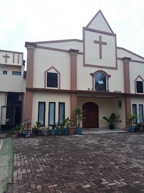
Church nearby GPI Petra
Coronavirus disease (COVID-19) Situation
confirmed cases
6829221
deaths
162063
Indonesia
Church nearby GPI Petra
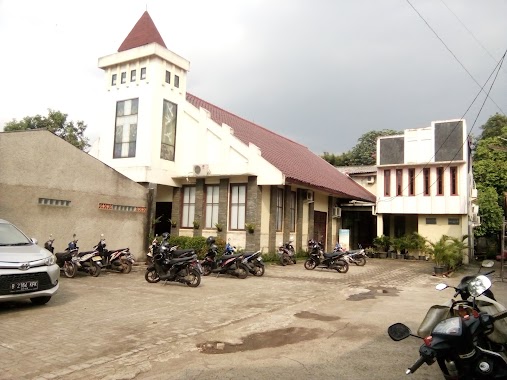
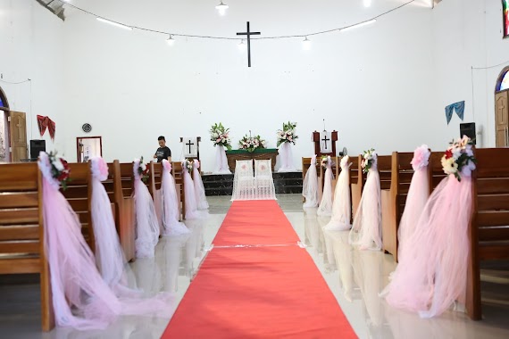
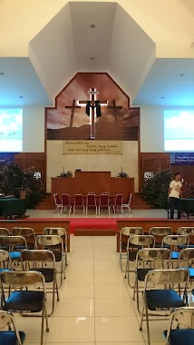
GPI Petra
10, Jalan Raya Kampung Sawah, 17415, Kota Bekasi, Jawa Barat, ID Indonesia
contacts phone
:
+62 21 84598419
website:
www.gpipetra.org
Latitude:
-6.3271581
, Longitude:
106.9367994
larger map & directions
read more
nearest Church
12 m
GPI Petra
Jalan Raya Kampung Sawah no 10, Kelurahan Jatimurni, Kecamatan Pondok Melati, Jatimurni
Church
read more
102 m
GKI KWITANG
Jalan Rambutan No.44, Jatimurni
Church
read more
103 m
GKI Jatimurni
Jalan Rambutan, Jatimurni, Pondok Melati, Jatimurni
Church
read more
135 m
GMAHK Pondok Melati
Jl. Raya Rambutan, Jatimurni, Pondok Melati, Jatimurni
Church
read more
270 m
HKBP Jatimurni Ressort Jatiasih
Jalan Gang Sadar 1 No.11, Jatimurni, Pondokmelati, Jatimurni
Church
read more
279 m
GKPA Jatimurni
Jl. Kenanga No.2, Cipayung, Jatimurni
Church
read more
279 m
St. Vladimir Russian Orthodox Church
Jl. Kampung Sawah Raya Gg. Kenanga II No. 90A, RT 05/RW 02, Jatimurni, Pondok Melati, Jatimurni
Church
read more
286 m
GKJ PONDOK GEDE
Gang Peka, Jatimurni
Church
read more
288 m
Церковь Святого ВЛАДИМИРА
Gang Kenanga II, Jatimurni
Church
read more
291 m
GMAHK Gracia Kampung Sawah
Jatimurni
Church
read more
378 m
Gereja Protestan di Indonesia
Jl. Hankam Raya Jatirahayu Pondok Gede Bekasi Jawa Barat, Jatimurni
Church
read more
388 m
Gereja Katolik St.Servatius
Jatimurni
Church
read more
406 m
Gereja Kristen Pasundan Kampung Sawah
Jl. Raya Kampung Sawah No. 33, RT.003/ RW.04, Jatimelati, Pondok Melati, Jatimelati
Church
read more
489 m
Catholic Church St. Servatius
Jalan Raya Kampung Sawah No.55, RT.1/RW.4, Jatimelati
Church
read more
666 m
Gereja Pentakosta Indonesia Sidang Ujung Aspal
Jalan Kelurahan Jatiwarna Blok C2 No. 34, Pondokmelati, Jatimelati
Church
read more
738 m
GSJPDI EKKLESIA PONDOK GEDE
jl. kelip raya no.85 RT06/03 JATIMURNI, PONDOK MELATI., Jatimurni
Church
read more
1.144 km
Gereja Kristen Pasundan
Jalan Pln No.22, RT.2/RW.4, Jatimurni
Church
read more
1.152 km
GPPS TALITAKUMI
Jalan Raya Pabuaran No.31, Jatiranggon
Church
read more
1.169 km
Gereja Angowuloa Masehi Indonesia Nias
Jl. Kresek Griya Agung No. 58, Jatimelati Pondok Melati, Gang Amin RT 04 RW 04, Jatimelati
Church
read more
1.231 km
HKBP Jati Murni
Jalan Raya Kampung Sawah, Jatimelati
Church
read more
1.277 km
GBI JATI MELATI
Jalan Tambakan No.16, Jatimelati
Church
read more
1.384 km
GPdI Betlehem
Jalan Raya Hankam No.19, Jatimurni
Church
read more
1.751 km
Gereja Kristen Pasundan
Jalan Raya Ujung Aspal No.7, 02, Jatiranggon
Church
read more
1.756 km
GKP Jatiranggon
No., Jalan Raya Ujung Aspal No.7, Jatiranggon
Church
read more
1.756 km
GKP Jatiranggon
Jalan Raya Ujung Aspal No.7, Jatiranggon
Church
read more
📑
all categories
Accounting
Administrative area level 1
Administrative area level 2
Airport
Amusement park
Aquarium
Art gallery
Atm
Bakery
Bank
Bar
Beauty salon
Bicycle store
Book store
Bowling alley
Bus station
Cafe
Campground
Car dealer
Car rental
Car repair
Car wash
Casino
Cemetery
Church
City hall
Clothing store
Colloquial area
Convenience store
Courthouse
Dentist
Department store
Doctor
Electrician
Electronics store
Embassy
Finance
Fire station
Florist
Food
Funeral home
Furniture store
Gas station
General contractor
Grocery or supermarket
Gym
Hair care
Hardware store
Health
Hindu Temple
Home goods store
Hospital
Insurance agency
Intersection
Jewelry store
Laundry
Lawyer
Library
Liquor store
Local government office
Locality
Locksmith
Lodging
Meal delivery
Meal takeaway
Mosque
Movie rental
Movie theater
Moving company
Museum
Natural feature
Neighborhood
Night club
Painter
Park
Parking
Pet store
Pharmacy
Physiotherapist
Place of worship
Plumber
Point of interest
Police
Political
Post office
Premise
Real estate agency
Restaurant
Roofing contractor
Route
Rv park, camping
School
Shoe store
Shopping mall
Spa
Stadium
Storage
Store
Subpremise
Supermarket
Synagogue
Taxi stand
Train station
Transit station
Travel agency
University
Veterinary care
Zoo
administrative area level 3
administrative area level 4
administrative area level 5
sublocality level 1
↑