Church nearby Gereja Bethel Injil Pondok Daud
Indonesia
Church nearby Gereja Bethel Injil Pondok Daud
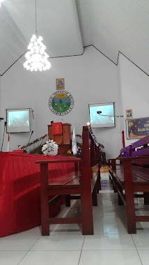
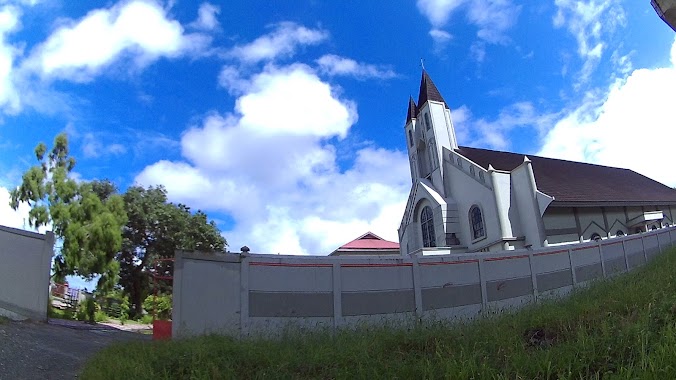
Gereja Bethel Injil Pondok Daud
Jalan Pandan Kasturi No.19, Hative Besar Indonesia
contacts phone
:
+62
Latitude:
-3.6660561
, Longitude:
128.1553746
read more
nearest Church
65 m
Gereja Irene GPM Jemaat Souhuru
Hative Besar
Church
read more
1.046 km
GPM PNIEL Wayame
Jalan Ir. M. Putuhena, Waiyame
Church
read more
1.201 km
GPM Lahai Roi Hative Besar
Jalan Dokter J. Leimena, Hative Besar
Church
read more
1.683 km
Jemaat Gereja Protestan Maluku Bethel Klasis Kota
Waiyame
Church
read more
4.042 km
Gereja Ignatius Slamet Riyadi
Uritetu
Church
read more
4.083 km
Gereja GKPB MDC Cahaya Kehidupan Satelit Rumah Tiga
Jl. Mr., Chr. Soplanit, Rumah Tiga
Church
read more
4.28 km
Gereja Efrata
Pandan Kasturi
Church
read more
4.326 km
Gereja Bala Keselamatan
Jalan Tulukabessy, Kel Rijali
Church
read more
4.383 km
Gereja Maranatha GPM
Uritetu
Church
read more
4.445 km
Gereja Protestan Maluku
JL. Mayjen DI Panjaitan No.2
Church
read more
4.491 km
Gereja Kristen Reformasi Indonesia
JL Bentas, RT 001/03, Kel Wainitu
Church
read more
4.604 km
SILO Ambon
Jalan Benteng Kapaha, Uritetu
Church
read more
4.63 km
CROM Ministry Ambon
jln dukuh no. 6, Lorong Pos, Kel Batu Meja
Church
read more
4.639 km
CROM MINISTRY
Lorong Pos, Uritetu
Church
read more
4.645 km
GPdI Shekinah Ambon
Uritetu
Church
read more
4.656 km
GPM Pusat
Kel Wainitu
Church
read more
4.723 km
Paroki Santo Yoseph, Rumahtiga
Rumah Tiga
Church
read more
4.812 km
Gereja Kristen Kalam Kudus (GKKK) Ambon
Jalan Yan Paays, Kel Ahusen
Church
read more
4.855 km
Paroki Santo Fransiskus Xaverius, Gereja Katedral
Jalan Pattimura No.32, Uritetu
Church
read more
4.887 km
Gereja Josep Kam
Jalan Rijali, Kel Karang Panjang
Church
read more
4.962 km
Gereja Ebenhaezer
Jalan Skip, Kel Karang Panjang
Church
read more
5.052 km
GMAHK Jemaat ABIN
Teluk Ambon, Kel Ahusen
Church
read more
5.083 km
Gereja Bait Eden
Kel Karang Panjang
Church
read more
5.109 km
Syaloom Church
Kel Batu Meja
Church
read more
5.931 km
Jemaat GPM BETHABARA,KLASIS KOTA AMBON
Unnamed Rd,, Soya
Church
read more
📑
all categories
Accounting
Administrative area level 1
Administrative area level 2
Airport
Amusement park
Aquarium
Art gallery
Atm
Bakery
Bank
Bar
Beauty salon
Bicycle store
Book store
Bowling alley
Bus station
Cafe
Campground
Car dealer
Car rental
Car repair
Car wash
Casino
Cemetery
Church
City hall
Clothing store
Colloquial area
Convenience store
Courthouse
Dentist
Department store
Doctor
Electrician
Electronics store
Embassy
Finance
Fire station
Florist
Food
Funeral home
Furniture store
Gas station
General contractor
Grocery or supermarket
Gym
Hair care
Hardware store
Health
Hindu Temple
Home goods store
Hospital
Insurance agency
Intersection
Jewelry store
Laundry
Lawyer
Library
Liquor store
Local government office
Locality
Locksmith
Lodging
Meal delivery
Meal takeaway
Mosque
Movie rental
Movie theater
Moving company
Museum
Natural feature
Neighborhood
Night club
Painter
Park
Parking
Pet store
Pharmacy
Physiotherapist
Place of worship
Plumber
Point of interest
Police
Political
Post office
Premise
Real estate agency
Restaurant
Roofing contractor
Route
Rv park, camping
School
Shoe store
Shopping mall
Spa
Stadium
Storage
Store
Subpremise
Supermarket
Synagogue
Taxi stand
Train station
Transit station
Travel agency
University
Veterinary care
Zoo
administrative area level 3
administrative area level 4
administrative area level 5
sublocality level 1
↑