
open
🕗 opening times
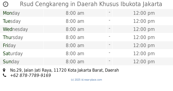
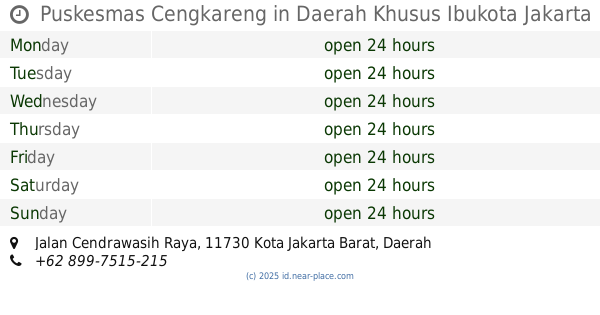
| Monday | open 24 hours | |||||
| Tuesday | open 24 hours | |||||
| Wednesday | open 24 hours | |||||
| Thursday | open 24 hours | |||||
| Friday | open 24 hours | |||||
| Saturday | open 24 hours | |||||
| Sunday | open 24 hours | |||||
1, Jalan Bumi Cengkareng Indah, 11730, Kota Jakarta Barat, Daerah Khusus Ibukota Jakarta, ID Indonesia
contacts phone: +62 21 54372882
website: www.rsudcengkareng.com
larger map & directionsLatitude: -6.1429944, Longitude: 106.7348141

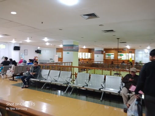
Kasra J. Munara
::State own general hospital. Easy access from the toll.
Yuliana Liu
::The worst. You must waiting for 4 hours only to get your examination
lal ali Nurmansyah
::Please Admin Google Map , Approve my change Coordinate ,that its real Tap new Coordinate. @
Rosin Tanya
::This is a huge and complete hospital complex own by government. I am impressed with the huge room even for third class in patient rooms! Located behind Taman Palem mall and close to Puri residence housing complex
Rachmani Nur Insani
::The service really so bad. My friends infus was already empty but the nurses didn't change it quickly, they promise to change after maghrib, but it's almost isya when they change it. Also they make my friends BPJS difficult. Really slow response in this hospital. So many things makes this hospital service really worst. Not recommended hospital for some urgent or C. I. T. O condition.