Cafe nearby Warung TEH RIKA
Indonesia
Cafe nearby Warung TEH RIKA
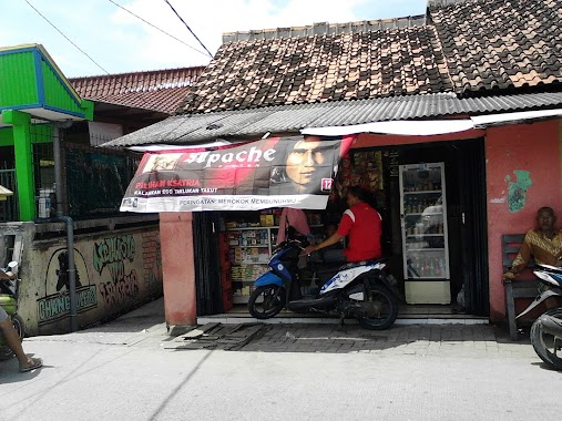
Warung TEH RIKA
Jalan Raya Tanjung Kait No.1213, Marga Mulya Indonesia
contacts phone
:
+62
Latitude:
-6.0359629
, Longitude:
106.5211445
read more
nearest Cafe
874 m
Cafe Pondok Kait
Unnamed Road, Ketapang
Cafe
read more
988 m
Bagan Bang Mardin
Jalan Raya Tanjung Kait, rt01 rw01
Cafe
read more
1.473 km
Marhaban Kebab
Jalan Raya Tanjung Kait, Ketapang
Cafe
read more
1.765 km
Warung Gado-gado
Jalan Raya Tanjung Kait, Kebon Baru
Cafe
read more
2.272 km
Rumah Makan Oklay
Tegal Kunir Lor
Cafe
read more
2.312 km
Goal Net
Tegal Kunir Lor
Cafe
read more
2.483 km
GOAL NET
Kp. Kebonan Ds, Tegal Kunir Lor
Cafe
read more
2.67 km
Warung Ibu Wati
Unnamed Road, Tanjung Anom
Cafe
read more
2.742 km
Banyu Walasa
Banyu Asih
Cafe
read more
2.753 km
Alsa Never Die cafe
Banyu Asih
Cafe
read more
2.797 km
Sosis Bakar Golem
Jalan Insinyur Sutami, Mauk Timur
Cafe
read more
2.816 km
Jajanan Lezat Dan Murah Meriah Nyonnyon
East Mauk
Cafe
read more
2.859 km
Eat Story Cafe
Kp. Lio 006/02, Mauk Timur, Tangerang, Mauk, Mauk Timur
Cafe
read more
2.907 km
Kedai Nobita
Jalan Raya Tanjung Kait No.33, Tanjung Anom
Cafe
read more
2.915 km
Caffe Joey Koyoshi 2
Jalan Raya Tanjung Kait, Tanjung Anom
Cafe
read more
2.919 km
Kedai Sosbak Nobita
Jalan Raya Tanjung Kait No.33, Tanjung Anom
Cafe
read more
2.924 km
Adhe Maming
Jalan Raya Tanjung Kait No.33, Tanjung Anom
Cafe
read more
2.945 km
Warung Ibu Ayoh
Jalan Raya Tanjung Kait No.33, Tanjung Anom
Cafe
read more
2.968 km
Warung Gado-gado Ibu Uci
Tanjung Anom
Cafe
read more
3.036 km
Bakso Sami Roso "Mas Harto"
East Mauk
Cafe
read more
3.062 km
Warung Babe MAMUNG
Tanjung Anom
Cafe
read more
3.065 km
Warung Ceu Ani
West Mauk
Cafe
read more
3.118 km
warung kopi nona yuli yolanda
Tanjung Anom
Cafe
read more
3.141 km
Bagan Bang Mardin
Tanjung Anom
Cafe
read more
3.257 km
diesayyidan
Jalan Insinyur Sutami No.27, Mauk Barat
Cafe
read more
📑
all categories
Accounting
Administrative area level 1
Administrative area level 2
Airport
Amusement park
Aquarium
Art gallery
Atm
Bakery
Bank
Bar
Beauty salon
Bicycle store
Book store
Bowling alley
Bus station
Cafe
Campground
Car dealer
Car rental
Car repair
Car wash
Casino
Cemetery
Church
City hall
Clothing store
Colloquial area
Convenience store
Courthouse
Dentist
Department store
Doctor
Electrician
Electronics store
Embassy
Finance
Fire station
Florist
Food
Funeral home
Furniture store
Gas station
General contractor
Grocery or supermarket
Gym
Hair care
Hardware store
Health
Hindu Temple
Home goods store
Hospital
Insurance agency
Intersection
Jewelry store
Laundry
Lawyer
Library
Liquor store
Local government office
Locality
Locksmith
Lodging
Meal delivery
Meal takeaway
Mosque
Movie rental
Movie theater
Moving company
Museum
Natural feature
Neighborhood
Night club
Painter
Park
Parking
Pet store
Pharmacy
Physiotherapist
Place of worship
Plumber
Point of interest
Police
Political
Post office
Premise
Real estate agency
Restaurant
Roofing contractor
Route
Rv park, camping
School
Shoe store
Shopping mall
Spa
Stadium
Storage
Store
Subpremise
Supermarket
Synagogue
Taxi stand
Train station
Transit station
Travel agency
University
Veterinary care
Zoo
administrative area level 3
administrative area level 4
administrative area level 5
sublocality level 1
↑