Cafe nearby Warung Bu Yudi
Indonesia
Cafe nearby Warung Bu Yudi
Warung Bu Yudi
Sidodadi Indonesia
contacts phone
:
+62
Latitude:
-5.3957667
, Longitude:
105.2574117
read more
nearest Cafe
98 m
@Nyemilgeh_bdl
Jalan Harimau No.10, Sukamenanti
Cafe
read more
334 m
Warung Makan Adrilia
Jalan Landak, Sidodadi
Cafe
read more
366 m
Cafe Pecut Kong's
Penengahan
Cafe
read more
371 m
Cafe Zona Santai
Sukamenanti
Cafe
read more
389 m
Warung Kopi Mas Ari
Jalan Kanguru Gang Sejahtera, Sidodadi
Cafe
read more
429 m
BBS Unilanet
JL. Prof DR Sumantri Brojonegoro 1, Bandarlampung, Penengahan
Cafe
read more
481 m
DE.CO Street Food
Surabaya
Cafe
read more
487 m
Happy Milk
Jalan Teuku Umar No.3 J, Surabaya
Cafe
read more
494 m
homestay david kos kosan
Jalan Teuku Umar, Sidodadi
Cafe
read more
495 m
Bakso judes lampung
Surabaya
Cafe
read more
547 m
Mie Ayam Ceker Ammar
Jalan Sam Ratulangi No.103, Penengahan
Cafe
read more
756 m
Warung Mpok Titien
Gang Boy No.25, Jagabaya II
Cafe
read more
768 m
Ramiracoll
JL. Teuku Umar, No 43, Surabaya
Cafe
read more
784 m
ES KEPAL MILO UPI
Jalan Teuku Umar No.75, Sidodadi
Cafe
read more
878 m
Es Campur 3 Putri
Jalan Pulau Buton No..03, jaga baya 2
Cafe
read more
879 m
Ci Bowl
Jagabaya II
Cafe
read more
893 m
Roemah Steak Lampung
Jalan Pajajaran No.19, Jagabaya II
Cafe
read more
907 m
LIA SOFT ICE CREAM (DIAMOND)
Sukamenanti
Cafe
read more
909 m
Warung Pecel Ngelih
Jalan Danau Toba No.30, Surabaya
Cafe
read more
915 m
Thai Tea Nam Nam
Gedong Air
Cafe
read more
956 m
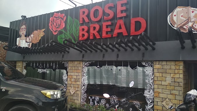
TOKO ROTI ROSE BREAD
Jalan Pajajaran No.90, Jagabaya II
Cafe
read more
960 m
Mitra - Mitra Mulia Jaya
Jalan Pajajaran, Jaga Baya I
Cafe
read more
967 m
Cilok Bunda
Pajajaran no, RW.6, Jagabaya II
Cafe
read more
1.025 km
Cemal Cemil BDL
No., Jl. Pajajaran No.129, 35122, Jagabaya II
Cafe
read more
1.03 km
Warung Kartono
Jalan Teuku Umar No.20B, Surabaya
Cafe
read more
📑
all categories
Accounting
Administrative area level 1
Administrative area level 2
Airport
Amusement park
Aquarium
Art gallery
Atm
Bakery
Bank
Bar
Beauty salon
Bicycle store
Book store
Bowling alley
Bus station
Cafe
Campground
Car dealer
Car rental
Car repair
Car wash
Casino
Cemetery
Church
City hall
Clothing store
Colloquial area
Convenience store
Courthouse
Dentist
Department store
Doctor
Electrician
Electronics store
Embassy
Finance
Fire station
Florist
Food
Funeral home
Furniture store
Gas station
General contractor
Grocery or supermarket
Gym
Hair care
Hardware store
Health
Hindu Temple
Home goods store
Hospital
Insurance agency
Intersection
Jewelry store
Laundry
Lawyer
Library
Liquor store
Local government office
Locality
Locksmith
Lodging
Meal delivery
Meal takeaway
Mosque
Movie rental
Movie theater
Moving company
Museum
Natural feature
Neighborhood
Night club
Painter
Park
Parking
Pet store
Pharmacy
Physiotherapist
Place of worship
Plumber
Point of interest
Police
Political
Post office
Premise
Real estate agency
Restaurant
Roofing contractor
Route
Rv park, camping
School
Shoe store
Shopping mall
Spa
Stadium
Storage
Store
Subpremise
Supermarket
Synagogue
Taxi stand
Train station
Transit station
Travel agency
University
Veterinary care
Zoo
administrative area level 3
administrative area level 4
administrative area level 5
sublocality level 1
↑