Cafe nearby Syabilla Cafe
Indonesia
Cafe nearby Syabilla Cafe
Syabilla Cafe
Unnamed Road, Saga Indonesia
contacts phone
:
+62
Latitude:
-6.1809889
, Longitude:
106.4599365
read more
nearest Cafe
363 m
warung uyut jaya
Saga, Balaraja, Saga
Cafe
read more
470 m
Warung Atmo
Jalan Mutiara No.2, Saga
Cafe
read more
550 m
Warung TO nana
Saga
Cafe
read more
560 m
Beskem Si Ireng
Jalan Raya Balaraja, Bakung
Cafe
read more
561 m
WARKOP KHAS JAWA 2
Jalan Raya Kresek No.69, Balaraja
Cafe
read more
820 m
Kue Balok Bandung, Kang Wawan Balaraja
Jl. Raya Kresek, Balaraja
Cafe
read more
823 m
Mazik Ice Cream
Saga
Cafe
read more
826 m
UpBox Cafe
Jl. Raya Kresek No.69, Kp. Tegal Kali baru, Balaraja
Cafe
read more
847 m
PATHNER ADD
Unnamed Road
Cafe
read more
847 m
PATHNER ADD
Unnamed Road, Balaraja
Cafe
read more
856 m
Warjiman Coffee
kp kiara mandiri, Tobat
Cafe
read more
859 m
ZhoZid Juice
Jalan Raya Kresek, Balaraja
Cafe
read more
861 m
Gerobak Moo Nenen
Jalan Raya Kresek No.69, Balaraja
Cafe
read more
878 m
Nasi Bakar 47
Jl. Raya Kresek, Km. 0,5 , Kp. Kiara No. 47, Desa. Tobat
Cafe
read more
893 m
Cluster Graha Hijau Blok B2 no 11
Saga
Cafe
read more
899 m
arie evanclassic
Saga
Cafe
read more
925 m
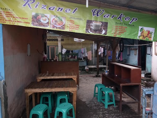
Rizanet
Balaraja
Cafe
read more
960 m
ANGKRINGAN ROSO KANGEN
Balaraja
Cafe
read more
968 m
Booth Villa
Unnamed Road, Saga
Cafe
read more
980 m
Singkong Keju Bandung
Jalan Raya Balaraja, Balaraja
Cafe
read more
980 m
Ayam Geprek Bossque Balaraja, Tangerang
Cafe
read more
998 m
Mie Ayam Ceker Pedas Pak Dwe
Balaraja
Cafe
read more
999 m
Angkringan Wedang Rempah Susu Jahe
Jln Raya Kresek Kp.kedaung, Balaraja, Balaraja
Cafe
read more
1.037 km
Mandiri Travel
Balaraja
Cafe
read more
1.136 km
Kedai Halaman Kita
Kepuh, Saga
Cafe
read more
📑
all categories
Accounting
Administrative area level 1
Administrative area level 2
Airport
Amusement park
Aquarium
Art gallery
Atm
Bakery
Bank
Bar
Beauty salon
Bicycle store
Book store
Bowling alley
Bus station
Cafe
Campground
Car dealer
Car rental
Car repair
Car wash
Casino
Cemetery
Church
City hall
Clothing store
Colloquial area
Convenience store
Courthouse
Dentist
Department store
Doctor
Electrician
Electronics store
Embassy
Finance
Fire station
Florist
Food
Funeral home
Furniture store
Gas station
General contractor
Grocery or supermarket
Gym
Hair care
Hardware store
Health
Hindu Temple
Home goods store
Hospital
Insurance agency
Intersection
Jewelry store
Laundry
Lawyer
Library
Liquor store
Local government office
Locality
Locksmith
Lodging
Meal delivery
Meal takeaway
Mosque
Movie rental
Movie theater
Moving company
Museum
Natural feature
Neighborhood
Night club
Painter
Park
Parking
Pet store
Pharmacy
Physiotherapist
Place of worship
Plumber
Point of interest
Police
Political
Post office
Premise
Real estate agency
Restaurant
Roofing contractor
Route
Rv park, camping
School
Shoe store
Shopping mall
Spa
Stadium
Storage
Store
Subpremise
Supermarket
Synagogue
Taxi stand
Train station
Transit station
Travel agency
University
Veterinary care
Zoo
administrative area level 3
administrative area level 4
administrative area level 5
sublocality level 1
↑