Cafe nearby Steam Pengkolan
Indonesia
Cafe nearby Steam Pengkolan
Steam Pengkolan
Grogol Indonesia
contacts phone
:
+62
Latitude:
-6.3833616
, Longitude:
106.7836755
read more
nearest Cafe
40 m
Warung Bang Majai
Grogol
Cafe
read more
86 m
Warung Nasi Uduk Betawi Mpo Anih
Grogol
Cafe
read more
249 m
Kedai Bararoti
Jalan Vila Santika Jaya, Mampang
Cafe
read more
260 m
Nasi uduk djogja
Jalan Kampung Grogol Sebrang No.3, Grogol
Cafe
read more
313 m
Warung Nasi Uduk Cek Komar
Jalan Kampung Grogol Sebrang No.13, Grogol
Cafe
read more
560 m
WR RENTA
Jalan Damai Raya, Meruyung
Cafe
read more
605 m
Toko Minuman Awang
Rangkapan Jaya
Cafe
read more
606 m
Chelsea fans club
Rangkapan Jaya
Cafe
read more
612 m
Warkop TSM
Jalan Pulo Mangga Raya #39 RT 001 RW 004, Grogol, Limo, Grogol
Cafe
read more
617 m
lup lup octo cafe
Mampang
Cafe
read more
633 m
Coclate Aca Ucu
Grogol
Cafe
read more
711 m
Ds'Snack
no.49B rangkepan jaya lama, Jalan Samudera Jaya, Rangkapan Jaya
Cafe
read more
717 m
New Land Tokyo Bubble
Jalan Pulo Mangga No.161, Grogol
Cafe
read more
752 m
Ndalem Kamarwatan
Jalan Perumahan Mampang Indah 2, Rangkapan Jaya
Cafe
read more
754 m
Doubledecker Cafe & Cake
Jalan Raya Grogol, Grogol
Cafe
read more
761 m
Ice Cream Me-Queen 28
Jalan Pulo Mangga, Grogol
Cafe
read more
891 m
ARISHA Cafe And Resto
Jalan Pramuka Raya No.3, Mampang
Cafe
read more
950 m
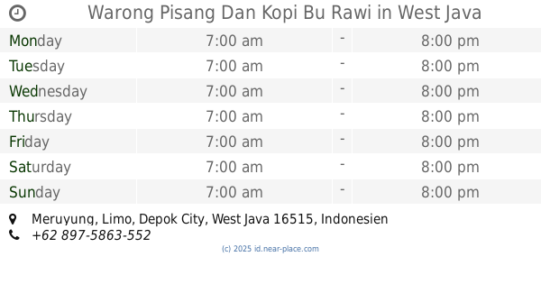
Warong Pisang Dan Kopi Bu Rawi
Meruyung
Cafe
read more
955 m
Kedai Sosmed
Jalan Samudra Jaya No.7, Rangkapan Jaya
Cafe
read more
970 m
Burger Gosong
No 23 Kelurahan Kecamatan Limo, Jalan Pramuka Raya, Grogol
Cafe
read more
977 m
Peugeot MAS Cafe
C., Jalan Kompleks Lemigas Blok Y1 No.10, Meruyung
Cafe
read more
984 m
Cafe Lesehan Adel
Gang Haji Jumin No.8, Mampang
Cafe
read more
994 m
Welcome To BBQ Grill
Jalan Samudra Jaya, Rangkapan Jaya
Cafe
read more
1.091 km
Saung Gaul Cepot
Meruyung
Cafe
read more
1.316 km
Waroeng Mak Iyok
Jalan Sukarma No.3, RT.2, Rangkapan Jaya Baru
Cafe
read more
📑
all categories
Accounting
Administrative area level 1
Administrative area level 2
Airport
Amusement park
Aquarium
Art gallery
Atm
Bakery
Bank
Bar
Beauty salon
Bicycle store
Book store
Bowling alley
Bus station
Cafe
Campground
Car dealer
Car rental
Car repair
Car wash
Casino
Cemetery
Church
City hall
Clothing store
Colloquial area
Convenience store
Courthouse
Dentist
Department store
Doctor
Electrician
Electronics store
Embassy
Finance
Fire station
Florist
Food
Funeral home
Furniture store
Gas station
General contractor
Grocery or supermarket
Gym
Hair care
Hardware store
Health
Hindu Temple
Home goods store
Hospital
Insurance agency
Intersection
Jewelry store
Laundry
Lawyer
Library
Liquor store
Local government office
Locality
Locksmith
Lodging
Meal delivery
Meal takeaway
Mosque
Movie rental
Movie theater
Moving company
Museum
Natural feature
Neighborhood
Night club
Painter
Park
Parking
Pet store
Pharmacy
Physiotherapist
Place of worship
Plumber
Point of interest
Police
Political
Post office
Premise
Real estate agency
Restaurant
Roofing contractor
Route
Rv park, camping
School
Shoe store
Shopping mall
Spa
Stadium
Storage
Store
Subpremise
Supermarket
Synagogue
Taxi stand
Train station
Transit station
Travel agency
University
Veterinary care
Zoo
administrative area level 3
administrative area level 4
administrative area level 5
sublocality level 1
↑