Cafe nearby sosis bakar mpo nunu
Indonesia
Cafe nearby sosis bakar mpo nunu
sosis bakar mpo nunu
63, Jalan Swadaya, 16413, Kota Depok, Jawa Barat, ID Indonesien
contacts phone
:
+62 896-7902-4011
Latitude:
-6.4352139
, Longitude:
106.8322456
larger map & directions
read more
nearest Cafe
66 m
Warung Nasi Bu Nenih
011 004, Jalan Swadaya No.43, Kalibaru
Cafe
read more
123 m
Warung Ibu Een
Jalan Mandor Samin No.126, Kalibaru
Cafe
read more
278 m
cafe Bu Tuni
rt 02/06, Jalan SMP 6 Kalibaru No.60, Kalibaru
Cafe
read more
401 m
Warkop 5 Bersodara
Jalan Kampung Cilodong, Kalibaru
Cafe
read more
518 m
warkop cell
Gang Jawa No.52, Cilodong
Cafe
read more
587 m
Ramelnet
Jalan Kemang Raya, Cilodong
Cafe
read more
625 m
Taruna Juice
Jalan H. Abdul Gani Raya No.37, Kalibaru
Cafe
read more
629 m
BM Bir Pletok Cilodong
Kalibaru
Cafe
read more
688 m
NONGKY KUY
Jalan Kailudin, Kalibaru
Cafe
read more
767 m
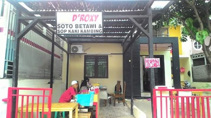
Soto Betawi D'roxy
Grand Depok City, Grand Cluster Jasmine, Jalan Boulevard Raya Grand Depok City, Jatimulya
Cafe
read more
786 m
Lontong Sayur Padang
Jalan H. Abdul Gani Raya, Pabuaran
Cafe
read more
789 m
Migliore Coffe
Cluster Jasmine, Jatimulya
Cafe
read more
792 m
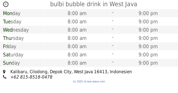
bulbi bubble drink
Kalibaru
Cafe
read more
798 m
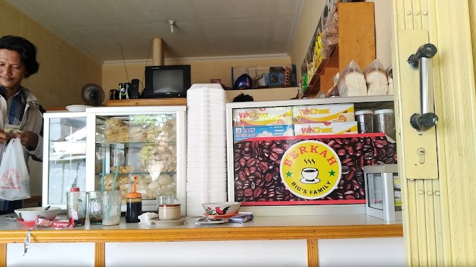
Warkop BERKAH
Jalan Kemang Raya, Kalibaru
Cafe
read more
850 m
Semi Cafe
Gang Haji Masam, Kalibaru
Cafe
read more
855 m
Warkop Petir Setu Cilodong
Kalibaru
Cafe
read more
860 m
Kedai QiQi
Jalan Boulevard Raya Grand Depok City, Jatimulya
Cafe
read more
970 m
Fabrik Drink and Meal
Jalan Toni, Cilodong
Cafe
read more
970 m
Fabrik Drink and Meal
Jalan Kemang Raya No.2
Cafe
read more
971 m
NASI PECEL NDESO (madiun)
Jalan Haji Abdul Gani II No.84, Kalibaru
Cafe
read more
979 m
BC.GoPang
Kalimulya
Cafe
read more
1.033 km
Joy Maren Purba
Kalimulya
Cafe
read more
1.062 km
Warpi Coffee
Jalan Setu, Cilodong
Cafe
read more
1.098 km
BC SLIM ONLINE(Grab/Gojek)
No.15 A, Jalan Sasak No.15 A, Kalimulya
Cafe
read more
1.105 km
Rumah Mohamad Isman
Jalan Sasak No.105, Kalimulya
Cafe
read more
📑
all categories
Accounting
Administrative area level 1
Administrative area level 2
Airport
Amusement park
Aquarium
Art gallery
Atm
Bakery
Bank
Bar
Beauty salon
Bicycle store
Book store
Bowling alley
Bus station
Cafe
Campground
Car dealer
Car rental
Car repair
Car wash
Casino
Cemetery
Church
City hall
Clothing store
Colloquial area
Convenience store
Courthouse
Dentist
Department store
Doctor
Electrician
Electronics store
Embassy
Finance
Fire station
Florist
Food
Funeral home
Furniture store
Gas station
General contractor
Grocery or supermarket
Gym
Hair care
Hardware store
Health
Hindu Temple
Home goods store
Hospital
Insurance agency
Intersection
Jewelry store
Laundry
Lawyer
Library
Liquor store
Local government office
Locality
Locksmith
Lodging
Meal delivery
Meal takeaway
Mosque
Movie rental
Movie theater
Moving company
Museum
Natural feature
Neighborhood
Night club
Painter
Park
Parking
Pet store
Pharmacy
Physiotherapist
Place of worship
Plumber
Point of interest
Police
Political
Post office
Premise
Real estate agency
Restaurant
Roofing contractor
Route
Rv park, camping
School
Shoe store
Shopping mall
Spa
Stadium
Storage
Store
Subpremise
Supermarket
Synagogue
Taxi stand
Train station
Transit station
Travel agency
University
Veterinary care
Zoo
administrative area level 3
administrative area level 4
administrative area level 5
sublocality level 1
↑