Cafe nearby PS BIMBIM
Indonesia
Cafe nearby PS BIMBIM
PS BIMBIM
Wanasari Indonesia
contacts phone
:
+62
Latitude:
-6.2617325
, Longitude:
107.0786957
read more
nearest Cafe
352 m
Waroeng Unay
Jalan Teratai IV D, Wanasari
Cafe
read more
386 m
Rumah Andryzh
Jalan Teratai IV C No.9, Rt 2 Rawa 3, Wanasari
Cafe
read more
581 m
Jayaningrat
Kp. Bahagia, Jalan Raya Teuku Umar, Tambun
Cafe
read more
634 m
Batagor Garut Pak TATA
Jalan Raya Setu No.304, Tambun
Cafe
read more
639 m
Mie Aceh Intan Kafe D&D
Jalan Raya Teuku Umar, Tambun
Cafe
read more
640 m
Warung BaleHai cibitung
Gang Darussalam, Wanasari
Cafe
read more
657 m
Warung Hj. Titin
Jalan Raya Teuku Umar No.5, Tambun
Cafe
read more
679 m
Nasi uduk karawang
Jalan Raya Setu No.11-28, Tambun
Cafe
read more
686 m
Warung Ompong
Jalan Kompleks Malpinas No.023, RT.003, Wanasari
Cafe
read more
730 m
cafe bunda vany
Jalan Kenanga 3, Wanasari
Cafe
read more
763 m
Aey's Cream
Blok D 32, Jalan Mawar Merah 2 Blok D 32 No.11, Wanasari
Cafe
read more
791 m
KEDAI JAJAN BIMA (ES KEPAL Dll)
Jalan Raya Setu No.8, Tambun
Cafe
read more
838 m
Martabak LANI
Mekarsari
Cafe
read more
852 m
Waroeng Amril
Jalan Raya Setu No.35, Tambun
Cafe
read more
869 m
Moo Nyusu - Bosih Cibitung
Blok E7 No., Jalan Raya Hm Bosih Selang Cau No.2, Wanasari
Cafe
read more
873 m
Warkop Net
Jalan Dahlia Utara No.9, Wanasari
Cafe
read more
909 m
YOGYA_QUA
Tridaya Sakti
Cafe
read more
934 m
cafe lift
Unnamed Road, Wanasari
Cafe
read more
969 m
Imagination caffe
Jalan Kalimaya I, Tambun
Cafe
read more
1.002 km
Warung Pak Arim
Jl. Harum Manis 1 Blok H.6 No.30, Wanasari
Cafe
read more
1.108 km
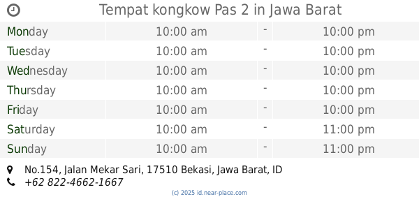
Tempat kongkow Pas 2
Jalan Mekar Sari No.154, Mekarsari
Cafe
read more
1.157 km
Wardep Gokil
Jalan Bosih Raya, Wanasari
Cafe
read more
1.158 km
Es Kepal Diva
Metland Tambun, Jalan Kalimaya Raya, Tambun
Cafe
read more
1.16 km
Saung Zora Kitchen & Coffee
Jalan Kalimaya Raya Blok B1 No.14, Tambun
Cafe
read more
1.231 km
WARKOP SINOK
Jalan Raya Hm Bosih Selang Cau, Wanasari
Cafe
read more
📑
all categories
Accounting
Administrative area level 1
Administrative area level 2
Airport
Amusement park
Aquarium
Art gallery
Atm
Bakery
Bank
Bar
Beauty salon
Bicycle store
Book store
Bowling alley
Bus station
Cafe
Campground
Car dealer
Car rental
Car repair
Car wash
Casino
Cemetery
Church
City hall
Clothing store
Colloquial area
Convenience store
Courthouse
Dentist
Department store
Doctor
Electrician
Electronics store
Embassy
Finance
Fire station
Florist
Food
Funeral home
Furniture store
Gas station
General contractor
Grocery or supermarket
Gym
Hair care
Hardware store
Health
Hindu Temple
Home goods store
Hospital
Insurance agency
Intersection
Jewelry store
Laundry
Lawyer
Library
Liquor store
Local government office
Locality
Locksmith
Lodging
Meal delivery
Meal takeaway
Mosque
Movie rental
Movie theater
Moving company
Museum
Natural feature
Neighborhood
Night club
Painter
Park
Parking
Pet store
Pharmacy
Physiotherapist
Place of worship
Plumber
Point of interest
Police
Political
Post office
Premise
Real estate agency
Restaurant
Roofing contractor
Route
Rv park, camping
School
Shoe store
Shopping mall
Spa
Stadium
Storage
Store
Subpremise
Supermarket
Synagogue
Taxi stand
Train station
Transit station
Travel agency
University
Veterinary care
Zoo
administrative area level 3
administrative area level 4
administrative area level 5
sublocality level 1
↑