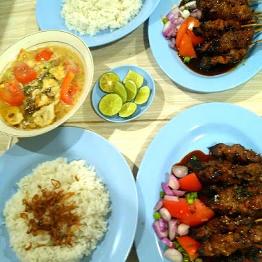
Cafe nearby Pos Kenuri
Indonesia
Cafe nearby Pos Kenuri
Pos Kenuri
Jalan Kenangan, 17145, Kota Bekasi, Jawa Barat, ID Indonesien
contacts phone
:
+62
Latitude:
-6.2403194
, Longitude:
106.9664157
larger map & directions
read more
nearest Cafe
209 m
Empang Bang Omat
Jalan Al-Ikhlas, Jakasampurna
Cafe
read more
290 m
Andian Home Stay
Blok Nurul Iman 8, Jalan Nurul Iman Raya Blok Nurul Iman 8 No.33, Jakasampurna
Cafe
read more
322 m
Warung Es Kelapa Muda
Jalan Assyafiiyah No.2, Jakasampurna
Cafe
read more
342 m
Toko Jamu Sidomuncul
Jalan Patriot No.19, Jakasampurna
Cafe
read more
349 m
Teras Kenzo
Jalan Rajawali V Blok A No.68, Jakasampurna
Cafe
read more
361 m
Warung Bambu
Jakasampurna
Cafe
read more
400 m
Moo Cucuu Inkopol Bekasi Barat
Jalan Merak Raya No.18, Jakasampurna
Cafe
read more
414 m
Soto Marem Kranji
Jalan Assyafiiyah No.20-3, Jakasampurna
Cafe
read more
437 m
Angkringan CESAR
Jakasampurna
Cafe
read more
480 m
Martabak Omen 313
Jalan Patriot, Jakasampurna
Cafe
read more
508 m
Feel It Vapor Patriot
No Jl. Patriot Blok Hafid No, 24, Jakasampurna
Cafe
read more
547 m
Es Doger
Jalan Patriot, Jakasampurna
Cafe
read more
662 m
Kantin Kita
Jalan Al-Falah II, Jakasampurna
Cafe
read more
725 m
cafe irex
Jalan Mawar Raya No.V No.46, Jakasampurna
Cafe
read more
750 m
Sembako Coffe
Jalan Bintara Raya No.1, Jakasampurna
Cafe
read more
791 m
Warkop Sederhana
Bintara
Cafe
read more
857 m
Base Go-Grab Bintara
Jalan Bintara Raya No.2, RT.6/RW.13, Bintara
Cafe
read more
956 m
Warkop HoAhHoEh
jl.kp.setu rt 011/02 no.1 17136, Bintara Jaya
Cafe
read more
973 m
BASECAMP ANCHAM KONOHA
Bintara
Cafe
read more
983 m
WARKOP RIZKYA
Jalan Bintara 17 No.24-28, Bintara
Cafe
read more
1.007 km
Sate Taichan KEPO
Jalan Cemara Raya No.18, Jakasampurna
Cafe
read more
1.008 km
Susu Jahe Putri Solo
Jalan Raya 15 (foodcourt), Bintara
Cafe
read more
1.03 km
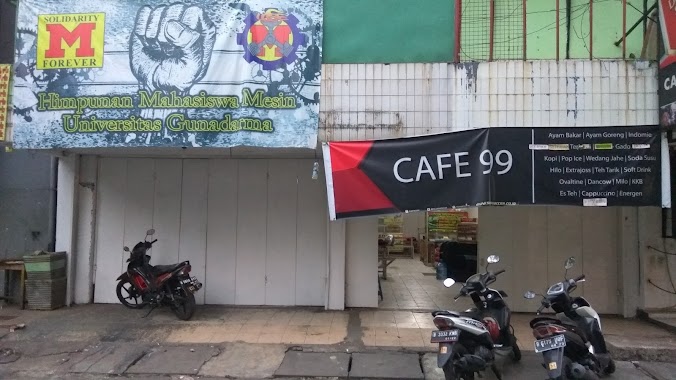
Cafe 99 Teknik Mesin
Jakasampurna
Cafe
read more
1.049 km
BC KBGB BANKER
Kranji
Cafe
read more
1.103 km
Nox Hangout
Jalan KH. Noer Ali No.36, Jakasampurna
Cafe
read more
📑
all categories
Accounting
Administrative area level 1
Administrative area level 2
Airport
Amusement park
Aquarium
Art gallery
Atm
Bakery
Bank
Bar
Beauty salon
Bicycle store
Book store
Bowling alley
Bus station
Cafe
Campground
Car dealer
Car rental
Car repair
Car wash
Casino
Cemetery
Church
City hall
Clothing store
Colloquial area
Convenience store
Courthouse
Dentist
Department store
Doctor
Electrician
Electronics store
Embassy
Finance
Fire station
Florist
Food
Funeral home
Furniture store
Gas station
General contractor
Grocery or supermarket
Gym
Hair care
Hardware store
Health
Hindu Temple
Home goods store
Hospital
Insurance agency
Intersection
Jewelry store
Laundry
Lawyer
Library
Liquor store
Local government office
Locality
Locksmith
Lodging
Meal delivery
Meal takeaway
Mosque
Movie rental
Movie theater
Moving company
Museum
Natural feature
Neighborhood
Night club
Painter
Park
Parking
Pet store
Pharmacy
Physiotherapist
Place of worship
Plumber
Point of interest
Police
Political
Post office
Premise
Real estate agency
Restaurant
Roofing contractor
Route
Rv park, camping
School
Shoe store
Shopping mall
Spa
Stadium
Storage
Store
Subpremise
Supermarket
Synagogue
Taxi stand
Train station
Transit station
Travel agency
University
Veterinary care
Zoo
administrative area level 3
administrative area level 4
administrative area level 5
sublocality level 1
↑