Cafe nearby Nutrition Club NCD Ceria
Coronavirus disease (COVID-19) Situation
confirmed cases
6829221
deaths
162063
Indonesia
Cafe nearby Nutrition Club NCD Ceria
Nutrition Club NCD Ceria
Jl. Raya Rambay no.49 Depan Koramil, Sukamantri Indonesia
contacts phone
:
+62
Latitude:
-6.912383
, Longitude:
106.898162
read more
nearest Cafe
150 m
Warung Nasi Sawo
Unnamed Road, Sukamanah
Cafe
read more
237 m
Audya Alamsyah
Sukamanah, Cisaat, Sukamanah
Cafe
read more
258 m
Sate Abg Sobur
Jalan Pajajaran I No.36, Sukamantri
Cafe
read more
516 m
Warung Elang
Jalan Cikiray-Cijambu, Sukamanah
Cafe
read more
536 m
Coffee Mandiri
Gelanggang samping damkar, Jalan Cikiray Kidul, Sukamanah
Cafe
read more
593 m
Hansip Gor Squad
Jalan Pasar Baru, Sukamanah
Cafe
read more
609 m
Pangkas Rambut Ducky
Jalan Nasional III, Sukaresmi
Cafe
read more
735 m
Warkop Saridona
gang, Jalan Pajajaran I, Sukamantri
Cafe
read more
752 m
Warung S O C B
Sukamanah
Cafe
read more
770 m
KangUlen Sukabumi
Jalan KH. Ahmad Sanusi Gang Cemara No.117, Sukaresmi
Cafe
read more
779 m
Indo Express Laundry Ahmad Sanusi
Jalan KH. Ahmad Sanusi, Degung
Cafe
read more
780 m
Indo Express Laundry
Jalan KH. Ahmad Sanusi, Degung
Cafe
read more
800 m
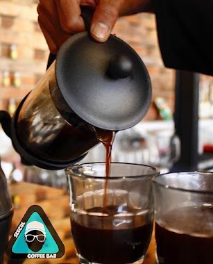
Seecul Coffee Bar
Jalan Cemerlang No.8, Sukakarya
Cafe
read more
833 m
Kedai Masbro
Cisaat
Cafe
read more
854 m
ZILDAN waroeng roti & kopi
Cisaat
Cafe
read more
874 m
Rajufood
Jalan Sukamanah II, Sukamanah
Cafe
read more
903 m
Coffee Pasteu 02
Cafe
read more
903 m
Coffee Pasteu 02
Cisaat
Cafe
read more
903 m
Kedai Coffee Pasteu 02
Komplek Alun-Alun, Samping Baznas
Cafe
read more
910 m
Warung Baso Mas Marlin
griya pratama, Sukamantri
Cafe
read more
920 m
Warung Abee
Jalan Raya Sukaraja - Sukabumi, Sukamanah
Cafe
read more
947 m
Warkop Gen
Cisaat
Cafe
read more
957 m
Bubur Ayam teh Neng
Jalan Tegal Wangi No.21, Sukakarya
Cafe
read more
1.074 km
Roti Bakar CS
Jalan Raya Cisaat, Sukamanah
Cafe
read more
1.1 km
Warkop Sari Rasa Cemerlang
Sukakarya
Cafe
read more
📑
all categories
Accounting
Administrative area level 1
Administrative area level 2
Airport
Amusement park
Aquarium
Art gallery
Atm
Bakery
Bank
Bar
Beauty salon
Bicycle store
Book store
Bowling alley
Bus station
Cafe
Campground
Car dealer
Car rental
Car repair
Car wash
Casino
Cemetery
Church
City hall
Clothing store
Colloquial area
Convenience store
Courthouse
Dentist
Department store
Doctor
Electrician
Electronics store
Embassy
Finance
Fire station
Florist
Food
Funeral home
Furniture store
Gas station
General contractor
Grocery or supermarket
Gym
Hair care
Hardware store
Health
Hindu Temple
Home goods store
Hospital
Insurance agency
Intersection
Jewelry store
Laundry
Lawyer
Library
Liquor store
Local government office
Locality
Locksmith
Lodging
Meal delivery
Meal takeaway
Mosque
Movie rental
Movie theater
Moving company
Museum
Natural feature
Neighborhood
Night club
Painter
Park
Parking
Pet store
Pharmacy
Physiotherapist
Place of worship
Plumber
Point of interest
Police
Political
Post office
Premise
Real estate agency
Restaurant
Roofing contractor
Route
Rv park, camping
School
Shoe store
Shopping mall
Spa
Stadium
Storage
Store
Subpremise
Supermarket
Synagogue
Taxi stand
Train station
Transit station
Travel agency
University
Veterinary care
Zoo
administrative area level 3
administrative area level 4
administrative area level 5
sublocality level 1
↑