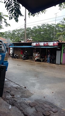
Cafe nearby Numero Uno
Indonesia
Cafe nearby Numero Uno
Numero Uno
Cogreg, Parung, Bogor, West Java 16120, Indonezja
contacts phone
:
+62
Latitude:
-6.432804
, Longitude:
106.687851
larger map & directions
read more
nearest Cafe
3 m
Caffe Kopi Parung
Cogreg
Cafe
read more
684 m
KELAPA MUDA
Jalan Raya Cogreg, Cogreg
Cafe
read more
709 m
WarKop Wak Salim
Jalan Raya Gunung Kapur No.30, Bojong Indah
Cafe
read more
766 m
Warung Gado2 Po Acih
Cihoe
Cafe
read more
871 m
Warung Sosis Bakar Aura
Unnamed Road, Bojong Indah
Cafe
read more
879 m
Warkop Teh Euis
Ciseeng
Cafe
read more
921 m
bolu karamel ibu nopi
Jalan Malang Nengah, Ciseeng
Cafe
read more
1.051 km
Cafe Prana Sniper
Cihoe
Cafe
read more
1.248 km
Ngopi Yuk Kopi Korner
Jalan Raya Haji Usa, Ciseeng
Cafe
read more
1.253 km
Warkop Akim
Jalan Raya Gunung Kapur, Ciseeng
Cafe
read more
1.276 km
Waroeng Lapar Mata
Kp. Setu, Jalan Raya Haji Usa No.01 RT.01, Parigi Mekar
Cafe
read more
1.279 km
Martabak Pak Aji perapatan ciseeng
Jl. Raya Haji Usa No. 376, Ciseeng, Parigi Mekar
Cafe
read more
1.337 km
Kedai POP ICE BRI Link
Parigi Mekar
Cafe
read more
1.351 km
Lala Ice Cream
Jl. AMD, Cibentang
Cafe
read more
1.422 km
JAVAS QIE
Jalan Haji Mawi, Bojong Sempu
Cafe
read more
1.485 km
es kelapa bang boim
Jalan Raya Cogreg, Cogreg
Cafe
read more
1.512 km
Dapur Raja
Cihoe
Cafe
read more
1.535 km
Caffe Salomone
Bojong Sempu, Gang Irbi, Bojong Indah
Cafe
read more
1.571 km
Seblak Ciseeng
Unnamed Road, Cibentang
Cafe
read more
1.615 km
Warkop "Mang Aep"
H. Usa No.1, cibogo Jl. Raya Ciseeng, Ciseeng
Cafe
read more
1.722 km
warung gaul
Jalan Haji Mawi, Bojong Indah
Cafe
read more
1.747 km
Warung Bi Mariyah
Cogreg
Cafe
read more
2.006 km
Steam Motor Mobil & Saung Seblak Dll.Kang Mus. & Kang Mus Toy's
Jalan Kades, Bojong Sempu
Cafe
read more
2.136 km
New ST Cellular
Cibentang
Cafe
read more
2.147 km
Baso Solo
Jalan Raya Haji Usa No.4000, Cibentang
Cafe
read more
📑
all categories
Accounting
Administrative area level 1
Administrative area level 2
Airport
Amusement park
Aquarium
Art gallery
Atm
Bakery
Bank
Bar
Beauty salon
Bicycle store
Book store
Bowling alley
Bus station
Cafe
Campground
Car dealer
Car rental
Car repair
Car wash
Casino
Cemetery
Church
City hall
Clothing store
Colloquial area
Convenience store
Courthouse
Dentist
Department store
Doctor
Electrician
Electronics store
Embassy
Finance
Fire station
Florist
Food
Funeral home
Furniture store
Gas station
General contractor
Grocery or supermarket
Gym
Hair care
Hardware store
Health
Hindu Temple
Home goods store
Hospital
Insurance agency
Intersection
Jewelry store
Laundry
Lawyer
Library
Liquor store
Local government office
Locality
Locksmith
Lodging
Meal delivery
Meal takeaway
Mosque
Movie rental
Movie theater
Moving company
Museum
Natural feature
Neighborhood
Night club
Painter
Park
Parking
Pet store
Pharmacy
Physiotherapist
Place of worship
Plumber
Point of interest
Police
Political
Post office
Premise
Real estate agency
Restaurant
Roofing contractor
Route
Rv park, camping
School
Shoe store
Shopping mall
Spa
Stadium
Storage
Store
Subpremise
Supermarket
Synagogue
Taxi stand
Train station
Transit station
Travel agency
University
Veterinary care
Zoo
administrative area level 3
administrative area level 4
administrative area level 5
sublocality level 1
↑