Cafe nearby noah cafe
Indonesia
Cafe nearby noah cafe
noah cafe
2, Jalan Raya Dago, 16360, Bogor, Jawa Barat, ID Indonesia
contacts phone
:
+62
Latitude:
-6.3584835
, Longitude:
106.583472
larger map & directions
read more
nearest Cafe
14 m
Flowing Coffee
Kabasiran
Cafe
read more
47 m
Yhuhandik BFC
Jalan Raya Dago No.2, Kabasiran
Cafe
read more
60 m
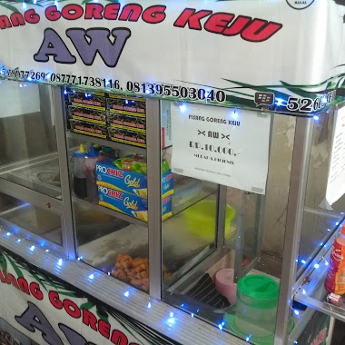
Pisang Goreng Keju AW
Jalan Raya Dago, Kabasiran
Cafe
read more
109 m
KEBAB & SEBLAK GALAXY
Griya Parung Panjang, Unnamed Road, Depan, Kabasiran
Cafe
read more
109 m
Kafe Sederhana
Kabasiran
Cafe
read more
128 m
Moh Karomah
griya/D IV NO 24, Blok Alea, Kabasiran
Cafe
read more
152 m
MANJAKA COFFE
Jalan Lontar Raya No.km No.2, Kabasiran
Cafe
read more
184 m
Waroeng Manjaka
Kabasiran
Cafe
read more
195 m
Sop Buah Bang Bendot
jalan raya Cialiuk, Cikuda
Cafe
read more
353 m
Six12 Caffee
Unnamed Road, Kabasiran
Cafe
read more
355 m
Six12 Caffee
Kabasiran
Cafe
read more
416 m
Warung Mamah Fatur
Jalan Aster III, Cikuda
Cafe
read more
445 m
Udugg Bu Gun
Jalan Aster III, Pingku
Cafe
read more
575 m
Griya Ayub Fadillah
RT.06/RW.01, Sukasari
Cafe
read more
575 m
Mie Jeletot ( Dian )
kabasiran04/02, Kabasiran
Cafe
read more
575 m
Bakso MAS DONO
Sentraland Paradise, Ruko No.RB35, Kabasiran
Cafe
read more
575 m
Coffee Parungpanjang
griya parungpanjang, Kabasiran
Cafe
read more
668 m
Warkop Uni Resta
Kabasiran, Parung Panjang, Kabasiran
Cafe
read more
1.168 km
Warung Kopi Yuk
griya parung panjang,blok f1/h no, 16, Kabasiran
Cafe
read more
1.561 km
Kedai Ibu Entin.
Jalan Raya Pancuran 7 pabuaran., Pingku
Cafe
read more
1.818 km
Cafe Pangesti Sari
Jalan Raya Dago, Kabasiran
Cafe
read more
1.836 km
Coffee Shop KPK
Mekarwangi
Cafe
read more
2.035 km
CAMP KORPP1.ALL OJOL
Jalan Mekar Jaya, Parung Panjang
Cafe
read more
2.418 km
ketoprak bang robin
Parung Panjang
Cafe
read more
2.441 km
Es Kelapa 80 Parung Panjang
Pasar Parung Panjung, Jl. Parung Panjung Raya, Jalan Parung Panjung Raya, Parung Panjang
Cafe
read more
📑
all categories
Accounting
Administrative area level 1
Administrative area level 2
Airport
Amusement park
Aquarium
Art gallery
Atm
Bakery
Bank
Bar
Beauty salon
Bicycle store
Book store
Bowling alley
Bus station
Cafe
Campground
Car dealer
Car rental
Car repair
Car wash
Casino
Cemetery
Church
City hall
Clothing store
Colloquial area
Convenience store
Courthouse
Dentist
Department store
Doctor
Electrician
Electronics store
Embassy
Finance
Fire station
Florist
Food
Funeral home
Furniture store
Gas station
General contractor
Grocery or supermarket
Gym
Hair care
Hardware store
Health
Hindu Temple
Home goods store
Hospital
Insurance agency
Intersection
Jewelry store
Laundry
Lawyer
Library
Liquor store
Local government office
Locality
Locksmith
Lodging
Meal delivery
Meal takeaway
Mosque
Movie rental
Movie theater
Moving company
Museum
Natural feature
Neighborhood
Night club
Painter
Park
Parking
Pet store
Pharmacy
Physiotherapist
Place of worship
Plumber
Point of interest
Police
Political
Post office
Premise
Real estate agency
Restaurant
Roofing contractor
Route
Rv park, camping
School
Shoe store
Shopping mall
Spa
Stadium
Storage
Store
Subpremise
Supermarket
Synagogue
Taxi stand
Train station
Transit station
Travel agency
University
Veterinary care
Zoo
administrative area level 3
administrative area level 4
administrative area level 5
sublocality level 1
↑