Cafe nearby Minang Cafe
Indonesia
Cafe nearby Minang Cafe
Minang Cafe
Jalan Perancis Blok Bd No.1, Dadap Indonesia
contacts phone
:
+62
Latitude:
-6.083325
, Longitude:
106.7048433
read more
nearest Cafe
96 m
Warung Teteh
Jalan Perancis Blok Bc No.3, Dadap
Cafe
read more
206 m
warung dua putra
blok BB21 PERGUDANGAN PANTAI INDAH, Dadap
Cafe
read more
363 m
Es Kelapa Muda Bang Udin
Dadap
Cafe
read more
367 m
Warung Kang Edi
Jalan Raya Dadap Blok Bf No.3, Dadap
Cafe
read more
444 m
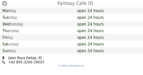
Fantasy Cafe
Jalan Raya Dadap
Cafe
read more
444 m
Fantasy Cafe
Jalan Raya Dadap, Dadap
Cafe
read more
505 m
Pabrik Atlas
Dadap
Cafe
read more
800 m
warung kopi Rizky
Dadap
Cafe
read more
922 m
Warung Mamih Sulyang
Unnamed Road, Dadap
Cafe
read more
964 m
Cafe DGPZ
Tim., Kosambi Timur
Cafe
read more
968 m
Kafe DIGUPAZA
Tim., Kosambi Timur
Cafe
read more
996 m
Waroeng Oos
Jalan Perancis, Dadap
Cafe
read more
1.018 km
Sate Bakut Babi Tan Dean
Jalan Perancis Blok B5 No.22, Kosambi Timur
Cafe
read more
1.023 km
BC--GOCEEENNNK
East Kosambi
Cafe
read more
1.023 km
Susu Jahe Merah Pantai Indah Dadap
Dadap, Kosambi, Dadap
Cafe
read more
1.029 km
Kelapa Muda Bakar Gunung Kidul
Jalan Raya Prancis, Kosambi Timur
Cafe
read more
1.058 km
Kimung CS
15213, No, Jalan Mutiara Kosambi 1 No.24, Kosambi Timur
Cafe
read more
1.086 km
Warkop Adiba
Jalan Adhi Karya Gang Bendungan, Dadap
Cafe
read more
1.088 km
BC GDJ
Jalan Dadap Jati No.1-10, Dadap
Cafe
read more
1.135 km
Big Big Thai Tea
Jalan Villa Taman Bandara, Dadap
Cafe
read more
1.158 km
Kedai Coto Makasar JJ"22"
Jalan Villa Taman Bandara 2, Dadap
Cafe
read more
1.176 km
Warung Mas Bro
Unnamed Road, Dadap
Cafe
read more
1.287 km
Tahu Sumedang Sedulur.
Dadap No.14, RT.2, Dadap
Cafe
read more
1.406 km
Chocolatte Bubble Dadap
Jalan Villa Taman Bandara, Dadap
Cafe
read more
1.43 km
Soto Cilacap
Blok D.-1, Jalan Villa Taman Bandara Blok D.-1 No.10, Dadap
Cafe
read more
📑
all categories
Accounting
Administrative area level 1
Administrative area level 2
Airport
Amusement park
Aquarium
Art gallery
Atm
Bakery
Bank
Bar
Beauty salon
Bicycle store
Book store
Bowling alley
Bus station
Cafe
Campground
Car dealer
Car rental
Car repair
Car wash
Casino
Cemetery
Church
City hall
Clothing store
Colloquial area
Convenience store
Courthouse
Dentist
Department store
Doctor
Electrician
Electronics store
Embassy
Finance
Fire station
Florist
Food
Funeral home
Furniture store
Gas station
General contractor
Grocery or supermarket
Gym
Hair care
Hardware store
Health
Hindu Temple
Home goods store
Hospital
Insurance agency
Intersection
Jewelry store
Laundry
Lawyer
Library
Liquor store
Local government office
Locality
Locksmith
Lodging
Meal delivery
Meal takeaway
Mosque
Movie rental
Movie theater
Moving company
Museum
Natural feature
Neighborhood
Night club
Painter
Park
Parking
Pet store
Pharmacy
Physiotherapist
Place of worship
Plumber
Point of interest
Police
Political
Post office
Premise
Real estate agency
Restaurant
Roofing contractor
Route
Rv park, camping
School
Shoe store
Shopping mall
Spa
Stadium
Storage
Store
Subpremise
Supermarket
Synagogue
Taxi stand
Train station
Transit station
Travel agency
University
Veterinary care
Zoo
administrative area level 3
administrative area level 4
administrative area level 5
sublocality level 1
↑