Cafe nearby kedai mom tita
Indonesia
Cafe nearby kedai mom tita
kedai mom tita
Rancabungur Indonesia
contacts phone
:
+62
Latitude:
-6.5252526
, Longitude:
106.701282
read more
nearest Cafe
103 m
RIZAL CLUB
UnnamedAMBAR TELAGA RESIDENT blok D5 no:2, Rancabungur
Cafe
read more
682 m
warkop mang ache
Jalan Raya Rancabungur, Rancabungur
Cafe
read more
1.539 km
Warkop Si Friend
Jalan Purnawarman, Ciampea
Cafe
read more
1.641 km
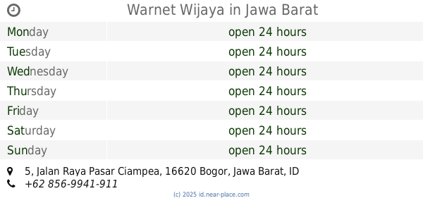
Warnet Wijaya
Jalan Raya Pasar Ciampea No.5, Benteng
Cafe
read more
1.681 km
Sugar Sugar Brownies & Cake
Ciampea
Cafe
read more
1.786 km
Warung Bu Tata
Jalan Raya Pasar Ciampea, Ciampea
Cafe
read more
1.955 km
Warung Juice & Snack Ibu Yayah
Gg Pribadi , kp kebon kopi, RT.02/RW.05, ciampe
Cafe
read more
1.961 km
Mie Ayam Bakso Kevin
pgri 2 rt04/08 blok AE no 10
Cafe
read more
2.029 km
Kedai Teh Poci Erwin
Benteng
Cafe
read more
2.038 km
WORM SQUAD
Filosopi Coffe
Cafe
read more
2.058 km
Cafe Senet Cepet
Benteng
Cafe
read more
2.06 km
Kedai Pa Asik
Benteng
Cafe
read more
2.218 km
Mie Bakso Sawargi
Jalan Raya Pasar Ciampea, Benteng
Cafe
read more
2.49 km
Saung Om Yok
Pabuaran
Cafe
read more
2.623 km
Abud Temmy B1 54
Benteng, Perumahan Ciampea Indah
Cafe
read more
2.66 km
ES KELAPA MUDA BERKAH ALAMI
Jalan Raya Letnan Sukarna No.10, Benteng
Cafe
read more
2.696 km
Nasi Goreng Upt Pendidikan Ciampea
Jalan Raya Letnan Sukarna No.37, Benteng
Cafe
read more
2.777 km
warung Gaul
Benteng
Cafe
read more
2.911 km
Warkop Kang Pelis
Unnamed Road, Cibanteng
Cafe
read more
2.92 km
Warung Adam
Benteng
Cafe
read more
2.923 km
Warung Waluyo
Unnamed Road, Candali
Cafe
read more
2.932 km
Postreet
Cibanteng
Cafe
read more
2.953 km
GASANDRY (GS) KOPI
JL Letnan Sukarna, RT 01/ RW 04, Ciampea, Kampung Bojong Jengkol, Ciampea
Cafe
read more
3 km
Bubur Umi Nana
Jl Darul Fallah, Benteng
Cafe
read more
3.703 km
G'vin Motor
Jalan Haji Miing No.59. Karihkil, Ciseeng, Bogor, Jawa Barat 16330, Karihkil
Cafe
read more
📑
all categories
Accounting
Administrative area level 1
Administrative area level 2
Airport
Amusement park
Aquarium
Art gallery
Atm
Bakery
Bank
Bar
Beauty salon
Bicycle store
Book store
Bowling alley
Bus station
Cafe
Campground
Car dealer
Car rental
Car repair
Car wash
Casino
Cemetery
Church
City hall
Clothing store
Colloquial area
Convenience store
Courthouse
Dentist
Department store
Doctor
Electrician
Electronics store
Embassy
Finance
Fire station
Florist
Food
Funeral home
Furniture store
Gas station
General contractor
Grocery or supermarket
Gym
Hair care
Hardware store
Health
Hindu Temple
Home goods store
Hospital
Insurance agency
Intersection
Jewelry store
Laundry
Lawyer
Library
Liquor store
Local government office
Locality
Locksmith
Lodging
Meal delivery
Meal takeaway
Mosque
Movie rental
Movie theater
Moving company
Museum
Natural feature
Neighborhood
Night club
Painter
Park
Parking
Pet store
Pharmacy
Physiotherapist
Place of worship
Plumber
Point of interest
Police
Political
Post office
Premise
Real estate agency
Restaurant
Roofing contractor
Route
Rv park, camping
School
Shoe store
Shopping mall
Spa
Stadium
Storage
Store
Subpremise
Supermarket
Synagogue
Taxi stand
Train station
Transit station
Travel agency
University
Veterinary care
Zoo
administrative area level 3
administrative area level 4
administrative area level 5
sublocality level 1
↑