Cafe nearby Fr Cafe
Indonesia
Cafe nearby Fr Cafe
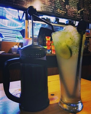
Fr Cafe
Situ Gadung Indonesia
contacts phone
:
+62
Latitude:
-6.3262282
, Longitude:
106.6284868
read more
nearest Cafe
7 m
FR Cafe (Cisauk)
Jalan Raya nengnong, Situ Gadung
Cafe
read more
160 m
Warung Ibu Jijah
Unnamed Road
Cafe
read more
160 m
Warung Ibu Jijah
Unnamed Road, Cisauk
Cafe
read more
418 m
Es Kelapa Muda Segar Wangi
Situ Gadung
Cafe
read more
605 m
Warnas Bu U'us Jamhadi
Jalan Pemancingan, Cisauk
Cafe
read more
738 m
Mie Ayam Bakso Dan Ketring Mba Sum
Cisauk
Cafe
read more
829 m
NASI GORENG GG
Jalan Raya Cisauk-Legok, Suradita
Cafe
read more
938 m
Ming Ming Makaroni
kampung, Situ Gadung
Cafe
read more
940 m
Kedai Abiyan
Cafe
read more
1.241 km
PEMPEK ASLI PALEMBANG 13 ULU
Cisauk
Cafe
read more
1.249 km
Warung coffè "the svelte"
Jalan Gangga No.68, Suradita
Cafe
read more
1.263 km
Warung Pempek Palembang 13 Ulu
Cisauk
Cafe
read more
1.277 km
Warung Makan Dan Ngopi
Cisauk
Cafe
read more
1.28 km
Stasiun Cicayur Order Ojek Online
Cisauk
Cafe
read more
1.402 km
Sosis Goreng Bunda Niki
Jalan Padat karya, Situ Gadung
Cafe
read more
1.472 km
Muzaky muzaer store
Jalan Raya Cisauk - Lapan No.3, Sampora
Cafe
read more
1.496 km
Tikar Pelangi
Jalan Raya Cisauk - Lapan, Cibogo
Cafe
read more
1.528 km
Warung Cappucino Chellin
Cisauk
Cafe
read more
1.588 km
Waroeng GF
Jl Raya Cisauk, Jl Raya Cisauk RT 05 RW 04 Kelurahan Cisauk Kecamatan Cisauk, Cisauk
Cafe
read more
1.605 km
Shiropisbak
Jalan Raya Cisauk-Legok Blok C 30 No.25, Cibogo
Cafe
read more
1.671 km
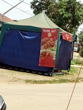
Awak Cafe
Jalan Kampung Cibogo, Cibogo
Cafe
read more
1.782 km
Warung Neng Seblak Pelangi
Jalan Kampung Cicayur, Kebun Manggu No.8
Cafe
read more
1.832 km
Kopi Sungguh2
Blok E2-9, Pasar Modern Intermoda - BSD, Jalan Raya Cisauk - Lapan No.14, Sampora
Cafe
read more
2.21 km
Kp Kadumangu
jln kampung kadumangu, Dangdang
Cafe
read more
2.607 km
Faren Cell
Sampora
Cafe
read more
📑
all categories
Accounting
Administrative area level 1
Administrative area level 2
Airport
Amusement park
Aquarium
Art gallery
Atm
Bakery
Bank
Bar
Beauty salon
Bicycle store
Book store
Bowling alley
Bus station
Cafe
Campground
Car dealer
Car rental
Car repair
Car wash
Casino
Cemetery
Church
City hall
Clothing store
Colloquial area
Convenience store
Courthouse
Dentist
Department store
Doctor
Electrician
Electronics store
Embassy
Finance
Fire station
Florist
Food
Funeral home
Furniture store
Gas station
General contractor
Grocery or supermarket
Gym
Hair care
Hardware store
Health
Hindu Temple
Home goods store
Hospital
Insurance agency
Intersection
Jewelry store
Laundry
Lawyer
Library
Liquor store
Local government office
Locality
Locksmith
Lodging
Meal delivery
Meal takeaway
Mosque
Movie rental
Movie theater
Moving company
Museum
Natural feature
Neighborhood
Night club
Painter
Park
Parking
Pet store
Pharmacy
Physiotherapist
Place of worship
Plumber
Point of interest
Police
Political
Post office
Premise
Real estate agency
Restaurant
Roofing contractor
Route
Rv park, camping
School
Shoe store
Shopping mall
Spa
Stadium
Storage
Store
Subpremise
Supermarket
Synagogue
Taxi stand
Train station
Transit station
Travel agency
University
Veterinary care
Zoo
administrative area level 3
administrative area level 4
administrative area level 5
sublocality level 1
↑