Cafe nearby Donat Dong!
Indonesia
Cafe nearby Donat Dong!
Donat Dong!
008, No. 21, Jl. Raya Narogong Km. 11 RT. 002 Indonesien
contacts phone
:
+62
Latitude:
-6.3269822
, Longitude:
106.9821348
read more
nearest Cafe
465 m
Waroeng BigPapa
Jalan Pangkalan 2 No.109, Bantargebang
Cafe
read more
484 m
Yagawa CAFE
Padurenan
Cafe
read more
636 m
Bunie's Bakery
blok EE1/ No.2, Jalan Vila Nusa Indah Blok W3 No.10, Bojong Kulur
Cafe
read more
651 m
Kedai Bumi Mutiara
Jl. Raya Bumi Mutiara No. 24 - DD3, Bojong Kulur
Cafe
read more
742 m
Coffee Pancong
Bojong Kulur
Cafe
read more
744 m
Brother Shake " N " Float
Vila Nusa Indah 2, Bojong Kulur
Cafe
read more
791 m
Pisang Nugget Pohon Pisang
Jalan Pangkalan 1A No.2, RT.003, Bantargebang
Cafe
read more
820 m
Arafat's Cafe
Gang Cendana, Cikiwul
Cafe
read more
860 m
Kedai Mommy 33
Jalan Sudirman, Bojong Kulur
Cafe
read more
862 m
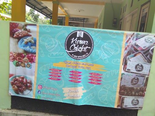
Kurma Cokelat Tyas
Jalan Pangkalan 2, Cikiwul
Cafe
read more
886 m
grab ojol
Blok Jf 9, Jalan Nusa Indah Raya Blok Jf 9 No.JF10-13, Bojong Kulur
Cafe
read more
908 m
Angkringan & bhinneka juice (dragon futsal)
Jalan Tari Kolot No.37-41, Cikiwul
Cafe
read more
916 m
Kafe Fuad
Jalan Raya Narogong No.17, Bantargebang
Cafe
read more
924 m
WARUNG BIRU bojong kulur
Bojong Kulur
Cafe
read more
937 m
Warung Bu Neng
Bojong Kulur
Cafe
read more
939 m
Warung JG mang Aceng
blok JG, Gn. Putri, Jalan Bumi Mutiara, Bojong Kulur
Cafe
read more
959 m
Pt Bulug
Jalan Raya Narogong No.27, Bantargebang
Cafe
read more
969 m
Es Dawet Hitam Manis Mas No
Cafe
read more
983 m
Seblak Al-furqon
Bojong Kulur
Cafe
read more
994 m
Warong Koko Tengah
Jalan Surya Kencana, Padurenan
Cafe
read more
1.015 km
Chicken Porridge Nusa Indah Cipta Rasa
Pasar Pocong, Jalan Pasar Vila Nusa Indah, Bojong Kulur
Cafe
read more
1.023 km
Warkop Agus
Jalan Raya Narogong, Cikiwul, Bantargebang, Cikiwul
Cafe
read more
1.148 km
Warung Kopi Ema
Bojong Kulur
Cafe
read more
1.187 km
Warung Bu Iis Gedeg
Bojong Kulur
Cafe
read more
1.195 km
Bale Oyag
Jalan Rawa Tengah, Cikiwul
Cafe
read more
📑
all categories
Accounting
Administrative area level 1
Administrative area level 2
Airport
Amusement park
Aquarium
Art gallery
Atm
Bakery
Bank
Bar
Beauty salon
Bicycle store
Book store
Bowling alley
Bus station
Cafe
Campground
Car dealer
Car rental
Car repair
Car wash
Casino
Cemetery
Church
City hall
Clothing store
Colloquial area
Convenience store
Courthouse
Dentist
Department store
Doctor
Electrician
Electronics store
Embassy
Finance
Fire station
Florist
Food
Funeral home
Furniture store
Gas station
General contractor
Grocery or supermarket
Gym
Hair care
Hardware store
Health
Hindu Temple
Home goods store
Hospital
Insurance agency
Intersection
Jewelry store
Laundry
Lawyer
Library
Liquor store
Local government office
Locality
Locksmith
Lodging
Meal delivery
Meal takeaway
Mosque
Movie rental
Movie theater
Moving company
Museum
Natural feature
Neighborhood
Night club
Painter
Park
Parking
Pet store
Pharmacy
Physiotherapist
Place of worship
Plumber
Point of interest
Police
Political
Post office
Premise
Real estate agency
Restaurant
Roofing contractor
Route
Rv park, camping
School
Shoe store
Shopping mall
Spa
Stadium
Storage
Store
Subpremise
Supermarket
Synagogue
Taxi stand
Train station
Transit station
Travel agency
University
Veterinary care
Zoo
administrative area level 3
administrative area level 4
administrative area level 5
sublocality level 1
↑